
Size of this preview: 650 × 600 pixels. Other resolution: 1,000 × 923 pixels.
Original file (1,000 × 923 pixels, file size: 354 KB, MIME type: image/jpeg)
Summary
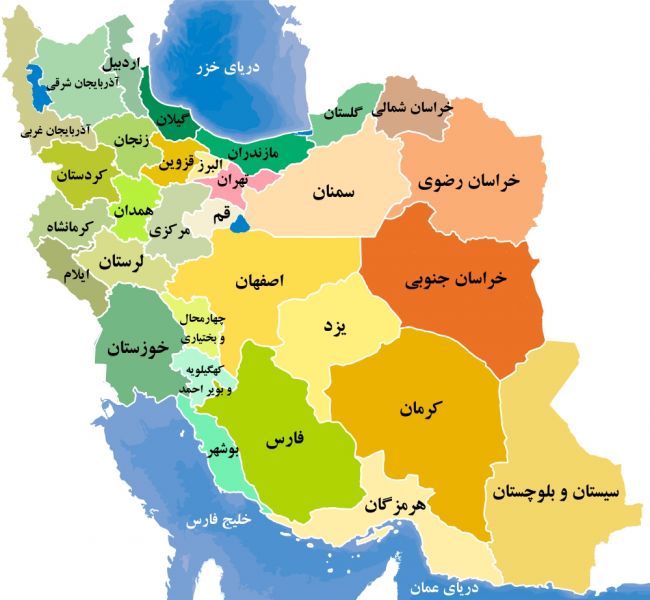
نقشه رنگی استانهای اریان
File history
Click on a date/time to view the file as it appeared at that time.
| Date/Time | Thumbnail | Dimensions | User | Comment | |
|---|---|---|---|---|---|
| current | 17:22, 14 October 2020 | | 1,000 × 923 (354 KB) | Ahoshmand (talk | contribs) | نقشه رنگی استانهای اریان |
You cannot overwrite this file.
File usage
There are no pages that use this file.