Size of this preview: 800 × 321 pixels. Other resolution: 901 × 361 pixels.
Original file (901 × 361 pixels, file size: 74 KB, MIME type: image/jpeg)
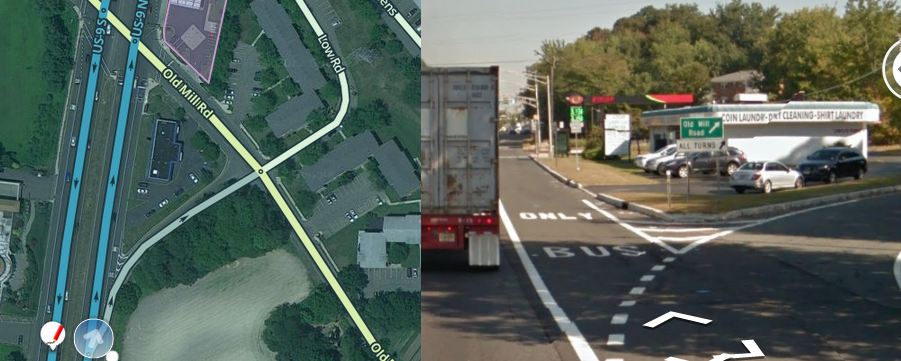
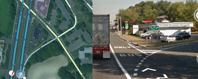
Type A Jughandle on US-9 N in Old Bridge Township, NJ (part of MapRaid Jersey Shore Area 1). Some special features included: cross street Old Mill Rd is at an angle, and there is a separate road named low road at the same junction ending the jug. The latter means that the jug cannot be unnamed.
File history
Click on a date/time to view the file as it appeared at that time.
| Date/Time | Thumbnail | Dimensions | User | Comment | |
|---|---|---|---|---|---|
| current | 18:10, 29 May 2015 | 901 × 361 (74 KB) | Qwaletee (talk | contribs) | Type A Jughandle on US-9 N in Old Bridge Township, NJ (part of MapRaid Jersey Shore Area 1). Some special features included: cross street Old Mill Rd is at an angle, and there is a separate road named low road at the same junction ending the jug. The l... |
You cannot overwrite this file.
File usage
There are no pages that use this file.