No higher resolution available.
Walking_trail_dest.png (509 × 463 pixels, file size: 15 KB, MIME type: image/png)
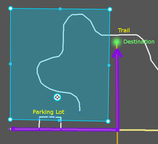
Example of routing "failure" caused by a walking trail being closer to a destination marker than a drivable road.
File history
Click on a date/time to view the file as it appeared at that time.
| Date/Time | Thumbnail | Dimensions | User | Comment | |
|---|---|---|---|---|---|
| current | 20:22, 3 May 2014 | | 509 × 463 (15 KB) | AlanOfTheBerg (talk | contribs) | Example of routing "failure" caused by a walking trail being closer to a destination marker than a drivable road. |
You cannot overwrite this file.
File usage
The following 2 pages use this file: