This special page shows all uploaded files.
| Date | Name | Thumbnail | Size | Description | Versions |
|---|---|---|---|---|---|
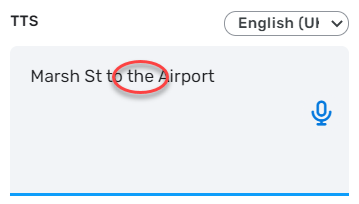
| 03:01, 29 August 2021 | Turn-instructions-custom-tts-example.png (file) |  |
12 KB | Turn instructions with an example of custom TTS | 1 |
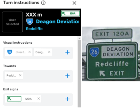
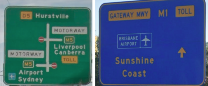
| 03:01, 29 August 2021 | Turn-instructions-exit-signs-example.png (file) |  |
102 KB | Example of exit signs using in turn instructions interface | 1 |
| 03:00, 29 August 2021 | Turn-instructions-towards-example.png (file) |  |
102 KB | Example of towards using in turn instructions interface | 1 |
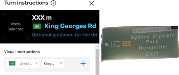
| 03:00, 29 August 2021 | Turn-instructions-visual-instructions-example.png (file) |  |
79 KB | Example of visual instructions using in turn instructions interface | 1 |
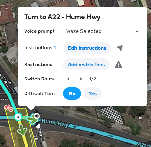
| 02:59, 29 August 2021 | Edit-turn-instructions-on-junction-box.png (file) |  |
232 KB | Edit turn instructions on junction box | 1 |
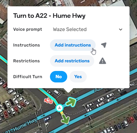
| 02:59, 29 August 2021 | Add-turn-instructions.png (file) |  |
233 KB | Add turn instructions | 1 |
| 02:58, 29 August 2021 | Turn-guidance-default-behaviour.png (file) | 97 KB | Turn guidance default behaviour | 1 | |
| 02:58, 29 August 2021 | Lanes-start-end-near-gore-point.png (file) |  |
608 KB | Lanes start and end near gore point | 1 |
| 02:58, 29 August 2021 | Bgs-green-blue.png (file) |  |
222 KB | Big green signs can also be blue in some states | 1 |
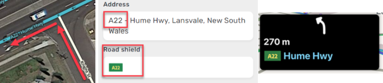
| 02:57, 29 August 2021 | Turn-instructions-terminology.png (file) |  |
300 KB | turn instruction terminology | 1 |
| 09:31, 28 August 2021 | Map-hacks.png (file) |  |
133 KB | 1 | |
| 09:31, 28 August 2021 | Roundabout-map-hacks.png (file) |  |
579 KB | 1 | |
| 09:30, 28 August 2021 | Map-hack-stubs.png (file) |  |
136 KB | Map hack using stubs | 1 |
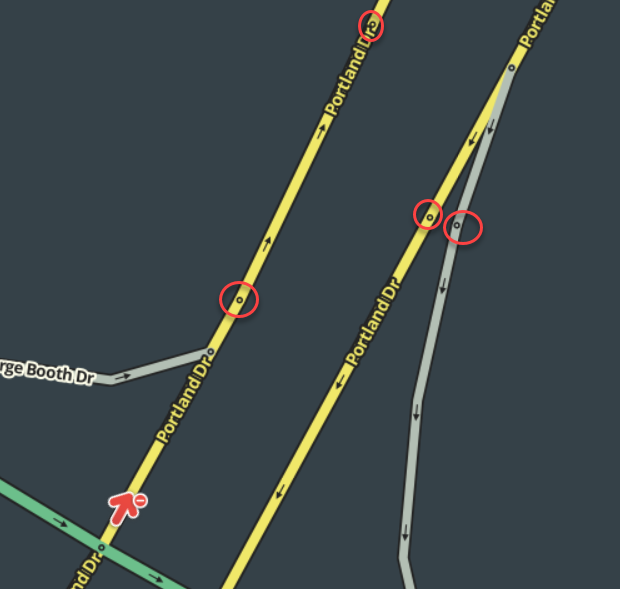
| 08:17, 28 August 2021 | Micro-dog-leg.png (file) |  |
185 KB | 1 | |
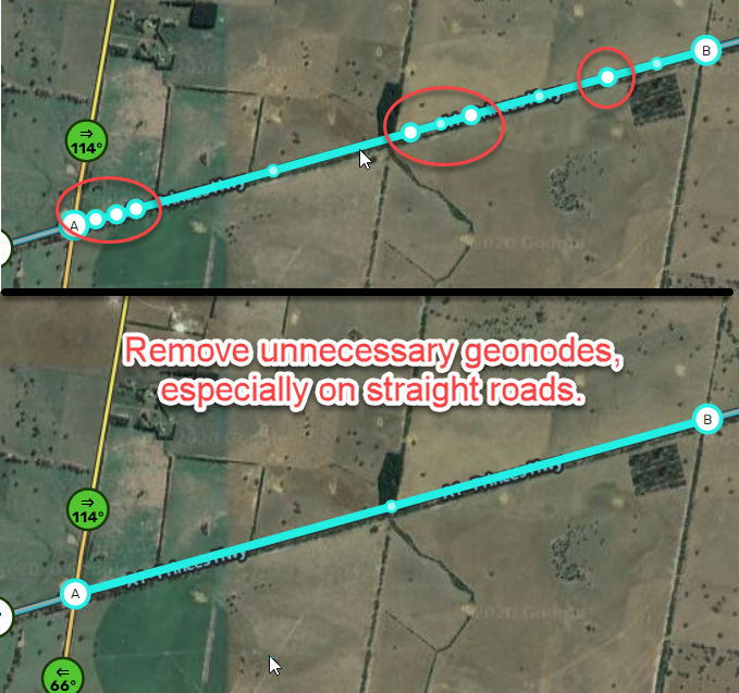
| 08:00, 28 August 2021 | Excess-geo-nodes.png (file) |  |
580 KB | 1 | |
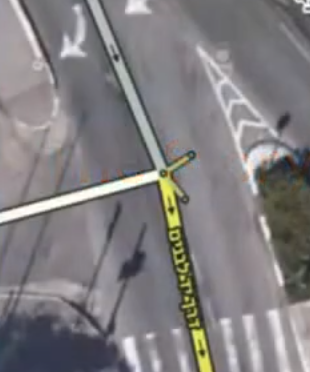
| 07:50, 28 August 2021 | Unnecessary-junction-nodes.png (file) |  |
99 KB | Here is an example of some unnecessary junction nodes that can be cleaned up. | 1 |
| 07:15, 28 August 2021 | Parallax-effect.png (file) |  |
641 KB | Parallax effect is particularly visible on bridges and overpasses | 1 |
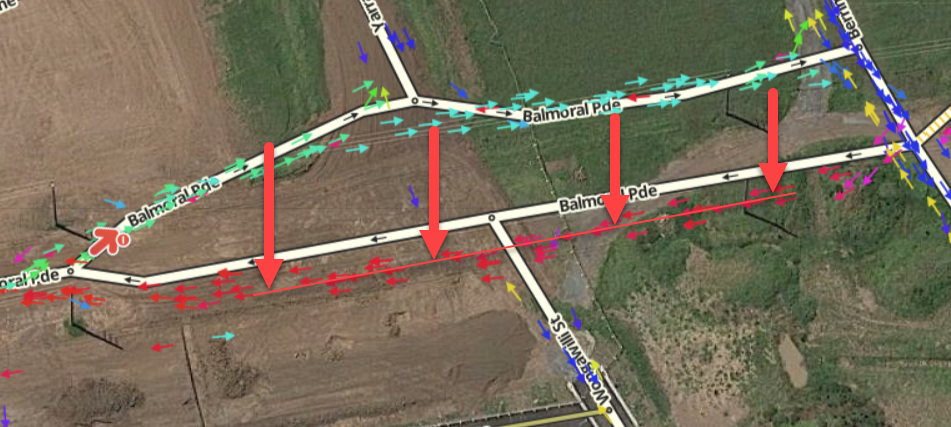
| 06:56, 28 August 2021 | One-way-road-cluster-gps-arrows.png (file) |  |
660 KB | Untrustworthy satellite imagery with a cluster of GPS arrows pointing one-way, indicating a one-way road. | 1 |
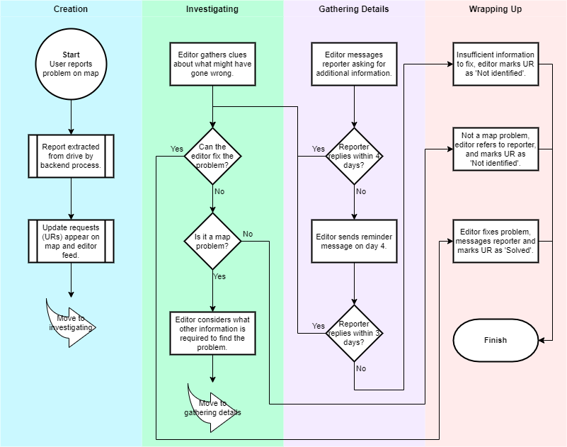
| 03:50, 28 August 2021 | UR Life Cycle 20210828.png (file) |  |
71 KB | Explains the life cycle of update reports in Australia, which is different from other countries. | 1 |
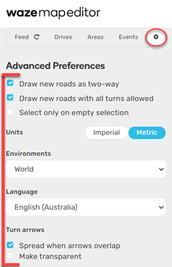
| 01:05, 28 August 2021 | Wme-settings-for-australia.png (file) |  |
51 KB | 1 | |
| 12:00, 11 February 2020 | AU video Loading a screenshot into WME Image Overlays.jpg (file) |  |
11 KB | 1 | |
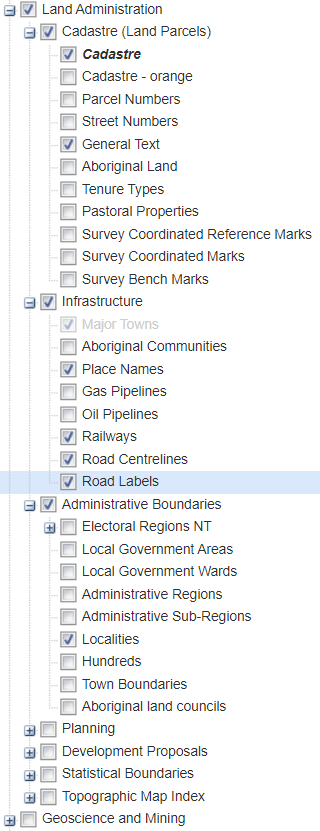
| 03:53, 11 February 2020 | AU SA Permitted Dataset v2.png (file) |  |
216 KB | 1 | |
| 11:20, 10 February 2020 | AU video Using the Main Roads Western Australia ArcGIS REST API road assets inside GQIS.jpg (file) |  |
10 KB | 1 | |
| 11:17, 10 February 2020 | AU video Preferred settings for mapping with MapShareVic.jpg (file) |  |
13 KB | 1 | |
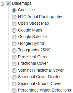
| 11:12, 10 February 2020 | AU SA Permitted Basemaps.png (file) |  |
377 KB | 1 | |
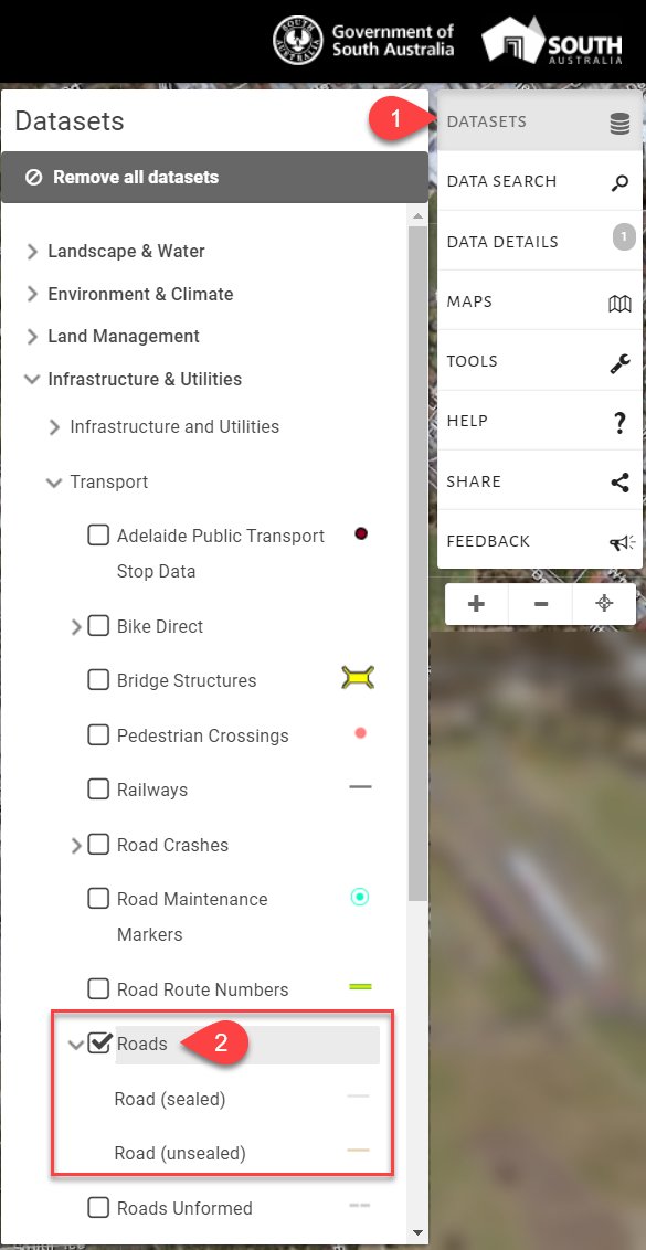
| 11:11, 10 February 2020 | AU SA Permitted Dataset.png (file) |  |
213 KB | 1 | |
| 11:07, 10 February 2020 | AU NT Natural Resource Maps Caution Layers.png (file) |  |
26 KB | 1 | |
| 11:04, 10 February 2020 | AU NT Natural Resource Maps Enabled.png (file) |  |
65 KB | 1 | |
| 11:00, 10 February 2020 | AU video Load NSW Base Map data into QGIS via API.jpg (file) |  |
8 KB | 1 | |
| 10:56, 10 February 2020 | AU video Load ACT Road Centrelines data into QGIS via API.jpg (file) |  |
6 KB | 1 | |
| 10:53, 10 February 2020 | AU video Load ACT Road Centrelines data into QGIS via File.jpg (file) |  |
7 KB | 1 | |
| 10:40, 10 February 2020 | AU video Load-PSMA-data-into-QGIS.jpg (file) |  |
8 KB | 1 | |
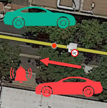
| 10:27, 30 May 2019 | Camera-shutter-direction.png (file) |  |
194 KB | Depicts how Waze will alert based on the direction of the camera shutter. | 1 |