This special page shows all uploaded files.
| Date | Name | Thumbnail | Size | Description | Versions |
|---|---|---|---|---|---|
| 16:27, 26 February 2015 | 600px-New Mexico road sign.png (file) |  |
34 KB | Road Sign, New Mexico, USA | 1 |
| 16:26, 26 February 2015 | 600px-Flag of New Mexico.png (file) |  |
7 KB | Flag of New Mexico, USA | 1 |
| 16:09, 4 February 2015 | Restricted-gate.png (file) |  |
13 KB | Private Installation - Diagram of a typical restricted gate | 1 |
| 16:01, 4 February 2015 | Specialty-gate.png (file) |  |
13 KB | Private Installation Specialty Gate diagram 1 | 1 |
| 15:46, 4 February 2015 | Modified-standard.png (file) |  |
12 KB | Private Installation graphic. Modified Standard Gate. | 1 |
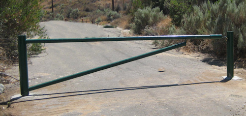
| 04:29, 22 January 2015 | PI restricted gate2.jpg (file) |  |
85 KB | Private Installation restricted gate | 1 |
| 04:28, 22 January 2015 | PI restricted gate1.jpg (file) |  |
96 KB | 2 | |
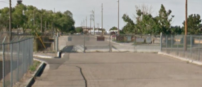
| 03:54, 22 January 2015 | PI contractor gate1.jpg (file) |  |
63 KB | Example of contractor gate | 1 |
| 06:25, 21 January 2015 | Blocked-gate-2.png (file) |  |
261 KB | Private Installation example of a blocked gate #2 | 1 |
| 06:25, 21 January 2015 | Blocked-gate-1.png (file) |  |
220 KB | Private Installation example of blocked gate #1 | 1 |
| 06:17, 21 January 2015 | PI lock gate 2.png (file) |  |
350 KB | Change gate name to Blocked | 2 |
| 06:15, 21 January 2015 | PI lock gate 1.png (file) |  |
344 KB | Change name of gate to Blocked | 2 |
| 05:06, 27 June 2014 | Place Categories Pick-NF.png (file) |  |
9 KB | 1 | |
| 05:05, 27 June 2014 | Place Categories.png (file) |  |
7 KB | Place categories for Area or Point Places | 1 |
| 04:50, 25 June 2014 | Formal mentoring step4.png (file) |  |
46 KB | 1 | |
| 04:50, 25 June 2014 | Formal mentoring step3.png (file) |  |
49 KB | 1 | |
| 04:49, 25 June 2014 | Formal mentoring step2.png (file) |  |
48 KB | 1 | |
| 04:49, 25 June 2014 | Formal mentoring step1.png (file) |  |
45 KB | 1 | |
| 16:29, 1 June 2014 | BIA-logo-transparent.png (file) | 530 KB | Bureau of Indian Affairs (BIA) logo, transparent PNG | 1 | |
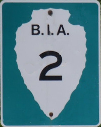
| 16:17, 1 June 2014 | BIA-road-sign-2.jpg (file) |  |
27 KB | Bureau of Indian Affairs (BIA) road sign for Route 2. | 1 |
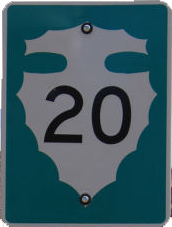
| 15:32, 1 June 2014 | Navajo Rte 20.jpg (file) |  |
25 KB | Route sign for Navajo Route 20 | 1 |
| 15:30, 1 June 2014 | Navajo-Nation-Map-PHS.jpg (file) |  |
1.5 MB | Obtained from Wikipedia Commons | 1 |
| 15:58, 28 May 2014 | Mentor-new-transparent-large.png (file) | 296 KB | Mentoring logo, transparent PNG, large image. | 1 | |
| 15:57, 28 May 2014 | Formal mentoring 2.png (file) |  |
24 KB | Formal Mentoring Logo concept with new eye-corrected mentoring logo. Transparent PNG. | 1 |
| 20:58, 16 March 2014 | USFS-naming-convention.png (file) |  |
12 KB | Example road naming convention for US Forest Service | 1 |
| 08:55, 9 March 2014 | BLM roads 2.png (file) |  |
19 KB | Upload to correct file error | 2 |
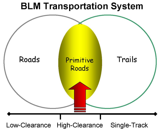
| 06:37, 9 March 2014 | BLM roads 1.png (file) |  |
77 KB | BLM Draft Road Schema under consideration for defining roads in the BLM system obtained from BLM 2006 report | 1 |
| 12:10, 5 March 2014 | BLM logo.png (file) | 162 KB | Bureau of Land Management, logo, transparent PNG | 1 | |
| 03:05, 3 March 2014 | National Park Service Road Classification2.png (file) |  |
565 KB | Road classification for National Park Service Roads from their current document on this subject. | 1 |
| 03:01, 3 March 2014 | National Park Service Road Classification.png (file) |  |
565 KB | Removes black line at top of prior image | 2 |
| 19:11, 23 February 2014 | National-park-service-logo.png (file) | 312 KB | National Park Service (NPS), logo | 1 | |
| 19:13, 20 February 2014 | USFS-logo.png (file) | 49 KB | Transparent background version | 2 | |
| 19:05, 19 February 2014 | USFS-icon-picnicarea.png (file) | 4 KB | US Forest Service, Motor Vehicle Use Map (MVUM), icon, picnic area | 1 | |
| 19:02, 19 February 2014 | USFS-icon-campsite.png (file) | 4 KB | US Forest Service, Motor Vehicle Use Maps, icon, campsite | 1 | |
| 17:02, 19 February 2014 | USFS-icon-infosite.png (file) | 3 KB | US Forest Service, Motor Vehicle Use Map, icon, information site or ranger station | 1 | |
| 17:01, 19 February 2014 | USFS-icon-campground.png (file) | 2 KB | US Forest Service, Motor Vehicle Use Map, icon, campground | 1 | |
| 16:43, 19 February 2014 | USFS-MVUM-1a.png (file) |  |
424 KB | US Forest Service, Motor Vehicle Use Map (MVUM), internal view, example | 1 |
| 16:41, 19 February 2014 | USFS-MVUM-1.png (file) |  |
164 KB | US Forest Service, Motor Vehicle Use Map (MVUM), front cover, example | 1 |
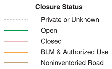
| 21:56, 17 February 2014 | USFS-legend-1.png (file) |  |
21 KB | United States Forest Service, sample road legend from a Motor Vehicle Use Map, modified. | 1 |
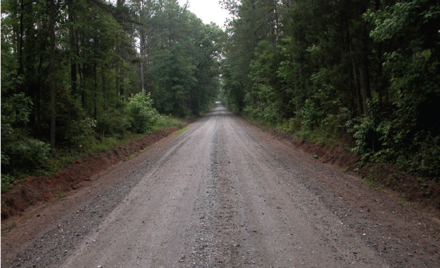
| 05:44, 12 February 2014 | USFS-level5b.jpg (file) |  |
182 KB | Example of USFS level-5 road | 1 |
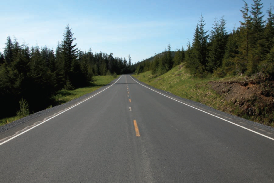
| 05:43, 12 February 2014 | USFS-level5a.jpg (file) |  |
175 KB | Example of USFS level-5 road | 1 |
| 05:43, 12 February 2014 | USFS-level4b.jpg (file) |  |
176 KB | Example of USFS level-4 road | 1 |
| 05:43, 12 February 2014 | USFS-level4a.jpg (file) |  |
226 KB | Example of USFS level-4 road | 1 |
| 05:42, 12 February 2014 | USFS-level3b.jpg (file) |  |
281 KB | Example of USFS level-3 road | 1 |
| 05:41, 12 February 2014 | USFS-level3a.jpg (file) |  |
257 KB | Example of USFS level-3 road | 1 |
| 05:41, 12 February 2014 | USFS-level2b.jpg (file) |  |
285 KB | Example of USFS level-2 road | 1 |
| 05:40, 12 February 2014 | USFS-level2a.jpg (file) |  |
353 KB | Example of USFS level-2 road | 1 |
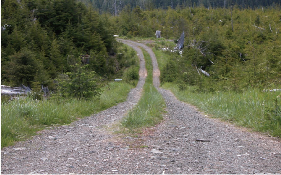
| 05:39, 12 February 2014 | USFS-level1b.jpg (file) |  |
321 KB | Example of USFS level-1 road | 1 |
| 05:39, 12 February 2014 | USFS-level1a.jpg (file) |  |
327 KB | Example of USFS level-1 road | 1 |
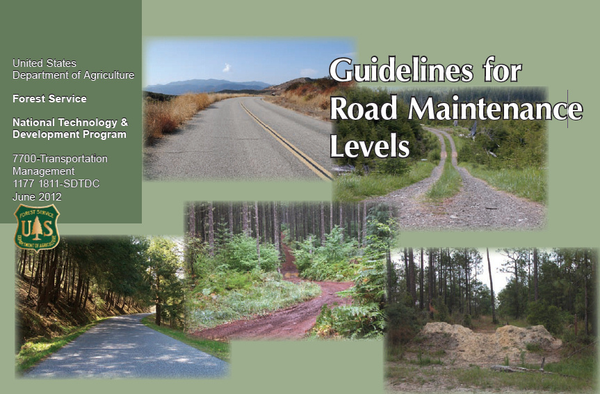
| 05:37, 12 February 2014 | USFS-maintenance guidelines.jpg (file) |  |
260 KB | Cover of USFS road maintenance level guidelines | 1 |