Dmcrandall (talk | contribs) (*/Resources*/ Added County Map) |
m (→Maricopa County: Correction to Maricopa Link Name) |
||
| (48 intermediate revisions by 6 users not shown) | |||
| Line 9: | Line 9: | ||
== Mapping and GIS Links == | == Mapping and GIS Links == | ||
<imagemap>Image:ArizonaCountymap.gif|500px| | |||
poly 64 5 149 3 145 18 145 28 141 35 143 47 99 73 96 205 83 202 78 209 49 203 35 190 34 183 31 182 30 169 19 159 21 146 25 143 20 112 20 84 19 70 29 66 36 68 47 77 53 76 60 60 [[#Mohave_County|Mohave County]] | |||
poly 157 5 258 3 261 203 256 205 231 193 217 193 215 164 199 165 200 153 166 152 165 137 160 138 158 131 152 133 147 126 127 123 110 108 104 108 104 75 149 48 147 37 150 31 151 16 153 10 [[#Coconino_County|Coconino County]] | |||
poly 265 4 308 4 310 105 319 109 319 110 316 115 320 244 315 252 315 260 312 260 312 228 265 227 [[#Navajo_County|Navajo County]] | |||
poly 367 5 371 243 353 243 351 249 346 250 342 258 333 261 327 268 320 258 319 253 323 247 322 117 327 112 322 104 313 104 312 5 [[#Apache_County|Apache County]] | |||
poly 372 249 374 348 369 349 365 340 366 328 347 298 344 259 357 247 [[#Greenlee_County|Greenlee County]] | |||
poly 101 228 102 168 104 112 108 113 123 126 145 133 151 138 156 137 154 142 161 142 162 157 196 157 196 170 211 171 212 193 203 200 201 217 216 223 216 227 207 228 206 230 173 224 165 237 139 228 [[#Yavapai_County|Yavapai County]] | |||
poly 11 297 13 287 11 279 11 273 24 264 25 231 30 225 31 221 51 207 80 215 86 208 96 209 95 274 61 273 60 265 35 267 36 299 13 299 [[#La_Paz_County|La Paz County]] | |||
poly 4 342 2 335 8 328 18 328 27 317 23 303 39 303 38 270 56 269 56 277 95 278 94 377 [[#Yuma_County|Yuma County]] | |||
poly 99 344 101 233 137 232 167 241 176 229 210 234 211 231 215 230 220 235 222 253 232 261 236 260 241 271 209 271 207 290 180 290 170 283 167 284 166 344 [[#Maricopa_County|Maricopa County]] | |||
poly 282 346 169 345 170 289 178 295 212 295 213 276 243 274 262 310 264 309 273 299 281 296 [[#Pinal_County|Pinal County]] | |||
poly 289 351 284 296 288 294 285 283 287 279 313 273 313 265 319 265 327 273 329 273 335 264 341 261 344 303 361 330 361 342 367 349 [[#Graham_County|Graham County]] | |||
poly 99 349 282 349 281 404 235 405 234 419 219 419 219 425 97 379 [[#Pima_County|Pima County]] | |||
poly 281 434 241 434 222 425 225 424 238 423 238 408 280 408 [[#Santa_Cruz_County|Santa Cruz County]] | |||
poly 285 434 287 353 373 354 374 433 [[#Cochise_County|Cochise County]] | |||
poly 220 220 204 215 208 201 215 197 225 201 233 199 256 211 262 211 263 232 310 234 309 270 283 278 283 293 269 297 263 305 239 254 236 256 234 259 225 250 223 233 220 229 [[#Gila_County|Gila County]] | |||
desc none | |||
</imagemap> | |||
Click within the borders of any county in the map to jump to that county's resource list. | |||
=== Countrywide === | |||
---- | |||
* [http://pe.usps.gov/text/pub28/28apc_002.htm '''United States Postal Service'''] | |||
<blockquote>The table lists examples of suffix forms that are primary street suffix names, common street suffixes or suffix abbreviations, and recommended official Postal Service standard suffix abbreviations. See also [https://wiki.waze.com/wiki/Abbreviations_and_acronyms#Standard_suffix_abbreviations '''Waze Standard Suffix Abbreviations]</blockquote> | |||
=== Statewide === | === Statewide === | ||
---- | ---- | ||
* [http://www.arcgis.com/home/webmap/viewer.html?webmap= | * [http://www.arcgis.com/home/webmap/viewer.html?webmap=b560059ae13b49d9b9161e4c6abda509&extent=-119.3098,28.2181,-103.083,37.2136 '''ArcGIS Functional Classification'''] | ||
<blockquote>This is the Arizona Department of Transportation APLAN ArcGIS Functional Classification map. This is the interactive map that all Arizona editors are to use when establishing FC implementation into the Waze Map Editor.</blockquote> | <blockquote>This is the Arizona Department of Transportation APLAN ArcGIS Functional Classification map. This is the interactive map that all Arizona editors are to use when establishing FC implementation into the Waze Map Editor.</blockquote> | ||
| Line 25: | Line 51: | ||
<blockquote>An interactive map showing the location of all the Arizona Highway mileposts.</blockquote> | <blockquote>An interactive map showing the location of all the Arizona Highway mileposts.</blockquote> | ||
*[http://adot.maps.arcgis.com/apps/ | *[http://adot.maps.arcgis.com/apps/Viewer/index.html?appid=f38fd1d129ce4c85aaac5b1e906f07de '''Arizona Highway Rest Area'''] | ||
<blockquote>An interactive map showing all of the Arizona Rest Stops location.</blockquote> | <blockquote>An interactive map showing all of the Arizona Rest Stops location.</blockquote> | ||
*[http://ctutools.azda.gov/dwm/pv/inspection_search.asp '''Arizona Department of Weights and Measures'''] | |||
<blockquote>Useful for verifying current Gas Station statuses.</blockquote> | |||
=== Counties === | === Counties === | ||
| Line 37: | Line 66: | ||
==== Cochise County ==== | ==== Cochise County ==== | ||
* '''[https://giscloud.cochise.az.gov/encompass/maps/parcelreport/ ''Cochise County'' Parcel Viewer]''' | |||
<blockquote>Access the '''Subdivision Plats & Surveys''' map for street names and other information through various layers.</blockquote> | |||
==== Coconino County ==== | ==== Coconino County ==== | ||
* [http://gismaps.coconino.az.gov/parcelviewer/ '''''Coconino County'' Parcel Viewer'''] | * [http://gismaps.coconino.az.gov/parcelviewer/ '''''Coconino County'' Parcel Viewer'''] | ||
<blockquote>Provides street names, house number assignments, parcel ownership, names of natural features, names of city facilities, and names of educational, medical, and religious institutions.</blockquote> | |||
* '''[https://coconinocounty.maps.arcgis.com/apps/webappviewer/index.html?id=868170827e4443d2be37eb60562446ae ''Coconino County'' Parcel Viewer - ''BETA'']''' | |||
<blockquote>Provides street names, house number assignments, parcel ownership, names of natural features, names of city facilities, and names of educational, medical, and religious institutions.</blockquote> | <blockquote>Provides street names, house number assignments, parcel ownership, names of natural features, names of city facilities, and names of educational, medical, and religious institutions.</blockquote> | ||
| Line 49: | Line 82: | ||
==== Gila County ==== | ==== Gila County ==== | ||
* [http://gilacountyaz.maps.arcgis.com/apps/webappviewer/index.html?id=bca47d05176246979c3301f0d641110b '''''Gila County'' Maps'''] | |||
<blockquote>Provides Street names, and additional information through various layers. (Scroll down to find the link to the current map application.)</blockquote> | |||
==== Graham County ==== | ==== Graham County ==== | ||
* [ | * '''[https://grahamco.maps.arcgis.com/apps/webappviewer/index.html?id=f9c1bb5cd1f644beacf7efd39e4f5407 ''Graham County'' Maps]''' | ||
<blockquote>Provides Street names, and additional information through various layers. (Scroll down to find the link to the current map application.)</blockquote> | <blockquote>Provides Street names, and additional information through various layers. (Scroll down to find the link to the current map application.)</blockquote> | ||
==== Greenlee County ==== | ==== Greenlee County ==== | ||
* '''''[https://www.arcgis.com/apps/View/index.html?appid=6fff7900abfd40ae8ba614626214112c Greenlee County GIS]''''' | |||
<blockquote>Provides street names.</blockquote> | |||
==== La Paz County ==== | ==== La Paz County ==== | ||
* [http:// | * '''[http://gis.lapazcountyaz.org/portal/apps/webappviewer/index.html?id=cb17ccc0aed140c88d27002344089041 ''La Paz County'' Community Development]''' | ||
<blockquote>Click on the ''GIS Mapping Website'' link in the lower right side of the page to access the current mapping application. Provides street names, property ownership, addresses, and other information through various layers.</blockquote> | <blockquote>Click on the ''GIS Mapping Website'' link in the lower right side of the page to access the current mapping application. Provides street names, property ownership, addresses, and other information through various layers.</blockquote> | ||
==== Maricopa County ==== | ==== Maricopa County ==== | ||
* [http://gis.fcd.maricopa.gov/apps/RoadClosures/Report.aspx '''''DOT Road Closures and Restrictions Report]<br /> | |||
<blockquote>Live sortable database</blockquote> | |||
* [http://maps.mcassessor.maricopa.gov '''''Maricopa County'' Assessors Office Parcel Viewer'''] | * [http://maps.mcassessor.maricopa.gov '''''Maricopa County'' Assessors Office Parcel Viewer'''] | ||
<blockquote>Provides street names, house number assignments, and parcel ownership. Note that street names for private streets can be highly inaccurate, as can the directional designation (N, E, S, W) in some areas.</blockquote> | <blockquote>Provides street names, house number assignments, and parcel ownership. Note that street names for private streets can be highly inaccurate, as can the directional designation (N, E, S, W) in some areas.</blockquote> | ||
* [http://www | * [http://www.avondale.org/index.aspx?NID=2963 '''''Avondale'' OpenMaps'''] | ||
<blockquote>Links to several prepared maps in PDF format. None seem to provide street names or house numbers, but several contain information valuable for other mapping tasks.</blockquote> | <blockquote>Links to several prepared maps in PDF format. None seem to provide street names or house numbers, but several contain information valuable for other mapping tasks.</blockquote> | ||
* [http://infomap.chandleraz.gov/ '''''Chandler'' InfoMap'''] | * [http://www.buckeyeaz.gov/developers/map-resources/ '''''Buckeye'' Map Resources'''] | ||
<blockquote>Including links to a few PDF maps, plus their [http://www.buckeyeaz.gov/map-anything/ ''Map Anything''] map which provides street names and city boundaries.</blockquote> | |||
* [http://infomap.chandleraz.gov/ '''''Chandler'' InfoMap''']<br/>''<small>(requires Microsoft Silverlight plugin)</small>'' | |||
<blockquote>Provides street names, and house number assignments.</blockquote> | <blockquote>Provides street names, and house number assignments.</blockquote> | ||
* [http://www.fh.az.gov/ | * [http://www.fh.az.gov/220/Planning-Zoning '''''Fountain Hills'' Development Services Maps'''] | ||
<blockquote>Non-interactive prepared maps in PDF format. | <blockquote>Non-interactive prepared maps in PDF format listed on the left side. Also, their ''2009 Street Map Index'' is available in both [http://www.fh.az.gov/documentcenter/view/266 large] and [http://www.fh.az.gov/documentcenter/view/265 small] editions, which include street names but not house number assignments.</blockquote> | ||
* [http://www.gilbertmapping.com/xslmaps/imapstestpage.aspx?T=CX '''''Gilbert'' CIP Interactive Map'''] | * [http://www.gilbertmapping.com/xslmaps/imapstestpage.aspx?T=CX '''''Gilbert'' CIP Interactive Map''']<br/>''<small>(requires Microsoft Silverlight plugin)</small>'' | ||
<blockquote>Provides street names, and house number assignments. Note that some minor streets might not be represented graphically, but with a sufficiently close zoom setting will be named.</blockquote> | <blockquote>Provides street names, and house number assignments. Note that some minor streets might not be represented graphically, but with a sufficiently close zoom setting will be named.</blockquote> | ||
* [http://cog-gis.maps.arcgis.com/apps/Solutions/s2.html?appid=aac760ab1e8e498f99091c14f6bd06d1 '''''Glendale'' Address Finder'''] | * [http://cog-gis.maps.arcgis.com/apps/Solutions/s2.html?appid=aac760ab1e8e498f99091c14f6bd06d1 '''''Glendale'' Address Finder'''] | ||
<blockquote>Provides street names, and house number assignments.</blockquote> | <blockquote>Provides street names, and house number assignments.</blockquote> | ||
* '''''[Https://www.maricopa-az.gov/departments/public-services/interactive-maps|City Maricopa Interactive Maps]''''' | |||
<blockquote>Provides street names, house number assignments, and other information.</blockquote> | |||
* [http://gis.mesaaz.gov/mTrac/ '''''Mesa'' Traffic Restriction Alerts and Closures (mTrac)'''] | * [http://gis.mesaaz.gov/mTrac/ '''''Mesa'' Traffic Restriction Alerts and Closures (mTrac)'''] | ||
| Line 89: | Line 131: | ||
* '''''Phoenix''''' | * '''''Phoenix''''' | ||
** [ | ** [https://www.phoenix.gov/Pages/imapindex.aspx '''Maps and Geographic Information Systems (GIS) Data''']<br />Provides street names, addresses and parcel information. (New mapping application for Phoenix as of 2015.) | ||
** [ | ** [https://www.phoenix.gov/streets/projects/7th-street-and-7th-avenue-reverse-lanes '''7th St and 7th Ave Reversible Lane Information''']<br />Information on the center reversible lanes that run on 7th Ave between McDowell and Northern, and on 7th St between McDowell and Dunlap. The project information is out of date (the noted projects are complete), but the information on restrictions and signage is current. | ||
** [https://www.phoenix.gov/streets/street-closures '''Planned Major Street Restrictions and Closures''']<br />Includes information about planned major street restrictions and closures associated with activities reported to the Street Transportation Department Right of Way Management Office. | |||
* {{anchor|Queen_Creek}}[http://gisweb.queencreek.org/mapcentral/map.html?webmap=d96d44f824844daaa3df0efd4250709a '''''Queen Creek'' CIP Projects''] | * {{anchor|Queen_Creek}}[http://gisweb.queencreek.org/mapcentral/map.html?webmap=d96d44f824844daaa3df0efd4250709a '''''Queen Creek'' CIP Projects''] | ||
| Line 102: | Line 146: | ||
** [http://arcgis.com/apps/OnePane/basicviewer/index.html?appid=15abed81bb36408280c183a77959ddc6 '''Zoning Map''']<br />Provides street names, and house number assignments. | ** [http://arcgis.com/apps/OnePane/basicviewer/index.html?appid=15abed81bb36408280c183a77959ddc6 '''Zoning Map''']<br />Provides street names, and house number assignments. | ||
==== | ==== Mohave County ==== | ||
* [ | * [https://www.mohavecounty.us/ContentPage.aspx?id=121&cid=39 '''''Mohave County'' Interactive Map Viewer'''] | ||
<blockquote>Provides street names, property ownership, house number assignments, and other information through various layers.</blockquote> | <blockquote>Provides street names, property ownership, house number assignments, and other information through various layers.</blockquote> | ||
==== Navajo County ==== | ==== Navajo County ==== | ||
* [http://www.navajocountyaz.gov/ | * [http://www.navajocountyaz.gov/Departments/Treasurer/Property-Taxes/Property-Tax-Map-Search '''''Navajo County'' Property Information Map'''] | ||
<blockquote>Provides street names, property ownership, house number assignments, and other information through various layers.</blockquote> | <blockquote>Provides street names, property ownership, house number assignments, and other information through various layers.</blockquote> | ||
==== Pima County ==== | ==== Pima County ==== | ||
* [https://pimamaps.pima.gov/ | * [https://pimamaps.pima.gov/Html5Viewer/index.html?configBase=https://pimamaps.pima.gov/Geocortex/Essentials/REST/sites/mainsite/viewers/mainmap/virtualdirectory/Resources/Config/Default '''''Pima County'' PimaMaps''']<br/> | ||
<blockquote>Provides a significant amount of information through various layers, including street names, house number assignments, property ownership, and the names of various types of institutions. Additional maps are available on the [http://webcms.pima.gov/cms/one.aspx?portalId=169&pageId=22235 ''GIS Maps''] page, including several transportation maps.</blockquote> | <blockquote>Provides a significant amount of information through various layers, including street names, house number assignments, property ownership, and the names of various types of institutions. Additional maps are available on the [http://webcms.pima.gov/cms/one.aspx?portalId=169&pageId=22235 ''GIS Maps''] page, including several transportation maps.</blockquote> | ||
| Line 122: | Line 166: | ||
==== Pinal County ==== | ==== Pinal County ==== | ||
* [https:// | * [https://pinal.maps.arcgis.com/apps/webappviewer/index.html?id=d92bad11160e425ca191f048ef6ca556'''''Pinal County'' General Interactive GIS Map (Parcel Viewer)''']<br/> | ||
<blockquote>Provides street names, and house number assignments.</blockquote> | <blockquote>Provides street names, and house number assignments.</blockquote> | ||
| Line 142: | Line 186: | ||
==== Santa Cruz County ==== | ==== Santa Cruz County ==== | ||
* [http://gis.santacruzcountyaz.gov/index.html '''''Santa Cruz'' Maps'''] | |||
<blockquote>Access the '''Assessors''' map for street names and other information through various layers.</blockquote> | |||
==== Yavapai County ==== | ==== Yavapai County ==== | ||
| Line 157: | Line 202: | ||
==== Yuma County ==== | ==== Yuma County ==== | ||
* [http:// | * [http://geo-viewer.yumacountyaz.gov/Html5Viewer/index.html?viewer=YumaCountyPublicApplication '''''Yuma County GIS'''''] | ||
<blockquote>Provides street names, property ownership, house number assignments, and | <blockquote>Provides street names, property ownership, house number assignments, and other information</blockquote> | ||
Revision as of 10:31, 25 October 2019
Mapping and GIS Systems
The following are statewide and county mapping and GIS links. For each county, countywide resources are listed first. City-specific resources are then listed alphabetically by city name. This list is not comprehensive. If a city is not listed, then search for its official site. If you find a mapping or GIS resource, then please consider adding it to this page.
Mapping and GIS Links
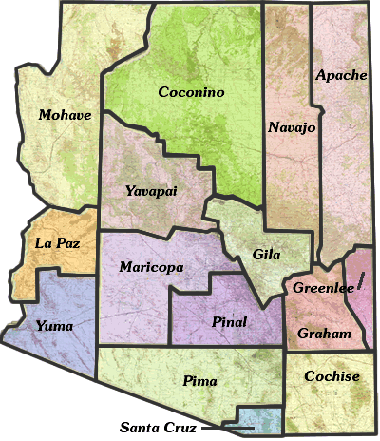
Click within the borders of any county in the map to jump to that county's resource list.
Countrywide
The table lists examples of suffix forms that are primary street suffix names, common street suffixes or suffix abbreviations, and recommended official Postal Service standard suffix abbreviations. See also Waze Standard Suffix Abbreviations
Statewide
This is the Arizona Department of Transportation APLAN ArcGIS Functional Classification map. This is the interactive map that all Arizona editors are to use when establishing FC implementation into the Waze Map Editor.
An interactive map showing Arizona's highways.
An interactive map showing all of Arizona's RailRoad network.
An interactive map showing the location of all the Arizona Highway mileposts.
An interactive map showing all of the Arizona Rest Stops location.
Useful for verifying current Gas Station statuses.
Counties
Apache County
Provides street names, and other information through various layers.
Cochise County
Access the Subdivision Plats & Surveys map for street names and other information through various layers.
Coconino County
Provides street names, house number assignments, parcel ownership, names of natural features, names of city facilities, and names of educational, medical, and religious institutions.
Provides street names, house number assignments, parcel ownership, names of natural features, names of city facilities, and names of educational, medical, and religious institutions.
Flagstaff does not freely provide direct access to its GIS interactive map. They do make a Street Map, and other maps available in PDF format.
Gila County
Provides Street names, and additional information through various layers. (Scroll down to find the link to the current map application.)
Graham County
Provides Street names, and additional information through various layers. (Scroll down to find the link to the current map application.)
Greenlee County
Provides street names.
La Paz County
Click on the GIS Mapping Website link in the lower right side of the page to access the current mapping application. Provides street names, property ownership, addresses, and other information through various layers.
Maricopa County
Live sortable database
Provides street names, house number assignments, and parcel ownership. Note that street names for private streets can be highly inaccurate, as can the directional designation (N, E, S, W) in some areas.
Links to several prepared maps in PDF format. None seem to provide street names or house numbers, but several contain information valuable for other mapping tasks.
Including links to a few PDF maps, plus their Map Anything map which provides street names and city boundaries.
- Chandler InfoMap
(requires Microsoft Silverlight plugin)
Provides street names, and house number assignments.
Non-interactive prepared maps in PDF format listed on the left side. Also, their 2009 Street Map Index is available in both large and small editions, which include street names but not house number assignments.
- Gilbert CIP Interactive Map
(requires Microsoft Silverlight plugin)
Provides street names, and house number assignments. Note that some minor streets might not be represented graphically, but with a sufficiently close zoom setting will be named.
Provides street names, and house number assignments.
Provides street names, house number assignments, and other information.
Provides street names, construction information, street closures, and house number assignments. This is a more accurate resource for private street names within the City of Mesa.
- Phoenix
- Maps and Geographic Information Systems (GIS) Data
Provides street names, addresses and parcel information. (New mapping application for Phoenix as of 2015.) - 7th St and 7th Ave Reversible Lane Information
Information on the center reversible lanes that run on 7th Ave between McDowell and Northern, and on 7th St between McDowell and Dunlap. The project information is out of date (the noted projects are complete), but the information on restrictions and signage is current. - Planned Major Street Restrictions and Closures
Includes information about planned major street restrictions and closures associated with activities reported to the Street Transportation Department Right of Way Management Office.
- Maps and Geographic Information Systems (GIS) Data
Provides street names, and house number assignments.
Provides street names, and house number assignments.
- Tempe
- Street Closures & Restrictions
Lists current, upcoming and past street closures and restrictions for both construction projects and other events. Closures and restrictions for ASU sporting events are typically listed here. - Zoning Map
Provides street names, and house number assignments.
- Street Closures & Restrictions
Mohave County
Provides street names, property ownership, house number assignments, and other information through various layers.
Provides street names, property ownership, house number assignments, and other information through various layers.
Pima County
Provides a significant amount of information through various layers, including street names, house number assignments, property ownership, and the names of various types of institutions. Additional maps are available on the GIS Maps page, including several transportation maps.
Provides street names and house number assignments. Additional maps are available on the Map Resources page, and of particular interest to Waze map editors, on the TDOT Resource Center page.
Pinal County
Provides street names, and house number assignments.
PDF map of city street names in AJ.
Provides street names. Parcels link to the Pinal County Assessor's web site record for the property, which can be used to obtain house number assignments.
Non-interactive maps in PDF format. The City Street Map privides street names. Also included is the Coolidge Portion Proposed North-South Freeway map.
Provides street names, and and names of parks.
- Queen Creek
See Queen Creek in Maricopa County.
Santa Cruz County
Access the Assessors map for street names and other information through various layers.
Yavapai County
Provides street names, and a significant amount of additional information by enabling various layers. For example, turn on the Address Labels under Property Features for house number assignments, or Topo Features under Land Features for the names of natural features, park names, city facilities, educational institution names, religious institution names, etc.
Chino Valley does not freely provide direct access to its GIS interactive map. They do make a Street Map, a Street Name List, and other maps available in PDF format. The Street Map provides street names.
Prescott Valley does not freely provide direct access to its GIS interactive map. They do make a Street Map, and other maps available in PDF format. The Street Map includes street names, and the names of parks, some city facilities, and educational institutions.
Yuma County
Provides street names, property ownership, house number assignments, and other information