< New York | UR Project
(→Project Work Areas: imagemap areas 1-10) |
|||
| Line 12: | Line 12: | ||
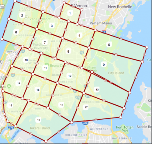
[[File:NY UR project areas in the Bronx.png|thumbnail|left|500px]] | [[File:NY UR project areas in the Bronx.png|thumbnail|left|500px]] | ||
<imagemap>Image:NY_UR_project_areas_in_the_Bronx.png | <imagemap>Image:NY_UR_project_areas_in_the_Bronx.png | ||
poly 248 74 264 7 336 39 324 100 [https://www.waze.com/en-US/editor/?lat=40.903843&lon=-73.845301&zoom=2 "Group 1"] | poly 248 74 264 7 336 39 324 100 [https://www.waze.com/en-US/editor/?lat=40.903843&lon=-73.845301&zoom=2 "Group 1"] | ||
poly 38 80 59 0 175 50 153 117 [https://www.waze.com/en-US/editor/?lat=40.901039&lon=-73.903980&zoom=2 "Group 2"] | poly 38 80 59 0 175 50 153 117 [https://www.waze.com/en-US/editor/?lat=40.901039&lon=-73.903980&zoom=2 "Group 2"] | ||
Revision as of 20:36, 6 April 2018
| Start: 5 April 2018 (subject to change) | End: 17 May 2018 (subject to change) |
Goals
- Use URs to find and fix the map
- Analyze, answer, and act on every open UR in NYC
- Learn, practice, and teach NY state guidelines and best practices for working URs
- Look for and fix other issues in the general vicinity of the URs
- If all the URs are currently dealt with (closed, or in a "waiting period"), address PURs and MPs in the current borough.

