This special page shows all uploaded files.
| Date | Name | Thumbnail | Size | Description | Versions |
|---|---|---|---|---|---|
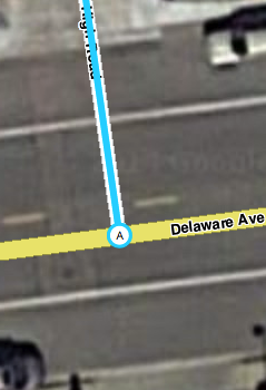
| 19:56, 13 September 2014 | Failed attach undetectable.png (file) |  |
91 KB | A segment that is not really attached, a fact that is undetectable even at close zoom. | 1 |
| 19:58, 13 September 2014 | Failed attach shown.png (file) |  |
91 KB | The invisibly-disconnected segment from Failed_attach_undetectable.png is revealed as disconnected by selecting it. | 1 |
| 20:34, 13 September 2014 | Failed attach fixed.png (file) |  |
95 KB | The failed attachment shown in Failed_attach_undetectable.png and Failed_attach_shown.png has been fixed. This new version shows the name of the new segment properly modified. | 2 |
| 13:20, 4 November 2014 | TryingTooHard fixed.jpg (file) |  |
118 KB | The situation depicted in TryingTooHard.png has been remedied. | 1 |
| 22:46, 14 March 2015 | RedundantRestriction Segment.png (file) |  |
137 KB | Example of a segment restriction redundant with the turn restriction shown in RedundantRestriction_Turn.png | 1 |
| 03:45, 1 April 2018 | Sufficient Detail.jpg (file) |  |
149 KB | No objections in forum discussion to the "sufficient detail" parking-lot image appearing to overlap building. Aerial imagery registration error -- combined with low-resolution app display of Area Places -- renders it pointless to try to match building... | 3 |
| 16:31, 2 August 2014 | AGC unnecessary.png (file) |  |
153 KB | Example of an unnecessary at-grade connector. | 1 |
| 16:31, 2 August 2014 | AGC unnecessary fixed.png (file) |  |
155 KB | The unnecessary at-grade connector in AGC_unnecessary.png has been removed. | 1 |
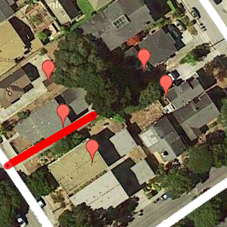
| 02:23, 13 September 2014 | Disjoint wrong.png (file) |  |
165 KB | Example of a disconnected and disjoint segment. | 1 |
| 14:31, 13 September 2014 | Disjoint fixed.png (file) |  |
183 KB | The disconnected and disjoint intersection shown in Disjoint_wrong.png has been corrected. | 2 |
| 19:54, 16 July 2014 | Roundabout wrong.png (file) |  |
186 KB | Example of the roundabout road type used improperly as a dead-end turnaround. | 1 |
| 15:17, 18 July 2014 | Unnecessary split.png (file) |  |
186 KB | Example of an unnecessarily-split road. | 1 |
| 23:03, 16 July 2014 | Roundabout fixed.png (file) |  |
189 KB | The incorrect roundabout shown in image file roundabout_wrong.png is shown fixed as per current guidance for turnarounds & cul-de-sacs. | 2 |
| 15:18, 18 July 2014 | Unnecessary split fixed.png (file) |  |
193 KB | The unnecessarily-split road in the image Unnecessary_split.png has been corrected. | 1 |
| 22:47, 14 March 2015 | RedundantRestriction Turn.png (file) |  |
196 KB | Example of a time-based turn restriction redundant with the segment restriction illustrated in RedundantRestriction_Segment.png | 1 |
| 16:13, 3 January 2015 | Overlapping fixed.jpg (file) |  |
202 KB | The overlapping roads shown in Overlapping.jpg have been fixed. | 1 |
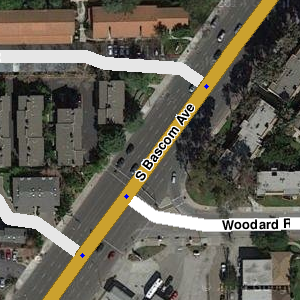
| 16:13, 3 January 2015 | Overlapping.jpg (file) |  |
210 KB | An example of overlapping road segments. | 1 |
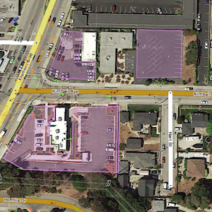
| 22:32, 17 July 2014 | Parkinglots noncompliant.png (file) |  |
233 KB | A screenshot of three noncompliant Parking-Lot Area Places. | 1 |
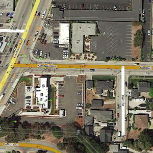
| 22:33, 17 July 2014 | Parkinglots removed.png (file) |  |
234 KB | The area shown in Parkinglots_noncompliant.png is shown with the noncompliant Parking-Lot Area Places removed. | 1 |
| 15:04, 17 July 2014 | UR inconsiderate closure.png (file) |  |
257 KB | Example of a region where inconsiderate closure of Update Requests has taken place. | 1 |
| 17:25, 3 August 2014 | CorruptedTurn fixed.png (file) |  |
258 KB | The corrupted turn restriction shown in CorruptedTurn.png has been fixed. | 1 |
| 17:24, 3 August 2014 | CorruptedTurn.png (file) |  |
261 KB | An example of a corrupted turn restriction that closed a road to Waze users. | 1 |
| 15:05, 17 July 2014 | UR healthy closure.png (file) |  |
277 KB | Example of an area where Update Requests are being handled with due consideration. | 1 |
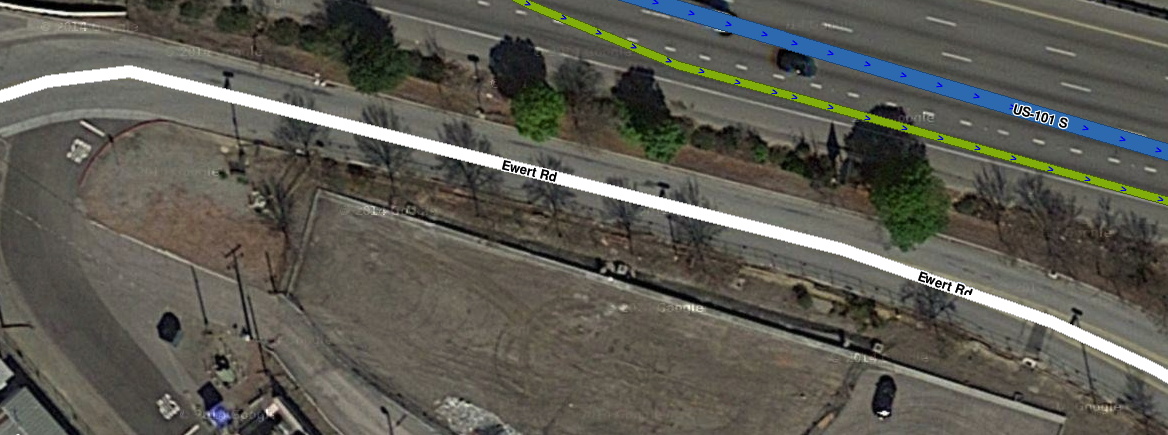
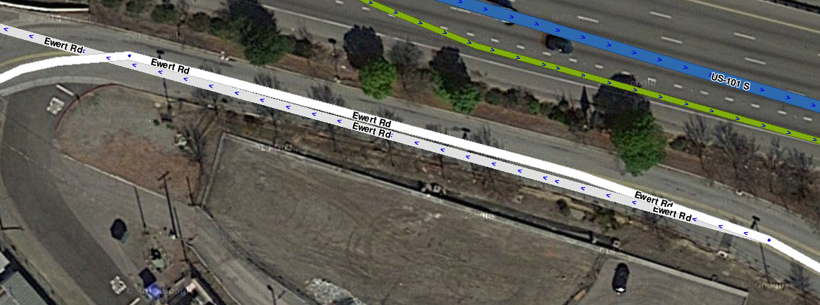
| 15:48, 23 July 2014 | AccessRoad distorts routing.png (file) |  |
279 KB | Added more addresses for which routing could be disrupted to really drive the point home :) | 3 |
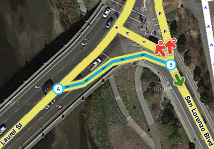
| 15:32, 15 August 2015 | AGCs and Missing Roads.jpg (file) |  |
292 KB | Area Places don't suppress missing roads after all. | 3 |
| 14:25, 4 October 2014 | MisunderstoodHighway fixed.png (file) |  |
352 KB | Functional classification for Elm St that was broken in MisunderstoodHighway.png has been restored. | 1 |
| 14:24, 4 October 2014 | MisunderstoodHighway.png (file) |  |
352 KB | An editor has dropped Elm St to Primary Street from the functional-classification rank of Minor Highway. | 1 |
| 04:45, 27 July 2014 | GeometryNodes efficient.png (file) |  |
507 KB | The segment displayed GeometryNodes_excessive.png has been reworked with more efficient use of geometry nodes. | 1 |
| 04:44, 27 July 2014 | GeometryNodes excessive.png (file) |  |
508 KB | An example of excessive use of geometry nodes. | 1 |
| 01:37, 21 July 2014 | AreaPlaces incorrect fixed.png (file) |  |
615 KB | The example in the file AreaPlaces_incorrect.png is shown after adjustment to improve routing and adhere to convention. | 1 |
| 01:36, 21 July 2014 | AreaPlaces incorrect.png (file) |  |
620 KB | An example of Area Places used in a way that is well-intentioned but counterproductive. | 1 |
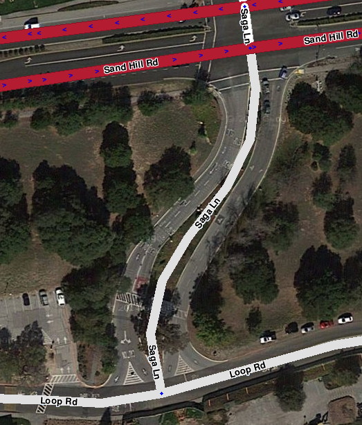
| 14:07, 3 November 2014 | TryingTooHard.png (file) |  |
636 KB | An example of trying too hard to match the satellite image. | 1 |
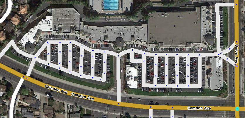
| 14:52, 18 July 2014 | PLR excessive.png (file) |  |
659 KB | Example of excessive use of Parking-Lot Roads. | 1 |
| 14:53, 18 July 2014 | PLR excessive fixed.png (file) |  |
674 KB | The example of excessive Parking-Lot Roads shown in PLR_excessive.png has been corrected. | 1 |
| 21:50, 14 March 2015 | WalkingTrailBBQ.png (file) |  |
732 KB | Example of a rectilinear park thoroughly mapped with walking trails. | 1 |
| 21:51, 14 March 2015 | WalkingTrailsParallel.png (file) |  |
837 KB | Example of multiple walking trails mapped in close proximity to roads and drivable destinations. | 1 |
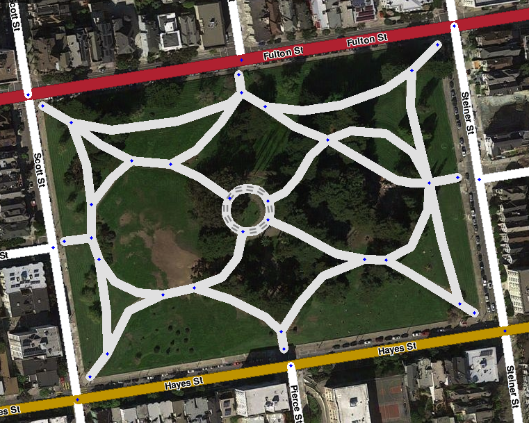
| 21:50, 14 March 2015 | WalkingTrailRoundabout.png (file) |  |
881 KB | Example of a park thoroughly mapped with walking trails, including a walking-trail roundabout. | 1 |