Use the following checklist step-by-step to determine whether the "City" field for a segment or place should contain a name or be marked as "None" in the states of Alabama, Georgia, and Florida
Mailing Address for City field in Waze
NOTE: Mailing addresses alone are not a determining factor for filling in the City field; city limits are. For example, everyone who lives in Leon County has a "Tallahassee, FL" mailing address, but not everyone in Leon County lives within the incorporated city limits of Tallahassee. Most unincorporated county areas should have the City field checked as "None", unless they meet one of the following exceptions.
Start Here
Step 1 : Incorporated Municipality
Is the segment within a city on the list of legally incorporated municipalities? Click the appropriate state link below.
 |
 |
 |
Is the city on one of the lists provided above?
|
|
|
Step 1a - Verify City Limits
Check if your segment falls within the city limits by using the appropriate state's mapping resources below
 |
 |
 |
Is the segment Within the City Limits?
|
|
|
Step 2 - Census Designated Place (CDP)
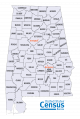
Click the image below for the state you are researching and scroll to the bottom. The list of places includes all Incorporated Cities and all Census Designated Places. You will find CDP after each Census Designated Place. DO NOT assume these boundaries are correct for Incorporated Cities as they may be out of date.
 |
 |
 |
Is the CDP listed on the appropriate state's list?
|
|
|
Step 2a: Determine Geographic Boundaries
The geographic boundaries of CDP's can be viewed in PDF form by selecting the appropriate State, then selecting the correct county on the next page at US Census Bureau 2010 Census Tracts(Places), or they can be overlaid on WME by following the presentation Overlay CDP's on WME by t0cableguy. The PDF's or the shapefiles provided by the census.gov website are the ONLY approved source for CDP boundaries.
US Census Bureau Reference Maps
US Census Bureau 2010 Census Tracts(Places)
Is the segment within the Census Designated Place selected in Step 2, according to the files listed in Step 2a?
|
|
|
STEP 3 - County Property Appraiser
If you look up a parcel for the segment using the appropriate Property Appraiser's website does it list the target name as a valid address?
|
|
|
|
|
|
Step 3a: Determine boundaries of target name
Try to determine the boundaries for use of that target name by checking subsequent parcels in the area or checking county GIS sites for your state provided below.
|
|
|
Is the Target Name listed in one of these resources for the parcels surrounding the segment?
|
|
|
STEP 4 - Indian Reservations / Government Installations
Is the segment / place located on an Indian Reservation or Government Installation?
|
|
|
STEP 5 - Other Place of Significance.
There are many other Census Designated Places and points of interest throughout the Southeast Regsion, but many are small. Does your target location have a major cultural significance (e.g. tourist attraction, county seat, travel milestone (e.g. Yeehaw Junction))?
|
|
|
Options for City Name Field
Incorporated City Name
| Segment is within an incorporated municipality's city limits. Use the name in the city field for the segment. | 
|
Census Designated Place(CDP)
| Segment is within a Census Designated Place's(CDP) boundary. Please Use this CDP in the city field. | 
|
NOTE: If this name is an incorporated municipality and the segment is outside its legal limits do not use it as the city name.
Use Target Name in City Field
| Segment is listed in appraisers maps as the city name for multiple parcels. Please Use this target name in the city field. | 
|
NOTE: If this name is an incorporated municipality and the segment is outside its legal limits do not use it as the city name.
Start Over
Consult Regional Managment
Listing the name of the reservation or installation in the City field may be appropriate. If you believe it may be beneficial to map, consult a State Manager or Regional Coordinator for more guidance.
No City
| Segment is not within any of the possible city name options. Please check None for the city field. These aren't the droid's you're looking for. |  |
Flowchart
The following flow-chart outlines the discussion from above:
