This special page shows all uploaded files.
| Date | Name | Thumbnail | Size | Description | Versions |
|---|---|---|---|---|---|
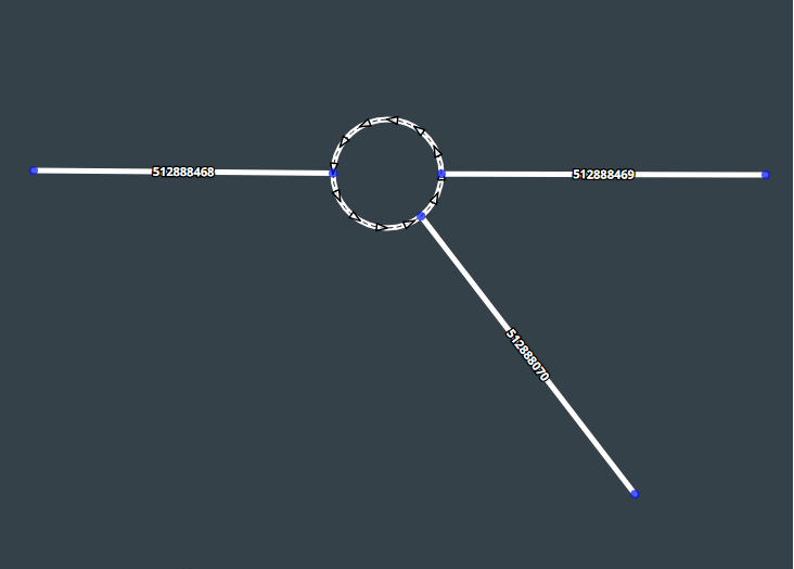
| 18:41, 11 February 2020 | Closure corner node English.png (file) |  |
967 KB | 1 | |
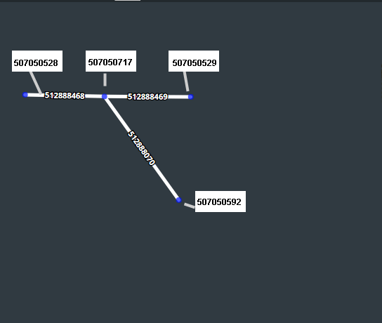
| 18:34, 11 February 2020 | Input node English.png (file) |  |
589 KB | For one-way closures, only the input node to the segment closure can be closed. | 1 |
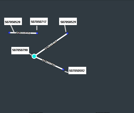
| 14:43, 11 February 2020 | Closure nodes English.png (file) |  |
374 KB | Example showing several nodes availble for closure, in English | 1 |
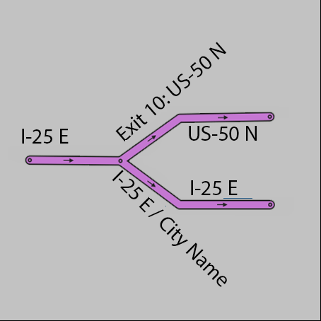
| 18:57, 7 March 2019 | CityRename.png (file) |  |
433 KB | 1 | |
| 17:26, 22 October 2018 | Segment node ids10.png (file) |  |
21 KB | 1 | |
| 16:52, 19 October 2018 | Segment node ids9.png (file) |  |
6 KB | 1 | |
| 16:52, 19 October 2018 | Segment node ids8.png (file) |  |
7 KB | 1 | |
| 16:51, 19 October 2018 | Segment node ids7.png (file) |  |
6 KB | 1 | |
| 16:50, 19 October 2018 | Segment node ids6.png (file) |  |
6 KB | 1 | |
| 16:49, 19 October 2018 | Segment node ids5.png (file) |  |
6 KB | 1 | |
| 16:48, 19 October 2018 | Segment node ids4.png (file) |  |
6 KB | 1 | |
| 16:40, 19 October 2018 | Segment node ids3.png (file) |  |
5 KB | 1 | |
| 16:35, 19 October 2018 | Segment node ids2.png (file) |  |
5 KB | 1 | |
| 16:32, 19 October 2018 | Segment node ids1.png (file) |  |
3 KB | 1 | |
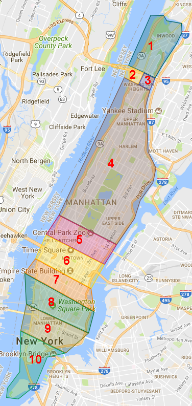
| 01:35, 23 May 2018 | Manhattan 10 groups.png (file) |  |
320 KB | 10 groups for Manhattan UR project | 1 |
| 23:15, 10 April 2018 | RTC destination on closed segment.jpeg (file) |  |
34 KB | If the closest segment to the destination is closed via RTC, waze will pick a different "closest segment" | 1 |
| 20:08, 26 March 2018 | NY UR project areas in the Bronx.png (file) |  |
467 KB | 1 | |
| 14:24, 12 March 2018 | Magic screen.png (file) |  |
2.11 MB | Example of Magic alerts in an area where segments were imported from a third-party service | 1 |
| 13:57, 2 March 2018 | MAGIC segment selected.PNG (file) |  |
50 KB | 1 | |
| 21:44, 30 January 2018 | Segment cross times.png (file) |  |
17 KB | Simplified representation of the three cross times for the three different segment transitions at end node B of a segment. | 1 |
| 13:56, 24 January 2018 | Windbreakers altai steppe c.png (file) |  |
86 KB | Derived (cropped image) from file by Doogal at English Wikipedia - Transferred from en.wikipedia to Commons by ArwinJ., Public Domain, https://commons.wikimedia.org/w/index.php?curid=8825340 | 1 |
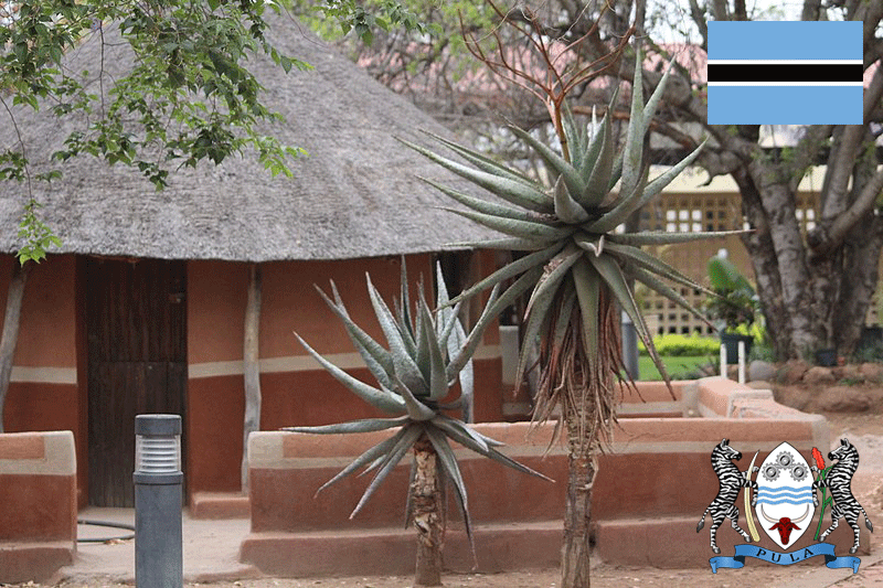
| 13:06, 17 November 2017 | Botswana mapraid groups.jpg (file) |  |
23 KB | 2 | |
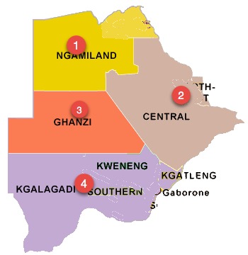
| 19:00, 13 November 2017 | Botswana Mapraid.png (file) |  |
267 KB | Category:Mapraid Category:Botswana | 1 |
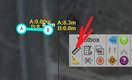
| 14:14, 30 October 2017 | Toolbox measure.png (file) |  |
49 KB | Use the toolbox "ruler" tool to measure the length of any segment, saved or not. | 1 |
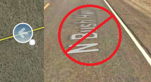
| 20:54, 26 October 2017 | SV street label.png (file) |  |
100 KB | These street labels come from Google Maps. They may be wrong. | 1 |
| 20:33, 26 October 2017 | Unpaved checkbox.JPG (file) |  |
10 KB | For unpaved roads, use the correct street type and the unpaved checkbox. | 1 |
| 20:26, 26 October 2017 | Major connectivity.JPG (file) |  |
32 KB | This freeway becomes a local streeet for a few segments | 1 |
| 20:18, 26 October 2017 | Basemap basics.jpeg (file) |  |
93 KB | missing roads, nonexistent roads, red arrows, unconfirmed or "soft" turns. | 1 |
| 16:28, 18 September 2017 | City border road US.png (file) |  |
44 KB | When addresses on opposite sides of the same segment are in different cities, use one of the city names in the primary name, and the other in the secondary name | 1 |
| 16:20, 18 September 2017 | Township and borough with same name.png (file) |  |
43 KB | 2 | |
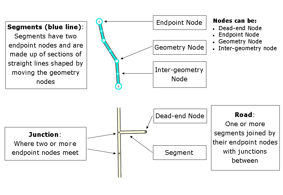
| 18:47, 17 May 2016 | Segments Nodes Junctions.png (file) |  |
27 KB | typo correction (mode -> more) | 3 |
| 14:52, 28 April 2016 | Green arrow highlighted.png (file) | 2 KB | From https://www.waze.com/assets-editor/sprites/vectors/turns-sd65f776611.png | 1 | |
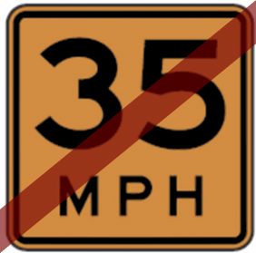
| 17:30, 22 March 2016 | No Advisory Speed Plaque.png (file) |  |
26 KB | Advisory Speed Plague with red "sash" indicating "no" | 1 |
| 20:51, 1 March 2016 | SpeedLimitReminders.png (file) |  |
104 KB | Category:Mapraid | 1 |
| 13:14, 1 March 2016 | Google form icon.PNG (file) | 2 KB | 1 | ||
| 01:30, 1 March 2016 | One way.png (file) |  |
3 KB | Category:Traffic sign | 1 |
| 01:29, 1 March 2016 | Do not enter3.PNG (file) |  |
2 KB | Traffic sign | 1 |
| 01:29, 1 March 2016 | Stop sign ahead.PNG (file) |  |
2 KB | Category:Traffic sign | 1 |
| 01:21, 1 March 2016 | Do not enter2.png (file) |  |
3 KB | Category:Traffic Sign | 1 |
| 20:07, 29 February 2016 | Do not enter1.PNG (file) |  |
5 KB | Category:Traffic Sign | 1 |
| 18:10, 29 February 2016 | NHS roads in PA.PNG (file) |  |
247 KB | Category:Pennsylvania | 1 |
| 22:52, 28 February 2016 | URO+ MPH.PNG (file) |  |
16 KB | Using URO+ to identify URs which contain "mph" | 1 |
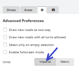
| 05:18, 28 February 2016 | Choose imperial units.png (file) |  |
10 KB | 1 | |
| 16:50, 26 February 2016 | Mapraid PA SL.PNG (file) |  |
46 KB | 4 | |
| 18:11, 23 February 2016 | Poland MMR hof.png (file) |  |
396 KB | Category:Mapraid | 1 |
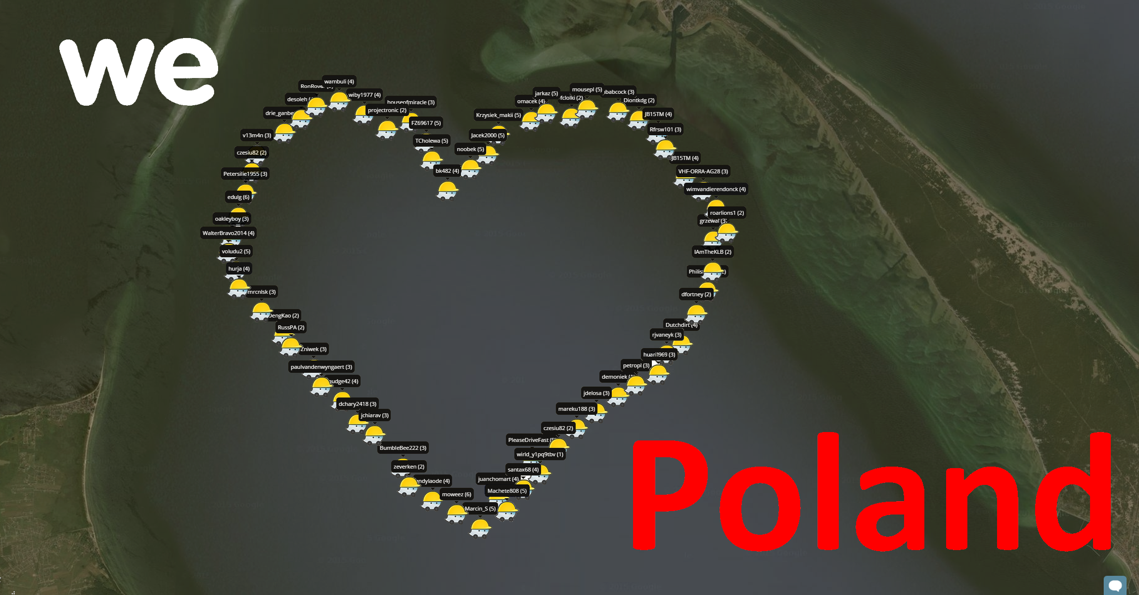
| 20:36, 16 February 2016 | MMR Poland Selfie.png (file) |  |
1.68 MB | Category:Mapraid | 1 |
| 07:46, 26 January 2016 | Poland Mapraid labels.png (file) |  |
77 KB | Category:Mapraid | 1 |
| 13:51, 14 December 2015 | Venezuela MMR Selfie.jpg (file) |  |
420 KB | Category:Mapraid | 1 |
| 21:58, 7 December 2015 | LeftExitSplit new.png (file) |  |
11 KB | replacement for [//wiki.waze.com/wiki/File:LeftExitSplit.png LeftExitSplit] | 1 |
| 21:55, 7 December 2015 | LeftExitRamp new.png (file) |  |
11 KB | replacement for File:LeftExitRamp.png | 1 |