This special page shows all uploaded files.
| Date | Name | Thumbnail | Size | Description | Versions |
|---|---|---|---|---|---|
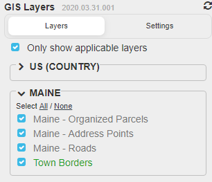
| 23:46, 19 May 2020 | GIS-Layer-Choices.PNG (file) |  |
14 KB | Reverted to version as of 23:44, 19 May 2020 (UTC) | 5 |
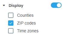
| 23:17, 19 May 2020 | USGB-Display-Zip-Codes.png (file) |  |
3 KB | USGB WME Display Zip Codes | 1 |
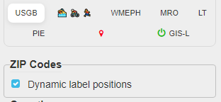
| 23:16, 19 May 2020 | USGB-ZIP-Codes.PNG (file) |  |
6 KB | USGB ZIP Codes Choose Dynamic label positions | 1 |
| 00:49, 18 May 2020 | GIS-Layers-Setup.png (file) | 7 KB | Steps to enable GIS layers for Maine 2020 Map Raid | 1 | |
| 00:48, 18 May 2020 | GIS-Layer-Maine-Example.PNG (file) |  |
772 KB | Example of GIS Layers in Maine showing street, parcel and house number | 1 |
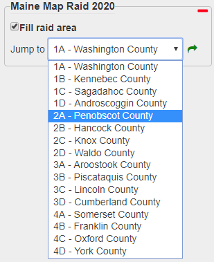
| 22:00, 17 May 2020 | MRO-choose-Maine-group-county.PNG (file) |  |
16 KB | Map Raid Overlay choose Main Group and County | 1 |
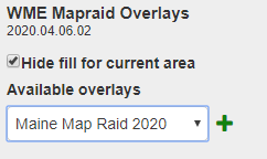
| 21:57, 17 May 2020 | MRO-choose-Maine-overlay.PNG (file) |  |
5 KB | WME Mapraid Overlays choose Maine Map Raid 2020 | 1 |