This special page shows all uploaded files.
| Date | Name | Thumbnail | Size | Description | Versions |
|---|---|---|---|---|---|
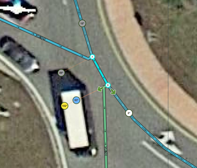
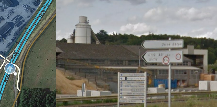
| 14:54, 9 March 2023 | JB not paths.jpg (file) |  |
226 KB | A junction box has been used to record speed differences in the exit lanes. Far lanes and turn instructions have been set on the junction box connections, instead of using paths for this. | 1 |
| 19:03, 8 March 2023 | Path tree 60frames.gif (file) |  |
233 KB | 1 | |
| 14:52, 10 August 2021 | RdAbt-DivRd.png (file) |  |
242 KB | 1 | |
| 13:00, 18 October 2016 | Basemap2.jpg (file) |  |
242 KB | 2 | |
| 02:57, 30 August 2019 | Pricecomp.jpg (file) |  |
252 KB | 1 | |
| 19:34, 6 August 2021 | CompleteRA.png (file) |  |
255 KB | 1 | |
| 19:36, 6 August 2021 | NeedsRA.png (file) |  |
256 KB | 1 | |
| 19:32, 6 August 2021 | ConfirmRA.png (file) |  |
265 KB | 1 | |
| 19:10, 10 March 2023 | Combined and preferred lanes compact.jpg (file) |  |
267 KB | 1 | |
| 12:58, 18 October 2016 | Basemap.jpg (file) |  |
277 KB | 2 | |
| 19:32, 6 August 2021 | BuildRA.png (file) |  |
277 KB | 1 | |
| 15:53, 10 October 2017 | 10WLA.png (file) |  |
277 KB | 1 | |
| 19:32, 6 August 2021 | AdjustforRA.png (file) |  |
280 KB | 1 | |
| 18:59, 17 May 2017 | FlagApproved.png (file) |  |
284 KB | 1 | |
| 15:08, 11 January 2019 | Polaris.png (file) |  |
318 KB | 1 | |
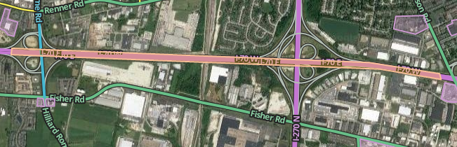
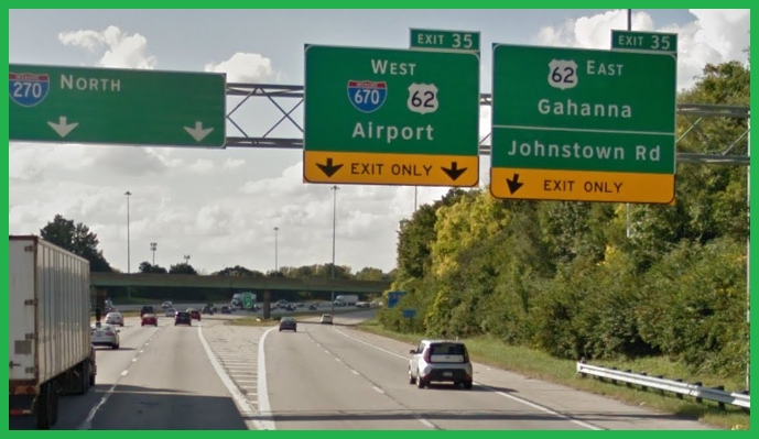
| 19:21, 1 March 2023 | 270-161-670-62 split signs.png (file) |  |
326 KB | 1 | |
| 18:51, 20 September 2017 | Fork35.png (file) |  |
332 KB | 2 | |
| 19:48, 22 December 2016 | MCArea.png (file) |  |
333 KB | 1 | |
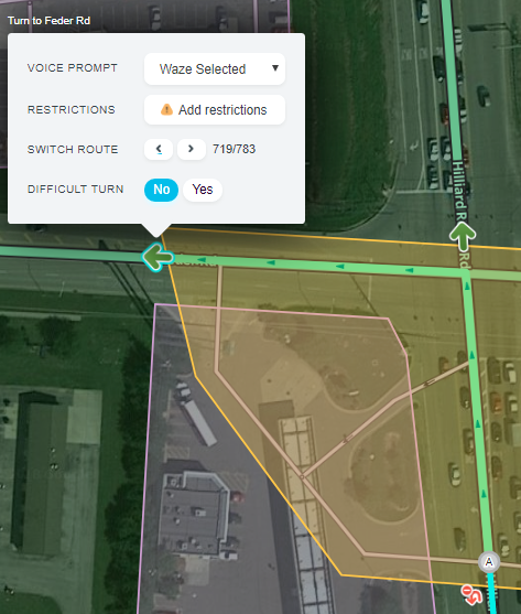
| 15:23, 9 February 2018 | 719JB.png (file) |  |
339 KB | 1 | |
| 02:27, 8 October 2017 | VPO.png (file) |  |
347 KB | 1 | |
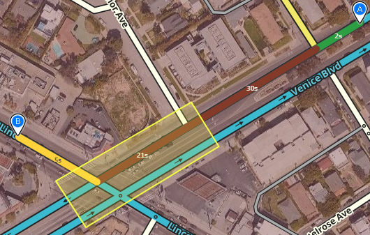
| 21:32, 2 March 2023 | Venice-Lincoln right turn.png (file) |  |
355 KB | This simple JB records a 30-second delay on the entering segment of Venice Blvd going SW for right turns on Lincoln. | 1 |
| 15:45, 1 March 2023 | Split sign exit instructions.png (file) |  |
355 KB | A far turn instruction at an exit, followed by a near turn instruction at a ramp fork, allow Waze to show and speak accurate turn instructions that match the signs here. | 1 |
| 18:39, 6 March 2023 | Combined and preferred lanes.jpg (file) |  |
359 KB | 1 | |
| 16:08, 6 November 2018 | ClosedPlace.png (file) |  |
360 KB | 6 | |
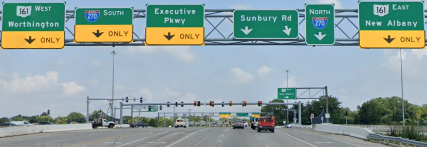
| 16:55, 1 March 2023 | Sunbury road signs.png (file) |  |
360 KB | Overhead sign assembly at a single-point urban interchange | 1 |
| 18:05, 22 May 2018 | Trailtracks.png (file) |  |
362 KB | 2 | |
| 15:07, 11 January 2019 | Easton.png (file) |  |
362 KB | 1 | |
| 20:17, 11 May 2018 | Virtualnode.png (file) |  |
381 KB | 1 | |
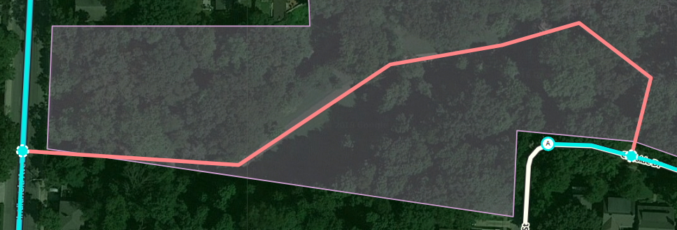
| 22:06, 24 February 2023 | Restricted cross route.png (file) |  |
396 KB | Reverted to version as of 15:08, 24 February 2023 (UTC) | 3 |
| 20:10, 8 August 2021 | TrafficCircleSquare.png (file) |  |
396 KB | 1 | |
| 15:39, 18 May 2018 | ClevCasc.png (file) |  |
401 KB | 1 | |
| 19:02, 6 August 2021 | RAhacks.png (file) |  |
408 KB | 4 | |
| 04:17, 8 August 2021 | PeanutRA.png (file) |  |
411 KB | 1 | |
| 18:35, 10 July 2017 | ExitRampLong.png (file) | 418 KB | 1 | ||
| 18:38, 20 September 2017 | Exit35.png (file) |  |
434 KB | 1 | |
| 18:28, 29 July 2021 | RA-bad.png (file) |  |
438 KB | 2 | |
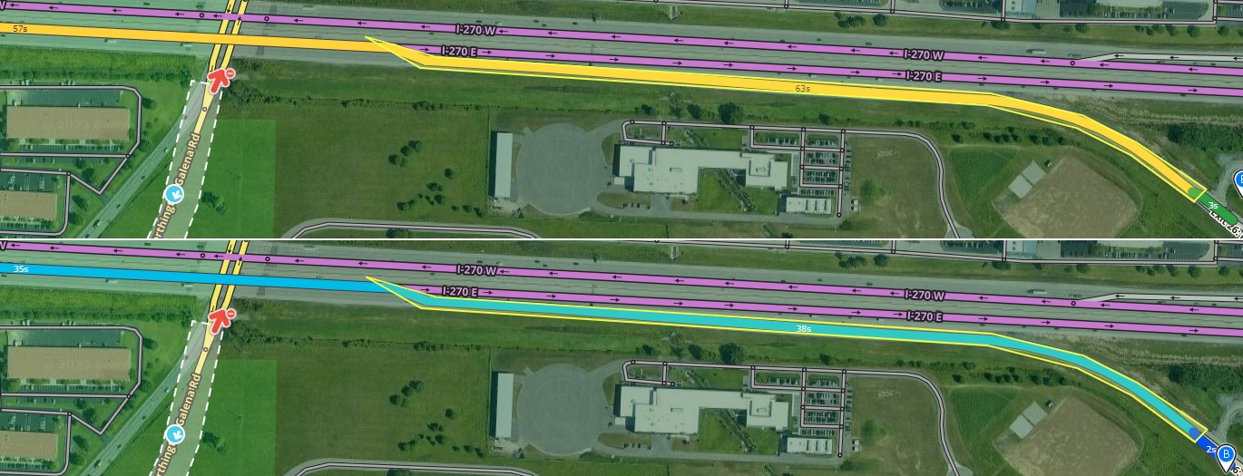
| 14:23, 28 February 2023 | Far lanes JB.png (file) |  |
443 KB | 2 | |
| 20:07, 6 August 2021 | RATracks.png (file) |  |
463 KB | 1 | |
| 14:33, 1 March 2018 | RPBDP.png (file) |  |
467 KB | 1 | |
| 15:01, 29 July 2021 | JuBRA.png (file) |  |
477 KB | 1 | |
| 20:32, 12 April 2019 | RA-UTP.png (file) |  |
483 KB | 1 | |
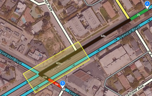
| 21:28, 2 March 2023 | Venice-Lincoln left turn.png (file) |  |
491 KB | This simple JB records a 60-second delay on the entering segment of Venice Blvd going SW for left turns on Lincoln. | 1 |
| 17:15, 27 February 2023 | Nested paths 1.png (file) |  |
496 KB | 1 | |
| 14:33, 15 July 2016 | Runway.JPG (file) |  |
515 KB | 1 | |
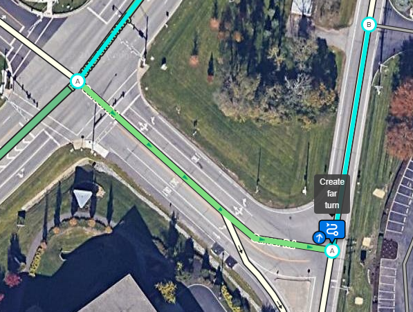
| 19:08, 1 March 2023 | Create a path.png (file) |  |
518 KB | A path can be created for preferred lane guidance here. | 1 |
| 14:56, 16 February 2018 | NewWT.png (file) |  |
531 KB | 1 | |
| 16:48, 19 October 2018 | White signs.png (file) |  |
557 KB | 1 | |
| 15:38, 18 May 2018 | WVilleBkWay.png (file) |  |
568 KB | 1 | |
| 18:10, 24 January 2017 | RampEvent.png (file) |  |
587 KB | 2 | |
| 18:12, 30 October 2017 | EntranceRamp.png (file) | 589 KB | 2 |