This special page shows all uploaded files.
| Date | Name | Thumbnail | Size | Description | Versions |
|---|---|---|---|---|---|
| 10:05, 22 May 2014 | Routes Erreur1.png (file) |  |
637 KB | Erreur à ne pas faire | 2 |
| 21:16, 13 February 2019 | 20150109142651!phpwEzOvA.png (file) |  |
615 KB | 2 | |
| 16:14, 27 April 2020 | StreetView Garnier.png (file) |  |
543 KB | 3 | |
| 14:06, 11 December 2017 | Creer une route.jpg (file) |  |
502 KB | Editeurs débutants : Créer une route | 1 |
| 20:15, 27 April 2020 | Zoom drag drop.png (file) |  |
498 KB | 2 | |
| 18:00, 9 May 2020 | DA31 oui1.png (file) |  |
495 KB | 1 | |
| 19:37, 1 April 2019 | Narrow hors ville.png (file) |  |
488 KB | 1 | |
| 08:12, 10 May 2020 | DA31 non5.png (file) |  |
446 KB | 1 | |
| 21:32, 30 April 2020 | Photo HS6.png (file) |  |
445 KB | 1 | |
| 10:50, 28 April 2020 | WME logon screen FR.png (file) |  |
438 KB | Mise à jour du visuel | 3 |
| 10:01, 16 February 2019 | TIO stop.png (file) |  |
430 KB | 2 | |
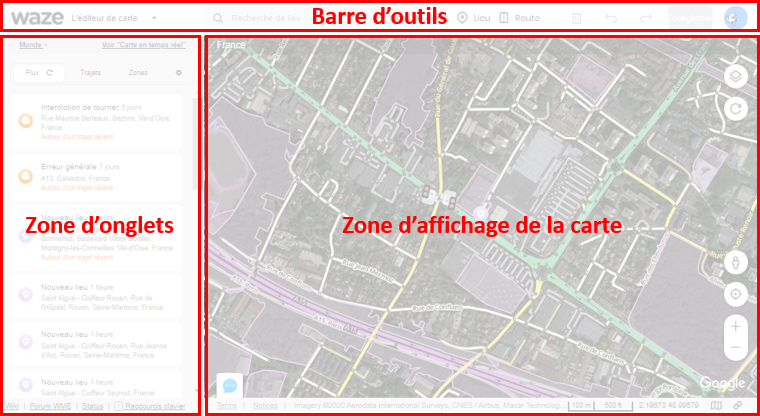
| 12:01, 27 April 2020 | Disposition de WME.png (file) |  |
423 KB | Mise à jour du visuel | 3 |
| 21:32, 30 April 2020 | Photo HS4.png (file) |  |
422 KB | 1 | |
| 19:36, 29 April 2020 | Editable area skinny.PNG (file) |  |
414 KB | 1 | |
| 21:31, 30 April 2020 | Photo HS1.png (file) |  |
406 KB | 1 | |
| 08:45, 10 May 2020 | DA31 oui5.png (file) |  |
396 KB | 1 | |
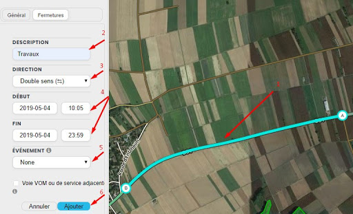
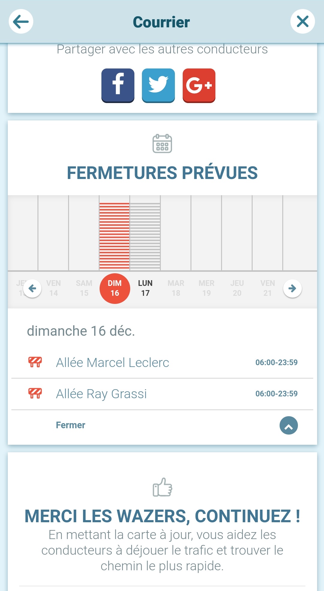
| 18:47, 29 November 2020 | FR ferm VOM.png (file) |  |
386 KB | 1 | |
| 21:32, 30 April 2020 | Photo HS5.png (file) |  |
370 KB | 1 | |
| 17:41, 27 April 2020 | Gps tracks straight skinny.png (file) |  |
354 KB | 3 | |
| 12:01, 2 October 2014 | Lieu-Dit.png (file) |  |
344 KB | Exemple de lieu-dit | 1 |
| 21:31, 30 April 2020 | Photo HS2.png (file) |  |
342 KB | 1 | |
| 14:47, 20 July 2020 | Intersection img H.png (file) |  |
335 KB | 2 | |
| 21:31, 30 April 2020 | Photo HS3.png (file) |  |
332 KB | 1 | |
| 15:23, 9 May 2020 | DA31 non2.png (file) |  |
316 KB | 1 | |
| 19:28, 1 April 2019 | Narrow ville.png (file) |  |
306 KB | 1 | |
| 19:03, 12 July 2021 | Rangs vs Roles.png (file) |  |
301 KB | 2 | |
| 15:50, 27 April 2020 | Zone Affichage Carte.png (file) |  |
300 KB | 3 | |
| 19:37, 1 May 2020 | RP Freeway.png (file) |  |
284 KB | 1 | |
| 16:36, 20 July 2020 | Jct cul-de-sac island ex.png (file) |  |
275 KB | Reverted to version as of 20:44, 16 July 2015 (UTC) | 6 |
| 18:46, 29 November 2020 | FR ferm new.png (file) |  |
272 KB | 1 | |
| 10:02, 22 May 2014 | Routes Erreur2.png (file) |  |
267 KB | Erreur à ne pas faire | 1 |
| 16:29, 5 May 2020 | Continuite C107.png (file) | 258 KB | 1 | ||
| 21:40, 29 November 2020 | FR MTE1.jpg (file) |  |
251 KB | 1 | |
| 21:41, 29 November 2020 | FR MTE2.jpg (file) |  |
247 KB | 1 | |
| 19:15, 12 January 2021 | FR PUR on map.png (file) |  |
246 KB | 1 | |
| 19:24, 1 May 2020 | Continuite geo.png (file) |  |
246 KB | 1 | |
| 19:47, 16 December 2020 | FR UR on map.png (file) |  |
239 KB | 1 | |
| 15:05, 24 February 2015 | Class geo.png (file) |  |
232 KB | Classification : Interruption géographique | 1 |
| 15:57, 9 May 2020 | DA31 non3.png (file) |  |
226 KB | 2 | |
| 13:26, 15 January 2015 | Simplification.png (file) |  |
225 KB | Simplification d'un carrefour | 1 |
| 07:38, 10 May 2020 | DA31 non4.png (file) |  |
210 KB | 1 | |
| 16:16, 20 July 2020 | Jct 4 offset align or not.png (file) |  |
209 KB | 1 | |
| 15:40, 8 March 2019 | Creer un lieu.png (file) |  |
207 KB | 1 | |
| 19:36, 1 May 2020 | RP Major.png (file) |  |
196 KB | 1 | |
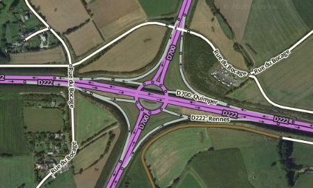
| 19:09, 20 July 2020 | Roundabout 06.png (file) |  |
175 KB | 2 | |
| 19:09, 20 July 2020 | Roundabout 07.png (file) |  |
175 KB | 2 | |
| 19:06, 20 July 2020 | Roundabout 01.png (file) |  |
174 KB | 2 | |
| 19:10, 20 July 2020 | Roundabout 02.png (file) |  |
174 KB | 2 | |
| 20:49, 29 April 2020 | POI combi.png (file) |  |
174 KB | 1 | |
| 15:05, 24 February 2015 | Class major2freeway.png (file) | 171 KB | Classification : Interruption Major / Freeway | 1 |