No edit summary |
|||
| (203 intermediate revisions by 3 users not shown) | |||
| Line 1: | Line 1: | ||
The Waze community has created the following plugins/extensions/addons for use in the Waze web-based environments. | The Waze community has created the following plugins/extensions/addons for use in the Waze web-based environments. | ||
See [[#browsers| browser requirements and instructions]]. | |||
Please be aware that these scripts commonly require updates in order to properly work after new releases of the Waze products. While some may update automatically once their authors make changes, others may require manual updating on your part. | |||
== | |||
[http://code.waze.tools/home/ Common Scripts Repository for Developers & End Users] | |||
== {{Anchor|browsers}}Browser requirements== | |||
[[ | === {{Anchor|Chrome}}Chrome / Blink / Opera Next === | ||
You might need to enable '''Developer Mode''' on your browser. | |||
* If a download is available from the Chrome Web Store, choose that. | |||
* Without an [[#Monkey|add-on]] to manage scripts, simply download the script file (.js) or Chrome executable package (CRX). Then drag and drop the file into the Chrome Extensions Tab [chrome://extensions] of the browser. | |||
* Install [[#Monkey|''TamperMonkey'' or equivalent]]. | |||
=== {{Anchor|Firefox}}Firefox / Mozilla === | |||
* Install [[#Monkey|''Greasemonkey'']]. | |||
* | === Internet Explorer === | ||
* Install [[#Monkey|''Greasemonkey'' or equivalent]]. | |||
=== Safari === | |||
* Install script as an extension. | |||
* Install [[#WazeBar|''WazeBar for Safari'']]. | |||
[http:// | === {{Anchor|Monkey}}Greasemonkey or Tampermonkey add-on for script management === | ||
The easiest way to load and manage add-on scripts is with [http://addons.mozilla.org/en-US/firefox/addon/greasemonkey/ ''Greasemonkey''], [http://tampermonkey.net/ ''Tampermonkey''], or an equivalent browser add-on for script management. When you install a user script, the script manager catalogs it and automatically runs it anytime any page for which it is declared is loaded by your browser. | |||
---- | ---- | ||
WME | == Map Editor presentation enhancements == | ||
=== {{Anchor |Highlights for Landmarks and Segments}}WME Color Highlights (WMECH) === | |||
by [[User:Timbones|Timbones]] | |||
This script adds color highlighting to segments and landmarks according to their status and type or other criteria. The highlighting of segments is likely to be most useful, for it shows locked and nameless roads. [[Traffic lock]]s highlight is available where applicable. | |||
[[Image:Wme-highlights.png]] | |||
<u>'''DOWNLOAD WME Color Highlights'''</u> | |||
* [http://userscripts-mirror.org/scripts/show/141050 from userscripts.org]. | |||
* [http://chrome.google.com/webstore/detail/wme-color-highlights/ijnldkoicbhinlgnoigchihmegdjobjc from Chrome Web Store]. | |||
<u>'''More information'''</u> | <u>'''More information'''</u> | ||
: [http://www.waze.com/forum/viewtopic.php?t=40705 ''WME Color Highlights'' forum thread] | |||
[http:// | |||
---- | ---- | ||
===WME | === WME Highlighter City === | ||
by [[User: | by [[User:AlexN-114|AlexN-114]] | ||
Highlighter City (HiLiCi) is a derivative of WME Color Highlights v. 1.7.2. It checks for some countries (Austria, Switzerland, Germany, Liechtenstein, Norway, Australia, France, Mexico, Italy and Puerto Rico) the correctness of the content of the city field. | |||
If you want this feature for your country, [http://www.waze.com/forum/viewtopic.php?f=819&t=78774 ask]. | |||
Please note that this conflicts with WME Color Highlights; both should NOT be active at the same time. | |||
<u>'''DOWNLOAD WME | <u>'''DOWNLOAD WME Highlighter City (loader)'''</u> | ||
* [http://greasyfork.org/de/scripts/2515-wme-color-highlights-city from greasyfork.org] | |||
* [http://userscripts-mirror.org/scripts/show/175260 from userscripts.org] | |||
<u>'''More information'''</u> | <u>'''More information'''</u> | ||
: [http://www.waze.com/forum/viewtopic.php?f=819&t=78774 ''WME Highlighter City'' forum thread] | |||
---- | |||
=== WME Level Highlighter === | |||
by [[User:Kuhlkatz|Kuhlkatz]] | |||
This WME script highlights segments based on Elevation (fka Level). Please note that this script conflicts with WME Color Highlights script; both should NOT be active at the same time. | |||
<u>'''DOWNLOAD WME Level Highlighter'''</u> | |||
* [http://userscripts-mirror.org/scripts/show/158183 from userscripts.org] | |||
<!-- | |||
<u>'''More information'''</u> | |||
: [URL-HERE DESCRIPTION HERE] | |||
--> | |||
---- | |||
=== WME Junction Angle info === | |||
by [[User:milkboy|milkboy]]; patched by [[User:AlanOfTheBerg|AlanOfTheBerg]]; Current version 1.8.3 | |||
This script helps with junction maintenance. If two connected segments are selected, it shows the turn angle, otherwise it shows the the angle between each segment. | |||
Routing instruction guessing works mostly, but bug reports with permalink and description are welcome ;) | |||
[[image:Junction_Angle_Info_Example.png]] | |||
<u>'''DOWNLOAD WME Junction Angle info'''</u> | |||
* [http://greasyfork.org/en/scripts/7887-wme-junction-angle-info from greasyfork.org (userscripts replacement)] | |||
* [http://chrome.google.com/webstore/detail/wme-junctionangle/cfcpfikgmfoghjfpfepmklballeagadf from Chrome Web Store]. | |||
* [http://github.com/milkboy/WME-ja/blob/master/wme_junctionangle.user.js from GitHub] | |||
* [http://addons.mozilla.org/en-US/firefox/addon/wme-ja/ from Mozilla for Firefox] (Slightly outdated, working on some fixes to make the validator happy) | |||
<!-- [[WME Junction Angle Info|from this wiki]] --> | |||
<u>'''More information'''</u> | <u>'''More information'''</u> | ||
: [http://www.waze.com/forum/viewtopic.php?f=819&t=61926 ''WME Junction Angle Info'' forum thread] | |||
[http:// | Report bugs, patches, ideas etc preferably on the [http://github.com/milkboy/WME-ja/issues?state=open Github issues page] | ||
---- | ---- | ||
=== | === {{anchor|UR_Overview_Plus}}UR Overview Plus (URO+) === | ||
by [[User:Twister-UK|Twister-UK]] | by [[User:Twister-UK|Twister-UK]] | ||
* URO+ adds a '''URO+''' tab in the left-hand panel to provide various filtering options to show/hide update requests, map problem, and camera markers according to type, age, comment keyword, etc. | |||
* For any UR markers where a conversation is taking place, the marker is modified to show a small quote icon in place of the Waze icon. The quotes are on a green background or if you have commented on the UR, a yellow background. Optionally, a small circle with the count of comments can be shown too. | |||
* For any markers that are visible, hovering the mouse pointer over the marker generates a pop-up which contains a summary of the marker information and some marker-type specific actions (e.g., opening an update request in a new tab, deleting a camera). | |||
* Optional functionality (Go to subtab '''Misc''', "Enable integrated scripts"): | |||
** Functionality from DrivesTabEnhancer (DTE) script: | |||
**: Modifies the '''Drives''' tab in the left-hand panel to show more drives per sub-page (up to the WME limit of 50/page), and to inform the user which drives are available to view on the map as a route trail. Although Waze stores the drive summaries (date, distance, etc) for every drive ever made, it stores the actual route data only for the most recent drives. | |||
** Functionality from Select Roundabout Segments (SRS) script. | |||
**: Adds a '''Select roundabout''' button to the segment edit panel when a single segment from a roundabout is selected. Clicking the button selects the entire roundabout. Note that if the entire roundabout doesn't get selected, it probably means the roundabout itself is broken. | |||
<u>'''DOWNLOAD UR Overview Plus'''</u> | |||
* [http://chrome.google.com/webstore/detail/uroverview/amdamgkgchnbaopmphhjapmjcdghdphi from Chrome Web Store]. | |||
* [http://greasyfork.org/scripts/1952-uroverview-plus-uro from GreasyFork] | |||
<u>'''More information'''</u> | |||
: [http://www.waze.com/forum/viewtopic.php?t=29054 ''UR Overview Plus'' forum thread] | |||
---- | |||
===UR Comments=== | |||
Streamline the process of responding to Update Requests. It can autofill the comment box based on UR type, or you can manually choose from the list of responses, depending on your preference. | |||
If you have UR Overview installed (URO+), UR Comments can integrate with it to provide quick presets that will change UR Overview's settings to show different UR types. UR Overview plus is not required to run UR comments. | |||
See [[User:Rickzabel/UrComments/|The author's page]] for more information. | |||
===WME layout tweaking user style=== | === WME layout tweaking user style === | ||
by [[User:CrazyTerabyte|CrazyTerabyte]] | by [[User:CrazyTerabyte|CrazyTerabyte]] | ||
This is a custom stylesheet that tweaks the Waze Map Editor layout to reduce the amount of | This is a custom stylesheet that tweaks the Waze Map Editor layout to reduce the amount of white-space and increase the editable area. | ||
Custom stylesheets require that you first install the ''Stylish'' add-on. (Get [http://chrome.google.com/webstore/detail/fjnbnpbmkenffdnngjfgmeleoegfcffe ''Stylish'' for Chrome] or [http://addons.mozilla.org/en-US/firefox/addon/stylish/?src=external-userstyleshome ''Stylish'' for Firefox]). | |||
<u>'''Download WME layout tweaking user style'''</u> | <u>'''Download WME layout tweaking user style'''</u> | ||
* [http://userstyles.org/styles/97276/waze-editor-layout-tweaking from userstyles.org] | |||
== Map Editing == | |||
{{Throttle warn}} | |||
=== WME Junction Node Fixer (JNF) === | |||
===WME Junction Node Fixer (JNF)=== | |||
by [[User:bgodette|bgodette]] | by [[User:bgodette|bgodette]] | ||
Junction Node Fixer has several features. The primary focus of JNF is that it overloads the 'q' (disallowAllTurns) keyboard shortcut to preserve existing turn restrictions. 'Overloading' means that it takes over all functionality of the 'q' hotkey only. The 'q' keyboard shortcut performs the following actions | Junction Node Fixer has several features. The primary focus of JNF is that it overloads the 'q' (disallowAllTurns) [[keyboard shortcut]] to preserve existing turn restrictions. 'Overloading' means that it takes over all functionality of the 'q' hotkey only. The 'q' keyboard shortcut performs the following actions | ||
* Fixes any self and reverse connectivity issues | * Fixes any self and reverse connectivity issues | ||
* Fixes closed loop roads (by splitting into two segments with a joining junction) | * Fixes closed loop roads (by splitting into two segments with a joining junction) | ||
| Line 126: | Line 175: | ||
<u>'''DOWNLOAD WME Junction Node Fixer'''</u> | <u>'''DOWNLOAD WME Junction Node Fixer'''</u> | ||
* [http://chrome.google.com/webstore/detail/wme-jnf/dhnjmbmlldgfomcdmflifibpappdadcm Chrome extension now available] | |||
<u>'''More information'''</u> | <u>'''More information'''</u> | ||
: [http://www.waze.com/forum/viewtopic.php?t=35237 ''WME Junction Node Fixer'' forum thread] | |||
[http://www.waze.com/forum/viewtopic.php?t=35237 ''WME Junction Node Fixer'' forum thread] | |||
---- | ---- | ||
=== WME Toolbox === | |||
===WME Toolbox=== | |||
by [[User:OyyoDams|OyyoDams]] | by [[User:OyyoDams|OyyoDams]] | ||
This script adds many features like small junctions highlight, redo roundabout, convert roundabout to standard road, clear road geometry, many permalinks to external sites, and more. | This script adds many features like small junctions highlight, redo roundabout, convert roundabout to standard road, clear road geometry, many permalinks to external sites, and more. | ||
[[Extension:WME_Toolbox|<u>'''Please read the WME Toolbox page'''</u>]] | |||
---- | |||
=== {{anchor|WazeBar}}WazeBar for Safari === | |||
by Mike Bronner; maintained by [[User:Edsonajj|edsonajj]] (Edson Jiménez) | |||
''WazeBar for Safari'' is an alternative menu bar for WME that integrates other scripts to make them available on Safari. | |||
Currently integrated scripts are: | |||
*''WME Colour Highlights'' by timbones. | |||
* WME Colour Highlights by timbones. | *''UR Overview'' by Twister-UK. | ||
*UR Overview by Twister-UK. | *''GeoWipe'' by bgodette. | ||
*GeoWipe by bgodette. | *''Junction Node Fixer'' by bgodette. | ||
* Junction Node Fixer | |||
Additional features: | |||
More features and | *Autosave at a certain number of edits. | ||
*More features and script integrations are underway. | |||
<u>'''DOWNLOAD WazeBar'''</u> | <u>'''DOWNLOAD WazeBar'''</u> | ||
[ | *[http://docs.google.com/file/d/0B-MuOTsnjIJcd2JyRnlsZWc1Qms/preview From Google Drive] | ||
<u>'''More information'''</u> | <u>'''More information'''</u> | ||
[http://www.waze.com/forum/viewtopic.php?t=47794 | :[http://www.waze.com/forum/viewtopic.php?t=47794 <i>WazeBar for Safari</i> forum thread] | ||
---- | ---- | ||
=== | === Roundabout Angles and Landmark === | ||
by [[User: | by [[User:davipt|davipt]] | ||
Roundabout Angles and Landmark is a script with two features: | |||
* selecting a roundabout node, on the left side there is a button to automatically create a "junction" landmark around the landmark. Roundabout segments shall not have street name set, but the roundabout name should be added to this landmark in the middle, so the label appears horizontally. | |||
* | * selecting a roundabout node, on the left side there is a button to create a temporary landmark in the form of a leaf, which will denote the approximate 90º, 180º and 270º range that Waze uses to switch from the "take the nth exit" to the "straight ahead/turn left/turn right" on roundabouts with two to four connections. | ||
* | |||
If the created landmark is not round, it means the roundabout has something screwed up, usually a reversed A->B segment, so it also helps ensuring proper roundabouts. | |||
<u>'''DOWNLOAD | <u>'''DOWNLOAD Roundabout Angles and Landmark'''</u> | ||
* [http://userscripts-mirror.org/scripts/show/152981 from userscripts.org] -- last updated Last update Jan 7, 2013 | |||
<u>'''More information'''</u> | |||
: [http://www.waze.com/forum/viewtopic.php?t=32633 ''Roundabout Angles and Landmark'' forum thread] | |||
<u>'''More information | |||
[http://www.waze.com/forum/viewtopic.php? | |||
---- | ---- | ||
Roundabout Angles | === WME Roundabout Angles === | ||
By {{Username|wlodek76}}, currently managed by {{Username|FZ69617}} | |||
The WME Roundabout Angles script can help in designing '''normal''' roundabouts. | |||
It draws angles for typical roundabouts and overlays a round helper line to adjust the geometry of a roundabout. | |||
[ | The script provides guidance based on the rules described [[Roundabouts/USA#Understanding_navigation_instruction|in the roundabouts wiki page]]. | ||
The original authorship of the script is by wlodek76, who decided to leave the Waze community (hopefully, not forever...). | |||
The rights for further maintenance of the script have been granted by the original author to {{Username|FZ69617}} ([http://www.waze.com/forum/memberlist.php?mode=viewprofile&u=16966442 forum profile]). | |||
{{U|'''Brief instructions:'''}} | |||
*Activate the script by enabling the "Roundabout Angles" layer in WME | |||
*The default is inactive, therefore the script will always be off when you reload WME. It must be activated again each time its needed (after reloading WME). | |||
*The script will automatically find all roundabouts visible on the map - pan and / or zoom the map, if it doesn't find them. | |||
*Angles will only be displayed for roundabouts with four or less nodes. The other roundabouts will still display the round helper line in a slightly different color, together with a line to the first three nodes, but no angles will be displayed. | |||
{{U|'''DOWNLOAD WME Roundabout Angles'''}} | |||
[http://greasyfork.org/en/scripts/5400-wme-roundabout-angles from GreasyFork.org] --last updated 2014-10-02 | |||
{{U|'''More information'''}} | |||
[http://www.waze.com/forum/viewtopic.php?t=87511 WME Roundabout Angles forum thread] | |||
---- | ---- | ||
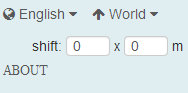
===WME Aerial Shifter (WAS)=== | === {{anchor|Waze Aerial Shifter}}WME Aerial Shifter (WAS) === | ||
by [[User:byo|byo]]; patched and packaged by [[User:berestovskyy|berestovskyy]] | by [[User:byo|byo]]; patched and packaged by [[User:berestovskyy|berestovskyy]] | ||
[[Image:WAS.jpg|right|link=]] | [[Image:WAS.jpg|right|link=]] | ||
This script helps you adjust the position of underlying satellite imagery to work on road alignment inside WME. | This script helps you adjust the position of underlying satellite imagery to work on road alignment inside WME. Generally the GPS points layer will be displayed on the map at a location parallel to the visual roadway. Adjust the setting until the GPS points are aligned with the visual map. Different sections of the map may or may not have this same amount of misalignment, so it is best to use this same technique in other areas before you use the same offset as a prior area. | ||
'''Before downloading a new version, uninstall or disable all previous versions of this script.''' | |||
* | <u>'''DOWNLOAD Waze Aerial Shifter''' version 1.3.2 (Oct 07, 2013):</u> | ||
* [http://docs.google.com/file/d/0B9yvR3S7YHqob2NsR01Ka3lvZkE/edit?usp=sharing WAS.1.3.2.crx Crome CRX package]. | |||
* [http://userscripts-mirror.org/scripts/show/176646 from userscripts.org]. | |||
<u>'''More information'''</u> | <u>'''More information'''</u> | ||
: [http://world.waze.com/forum/viewtopic.php?t=53022 ''WME Aerial Shifter'' forum thread] | |||
---- | |||
=== Street to River PLUS === | |||
===Street to River=== | by [[User:EduardoCarvajal|EduardoCarvajal]] based on [[User:aeytom|aeytom]] script | ||
by [[User:aeytom|aeytom]] | |||
[[image:street-created-selected-and-named.png|thumb|Street created, selected and named]] | [[image:street-created-selected-and-named.png|thumb|Street created, selected and named]] | ||
[[image:created-river-after-helper-street-deleted.png|thumb|River created and helper street deleted]] | [[image:created-river-after-helper-street-deleted.png|thumb|River created and helper street deleted]] | ||
The script is designed as a helper for creating river | The script is designed as a helper for creating river landmarks for the free Waze navigation system. The script transforms the geometry of a new unsaved street to a river landmark. You can predefine the width and the name for the new landmark in the form of a special street name. | ||
Mini how-to: | '''Mini how-to:''' | ||
* Install this script | |||
'''To add a new river:''' | |||
* Install this script and go to WME. | |||
* Draw a new street but do not save the street. | * Draw a new street but do not save the street. | ||
* Add and apply a street name to define the rivers name and width. This step is optional. | * Add and apply a street name to define the rivers name and width. This step is optional. | ||
: Example: ''20m Spree'' creates a 20 meters wide river named ''Spree'' | : Example: ''20m Spree'' creates a 20 meters wide river named ''Spree'' | ||
* Select the helper street. | * Select the helper street. | ||
* Click the '''Street to river | * Click the '''Street to river''' button. | ||
* Delete the helper street. | * Delete the helper street. | ||
* Edit the new landmark as you like. You can even set the landmark to another type. [http://world.waze.com/livemap/?zoom=9&lat=52.45873&lon=6.17407 Here it is used] to mark a railroad, using landmark type 'other'. | * Edit the new landmark as you like. You can even set the landmark to another type. [http://world.waze.com/livemap/?zoom=9&lat=52.45873&lon=6.17407 Here it is used] to mark a railroad, using landmark type 'other'. | ||
Examples of rivers created by the script are [ | '''To expand an existing river:''' | ||
* Draw a new Street that starts inside an existing river, but do not save the Street. | |||
* '''Make sure that you see on map the begining of the Street''' (the instersection point of the street and the river) | |||
* Select the helper Street. | |||
* Click the "Street to river" button. | |||
* Delete the helper Street. | |||
* Edit the new landmark as you like. | |||
Examples of rivers created by the script are [http://www.waze.com/editor/?zoom=3&lat=9.61618&lon=-82.84518&layers=1445&env=row&landmarks=1836066 Sixaola River] and [http://www.waze.com/editor/?zoom=0&lat=9.53565&lon=-83.10199&layers=1445&env=row&landmarks=2095946 Telire River]. | |||
'''Multilingual interface''': English, Spanish, Portuguese, French, Russian, Hungarian and Czech. | |||
<u>'''DOWNLOAD Street to River PLUS'''</u> | |||
* [http://greasyfork.org/scripts/1879-wme-street-to-river-plus from GreasyFork.org]. | |||
<u>'''More information'''</u> | |||
: [http://www.waze.com/forum/viewtopic.php?f=819&t=87931 ''Street to River PLUS'' forum thread] | |||
{{clear|right}} | {{clear|right}} | ||
---- | |||
===Road Type Calculator=== | |||
by [[User:Edsonajj|edsonajj]] (Edson Jiménez) | |||
This is a calculator meant as an aid to classify roads, specially when faced with routing issues or difficulties on applying the current classification found on the wiki. | |||
The current version is only designed to work for Mexico, but anyone interested in adapting it to another country can contact [[User:Edsonajj|edsonajj]] and work together in developing a version for another country. | |||
The extension is currently available for the four major browsers (Chrome, Firefox, Internet Explorer and Safari). | |||
* | |||
<u>'''DOWNLOAD Road Type Calculator'''</u> | |||
* [http://crossrider.com/install/56884 from crossrider.com] | |||
<u>'''More information'''</u> | <u>'''More information'''</u> | ||
: [http://crossrider.com/install/56884 ''Road Type Calculator'' main page] | |||
{{clear}} | |||
---- | |||
===WME center to begin-end of street=== | |||
by [[User:tkr85|tkr85]] | |||
[[File:CenterOnA-B.png|300px|right]][[File:CenterOnA-B-Close.png|border|right]] | |||
The script adds the ability to center the map at the beginning or end of the currently selected segment. The ends are selected with the '''A''' and '''B''' buttons. The script also remembers the last map position and zoom level before pressing either '''A''' or '''B'''. That feature is accessed with the '''return''' button. The '''X''' button will clear the last map position until '''A''' or '''B''' is pressed again (setting a new remembered map position). | |||
[http:// | <u>'''DOWNLOAD WME center to begin-end of street'''</u> | ||
* [http://pyrczak.pl/WME-begin-end-street.user.js from pyrczak.pl] | |||
<u>'''More information'''</u> | |||
: [http://www.waze.com/forum/viewtopic.php?f=819&t=83820 ''WME center to begin-end of street'' forum thread] | |||
---- | ---- | ||
== Map validation and routing == | == Map validation and routing == | ||
===WME Route | === WME Route Checker=== | ||
by [[User:Timbones|Timbones]] | by [[User:Timbones|Timbones]] | ||
| Line 308: | Line 374: | ||
Screenshot: [http://s3.amazonaws.com/uso_ss/23545/large.png?1381137285 wme-routes.png] | Screenshot: [http://s3.amazonaws.com/uso_ss/23545/large.png?1381137285 wme-routes.png] | ||
<u>'''DOWNLOAD Route | <u>'''DOWNLOAD Route Checker'''</u> | ||
* [http://chrome.google.com/webstore/detail/wme-route-checker/gfjnhelaghhdbglpieidncdppchpnlfh from Chrome Web Store]. | |||
* [http://greasyfork.org/en/scripts/3202-wme-route-checker/versions from greasyfork.org]. | |||
<u>'''More information'''</u> | |||
: [http://www.waze.com/forum/viewtopic.php?f=819&t=64777 ''WME Route Checker'' forum thread] | |||
===WME Route Speeds (Traffic)=== | |||
by [[User:FZ69617|FZ69617]] | |||
Initially developed by wlodek76, now under development by a new team. | |||
Installation Requirements: Tampermonkey (Chrome) or Greasemonkey(Firefox) | |||
Download [http://greasyfork.org/scripts/5402-wme-route-speeds WME Route Speeds from greasy fork]. | |||
Read news at [http://www.waze.com/forum/viewtopic.php?f=819&t=105839#p873523 the WME Route Speeds forum thread] | |||
- | To use: | ||
* Find the "Route Speeds" tab somewhere after your drives tab. | |||
* Multi-select two segments connected to each other. | |||
* Switch back to the Route Speeds tab | |||
* You may now drag and drop the "A" and "B" markers. | |||
* You may also start a route by specifying lat/long coordinates, and you may copy these coordinates from route speeds to test the same route again later. | |||
===WME Validator=== | === WME Validator === | ||
by [[User:Berestovskyy|berestovskyy]] | |||
This script validates a map area in Waze Map Editor, highlights issues, and generates a [http://www.waze.com/forum/viewtopic.php?f=819&t=76488&start=110#p671943 very detailed report] with wiki references and how-tos. | |||
*''Validator'' reports issues for your country and provides links to the country wiki. See [http://www.waze.com/forum/viewtopic.php?f=819&t=76488&p=661300#p661185 How to adjust ''Validator'' for your country]. | |||
*''Validator'' highlights issues not features. For example, it highlights not just any locked segment, but only if the lock is an issue. | |||
*There are many country-specific checks on every segment. See [http://www.waze.com/forum/viewtopic.php?f=819&t=76488&start=50#p663098 complete list of validations]. | |||
*You may define your own [http://www.waze.com/forum/viewtopic.php?f=819&t=76488&sid=c6281ac8cdd29f8b0c56055aea2e05ad&start=670#p749456 custom validations]. | |||
'''''Validator'' is BETA software. Please report any issues/suggestions in the [http://www.waze.com/forum/viewtopic.php?f=819&t=76488 forum thread].''' | |||
<u>'''DOWNLOAD WME Validator'''</u> | <u>'''DOWNLOAD WME Validator'''</u> | ||
* | *[http://chrome.google.com/webstore/detail/wme-validator/baojhpeknpmkhplkcnpdcficcaaniaih from Chrome Web Store] | ||
<!-- Userscripts no longer being updated by author | |||
*[http://userscripts.org/scripts/show/191016 from userscripts.org] --> | |||
*[http://greasyfork.org/scripts/1571-wme-validator for Firefox use GreasyFork] or [http://drive.google.com/file/d/0B9yvR3S7YHqoZndPYXUzZ1dqNm8 the author's Google Drive] | |||
<u>'''More information'''</u> | <u>'''More information'''</u> | ||
[ | :[http://www.waze.com/forum/viewtopic.php?f=819&t=76488&p=666476#p666476 ''Validator'' FAQ and forum thread]. | ||
== WME Chat == | |||
=== WME Chat addon === | |||
<!-- The text for this section is transcluded from [[WME Chat#WME Chat addon]] please make any changes there. --> | |||
{{:Waze Map Editor/Chat|transcludesection=WME_chat_addon}} | |||
=== WME Chat Jumper === | |||
<!-- The text for this section is transcluded from [[WME Chat#WME Chat Jumper]] please make any changes there. --> | |||
{{:Waze_Map_Editor/Chat|transcludesection=WME_chat_jumper}} | |||
---- | ---- | ||
==Device== | == Device == | ||
===Geocaching=== | === Geocaching === | ||
by [[User:davipt|davipt]] | by [[User:davipt|davipt]] | ||
| Line 351: | Line 443: | ||
<u>'''More information'''</u> | <u>'''More information'''</u> | ||
: [http://world.waze.com/forum/viewtopic.php?f=3&t=36866 ''Geocaching-Waze bookmarklet'' forum thread] | |||
---- | ---- | ||
== Live Map == | |||
== | === Live Map UR Overlay (LMUR) === | ||
=== | |||
by [[User:Twister-UK|Twister-UK]] | by [[User:Twister-UK|Twister-UK]] | ||
LMUR allows update requests and map problems to be displayed on the | LMUR allows update requests and map problems to be displayed on the [[Live Map]], with various filtering options to show/hide requests/problems by type, age, keyword, etc. Requires Live Map to be viewed via the secure (https) URL - LMUR will prompt you if a non-secure URL is used. | ||
<u>''' | <u>'''DOWNLOAD Live Map UR Overlay (LMUR)'''</u> | ||
* [http://chrome.google.com/webstore/detail/lmur/ofjdjffkbglgpdikoofpkeniefljookp from Chrome Web Store]. | |||
* | * [http://greasyfork.org/scripts/1948-livemap-ur-overlay from GreasyFork]. | ||
* | |||
<u>'''More information'''</u> | <u>'''More information'''</u> | ||
: [http://www.waze.com/forum/viewtopic.php?t=29381 ''LiveMap UR Overlay'' forum thread] | |||
---- | ---- | ||
== Bookmarklets == | |||
Several very useful [http://en.wikipedia.org/wiki/Bookmarklet bookmarklet] scripts have been developed to enhance the map editing process. A complete list of available scripts are on the [[Bookmarklets]] Wiki page along with instructions on how to add them to your browser. | |||
---- | ---- | ||
==Developing scripts== | == Developing scripts == | ||
Please see [[WME JavaScript development]]. | Please see [[Community Plugins, Extensions and Tools/WME JavaScript development]]. | ||
[[Category:Waze Map Editor]] | |||
Latest revision as of 13:35, 24 May 2015
The Waze community has created the following plugins/extensions/addons for use in the Waze web-based environments. See browser requirements and instructions.
Please be aware that these scripts commonly require updates in order to properly work after new releases of the Waze products. While some may update automatically once their authors make changes, others may require manual updating on your part.
Common Scripts Repository for Developers & End Users
Browser requirements
Chrome / Blink / Opera Next
You might need to enable Developer Mode on your browser.
- If a download is available from the Chrome Web Store, choose that.
- Without an add-on to manage scripts, simply download the script file (.js) or Chrome executable package (CRX). Then drag and drop the file into the Chrome Extensions Tab [chrome://extensions] of the browser.
- Install TamperMonkey or equivalent.
Firefox / Mozilla
- Install Greasemonkey.
Internet Explorer
- Install Greasemonkey or equivalent.
Safari
- Install script as an extension.
- Install WazeBar for Safari.
Greasemonkey or Tampermonkey add-on for script management
The easiest way to load and manage add-on scripts is with Greasemonkey, Tampermonkey, or an equivalent browser add-on for script management. When you install a user script, the script manager catalogs it and automatically runs it anytime any page for which it is declared is loaded by your browser.
Map Editor presentation enhancements
WME Color Highlights (WMECH)
by Timbones
This script adds color highlighting to segments and landmarks according to their status and type or other criteria. The highlighting of segments is likely to be most useful, for it shows locked and nameless roads. Traffic locks highlight is available where applicable.

DOWNLOAD WME Color Highlights
More information
WME Highlighter City
by AlexN-114
Highlighter City (HiLiCi) is a derivative of WME Color Highlights v. 1.7.2. It checks for some countries (Austria, Switzerland, Germany, Liechtenstein, Norway, Australia, France, Mexico, Italy and Puerto Rico) the correctness of the content of the city field. If you want this feature for your country, ask.
Please note that this conflicts with WME Color Highlights; both should NOT be active at the same time.
DOWNLOAD WME Highlighter City (loader)
More information
WME Level Highlighter
by Kuhlkatz
This WME script highlights segments based on Elevation (fka Level). Please note that this script conflicts with WME Color Highlights script; both should NOT be active at the same time.
DOWNLOAD WME Level Highlighter
WME Junction Angle info
by milkboy; patched by AlanOfTheBerg; Current version 1.8.3
This script helps with junction maintenance. If two connected segments are selected, it shows the turn angle, otherwise it shows the the angle between each segment.
Routing instruction guessing works mostly, but bug reports with permalink and description are welcome ;)

DOWNLOAD WME Junction Angle info
- from greasyfork.org (userscripts replacement)
- from Chrome Web Store.
- from GitHub
- from Mozilla for Firefox (Slightly outdated, working on some fixes to make the validator happy)
More information
Report bugs, patches, ideas etc preferably on the Github issues page
UR Overview Plus (URO+)
by Twister-UK
- URO+ adds a URO+ tab in the left-hand panel to provide various filtering options to show/hide update requests, map problem, and camera markers according to type, age, comment keyword, etc.
- For any UR markers where a conversation is taking place, the marker is modified to show a small quote icon in place of the Waze icon. The quotes are on a green background or if you have commented on the UR, a yellow background. Optionally, a small circle with the count of comments can be shown too.
- For any markers that are visible, hovering the mouse pointer over the marker generates a pop-up which contains a summary of the marker information and some marker-type specific actions (e.g., opening an update request in a new tab, deleting a camera).
- Optional functionality (Go to subtab Misc, "Enable integrated scripts"):
- Functionality from DrivesTabEnhancer (DTE) script:
- Modifies the Drives tab in the left-hand panel to show more drives per sub-page (up to the WME limit of 50/page), and to inform the user which drives are available to view on the map as a route trail. Although Waze stores the drive summaries (date, distance, etc) for every drive ever made, it stores the actual route data only for the most recent drives.
- Functionality from Select Roundabout Segments (SRS) script.
- Adds a Select roundabout button to the segment edit panel when a single segment from a roundabout is selected. Clicking the button selects the entire roundabout. Note that if the entire roundabout doesn't get selected, it probably means the roundabout itself is broken.
- Functionality from DrivesTabEnhancer (DTE) script:
DOWNLOAD UR Overview Plus
More information
UR Comments
Streamline the process of responding to Update Requests. It can autofill the comment box based on UR type, or you can manually choose from the list of responses, depending on your preference.
If you have UR Overview installed (URO+), UR Comments can integrate with it to provide quick presets that will change UR Overview's settings to show different UR types. UR Overview plus is not required to run UR comments.
See The author's page for more information.
WME layout tweaking user style
This is a custom stylesheet that tweaks the Waze Map Editor layout to reduce the amount of white-space and increase the editable area.
Custom stylesheets require that you first install the Stylish add-on. (Get Stylish for Chrome or Stylish for Firefox).
Download WME layout tweaking user style
Map Editing
You may not be granted edit points for making a large number of edits in a short time (usually only possible using scripts to edit).
|
WME Junction Node Fixer (JNF)
by bgodette
Junction Node Fixer has several features. The primary focus of JNF is that it overloads the 'q' (disallowAllTurns) keyboard shortcut to preserve existing turn restrictions. 'Overloading' means that it takes over all functionality of the 'q' hotkey only. The 'q' keyboard shortcut performs the following actions
- Fixes any self and reverse connectivity issues
- Fixes closed loop roads (by splitting into two segments with a joining junction)
- Terminates dead-ends with a junction
- Makes dead-ends two-way (only if both ends of the segment are visible)
- Sets the Type of a roundabouts using lowest of two highest rule and sets country/state if needed
- For UK sets Type of roundabouts using highest type excluding Freeway rule.
- Does a traditional 'qw' (clears reverse connectivity, and locks turns)
- Causes the turn arrows to refresh (the side effect of 's' but without the shifting).
Since you end up with the same turns restricted, that means you need to press 'w' if you really want all turns allowed. This is why it overloads 'q' instead of 'w'. Ultimately this will be a separate hotkey that's editable through WME's '?' interface.
JNF also:
- Saves the state of WME's ShowAllTurns, ShowTurns, and Full-screen mode across Refresh/F5/Permalink.
- Forces data model reload after successful save.
This has been tested only in Chrome; it has been reported to work in Firefox with GreaseMonkey.
DOWNLOAD WME Junction Node Fixer
More information
WME Toolbox
by OyyoDams
This script adds many features like small junctions highlight, redo roundabout, convert roundabout to standard road, clear road geometry, many permalinks to external sites, and more.
Please read the WME Toolbox page
WazeBar for Safari
by Mike Bronner; maintained by edsonajj (Edson Jiménez)
WazeBar for Safari is an alternative menu bar for WME that integrates other scripts to make them available on Safari.
Currently integrated scripts are:
- WME Colour Highlights by timbones.
- UR Overview by Twister-UK.
- GeoWipe by bgodette.
- Junction Node Fixer by bgodette.
Additional features:
- Autosave at a certain number of edits.
- More features and script integrations are underway.
DOWNLOAD WazeBar
More information
Roundabout Angles and Landmark
by davipt
Roundabout Angles and Landmark is a script with two features:
- selecting a roundabout node, on the left side there is a button to automatically create a "junction" landmark around the landmark. Roundabout segments shall not have street name set, but the roundabout name should be added to this landmark in the middle, so the label appears horizontally.
- selecting a roundabout node, on the left side there is a button to create a temporary landmark in the form of a leaf, which will denote the approximate 90º, 180º and 270º range that Waze uses to switch from the "take the nth exit" to the "straight ahead/turn left/turn right" on roundabouts with two to four connections.
If the created landmark is not round, it means the roundabout has something screwed up, usually a reversed A->B segment, so it also helps ensuring proper roundabouts.
DOWNLOAD Roundabout Angles and Landmark
- from userscripts.org -- last updated Last update Jan 7, 2013
More information
WME Roundabout Angles
By wlodek76 (PM), currently managed by FZ69617 (PM)
The WME Roundabout Angles script can help in designing normal roundabouts.
It draws angles for typical roundabouts and overlays a round helper line to adjust the geometry of a roundabout.
The script provides guidance based on the rules described in the roundabouts wiki page.
The original authorship of the script is by wlodek76, who decided to leave the Waze community (hopefully, not forever...). The rights for further maintenance of the script have been granted by the original author to FZ69617 (PM) (forum profile).
Brief instructions:
- Activate the script by enabling the "Roundabout Angles" layer in WME
- The default is inactive, therefore the script will always be off when you reload WME. It must be activated again each time its needed (after reloading WME).
- The script will automatically find all roundabouts visible on the map - pan and / or zoom the map, if it doesn't find them.
- Angles will only be displayed for roundabouts with four or less nodes. The other roundabouts will still display the round helper line in a slightly different color, together with a line to the first three nodes, but no angles will be displayed.
DOWNLOAD WME Roundabout Angles
from GreasyFork.org --last updated 2014-10-02
More information
WME Roundabout Angles forum thread
WME Aerial Shifter (WAS)
by byo; patched and packaged by berestovskyy
This script helps you adjust the position of underlying satellite imagery to work on road alignment inside WME. Generally the GPS points layer will be displayed on the map at a location parallel to the visual roadway. Adjust the setting until the GPS points are aligned with the visual map. Different sections of the map may or may not have this same amount of misalignment, so it is best to use this same technique in other areas before you use the same offset as a prior area.
Before downloading a new version, uninstall or disable all previous versions of this script. DOWNLOAD Waze Aerial Shifter version 1.3.2 (Oct 07, 2013):
More information
Street to River PLUS
by EduardoCarvajal based on aeytom script


The script is designed as a helper for creating river landmarks for the free Waze navigation system. The script transforms the geometry of a new unsaved street to a river landmark. You can predefine the width and the name for the new landmark in the form of a special street name.
Mini how-to:
To add a new river:
- Install this script and go to WME.
- Draw a new street but do not save the street.
- Add and apply a street name to define the rivers name and width. This step is optional.
- Example: 20m Spree creates a 20 meters wide river named Spree
- Select the helper street.
- Click the Street to river button.
- Delete the helper street.
- Edit the new landmark as you like. You can even set the landmark to another type. Here it is used to mark a railroad, using landmark type 'other'.
To expand an existing river:
- Draw a new Street that starts inside an existing river, but do not save the Street.
- Make sure that you see on map the begining of the Street (the instersection point of the street and the river)
- Select the helper Street.
- Click the "Street to river" button.
- Delete the helper Street.
- Edit the new landmark as you like.
Examples of rivers created by the script are Sixaola River and Telire River.
Multilingual interface: English, Spanish, Portuguese, French, Russian, Hungarian and Czech.
DOWNLOAD Street to River PLUS
More information
Road Type Calculator
by edsonajj (Edson Jiménez)
This is a calculator meant as an aid to classify roads, specially when faced with routing issues or difficulties on applying the current classification found on the wiki.
The current version is only designed to work for Mexico, but anyone interested in adapting it to another country can contact edsonajj and work together in developing a version for another country.
The extension is currently available for the four major browsers (Chrome, Firefox, Internet Explorer and Safari).
DOWNLOAD Road Type Calculator
More information
WME center to begin-end of street
by tkr85


The script adds the ability to center the map at the beginning or end of the currently selected segment. The ends are selected with the A and B buttons. The script also remembers the last map position and zoom level before pressing either A or B. That feature is accessed with the return button. The X button will clear the last map position until A or B is pressed again (setting a new remembered map position).
DOWNLOAD WME center to begin-end of street
More information
Map validation and routing
WME Route Checker
by Timbones
This script allows you to see the current navigation instructions in the editor. Simply select two segments, and click on the Routes tab that appears on the left.
Screenshot: wme-routes.png
DOWNLOAD Route Checker
More information
WME Route Speeds (Traffic)
by FZ69617
Initially developed by wlodek76, now under development by a new team.
Installation Requirements: Tampermonkey (Chrome) or Greasemonkey(Firefox) Download WME Route Speeds from greasy fork. Read news at the WME Route Speeds forum thread
To use:
- Find the "Route Speeds" tab somewhere after your drives tab.
- Multi-select two segments connected to each other.
- Switch back to the Route Speeds tab
- You may now drag and drop the "A" and "B" markers.
- You may also start a route by specifying lat/long coordinates, and you may copy these coordinates from route speeds to test the same route again later.
WME Validator
by berestovskyy
This script validates a map area in Waze Map Editor, highlights issues, and generates a very detailed report with wiki references and how-tos.
- Validator reports issues for your country and provides links to the country wiki. See How to adjust Validator for your country.
- Validator highlights issues not features. For example, it highlights not just any locked segment, but only if the lock is an issue.
- There are many country-specific checks on every segment. See complete list of validations.
- You may define your own custom validations.
Validator is BETA software. Please report any issues/suggestions in the forum thread.
DOWNLOAD WME Validator
More information
WME Chat
WME Chat addon
by: dummyd2
Version: 0.8

This script changes the chat GUI to add more functionality to the chat window:

- Removes duplicate messages, make links clickable, transforms permalinks into clickable target without reloading WME, hover shows amount of included elements, small icon next to the input message area to insert current permalink, bell/Zzz icon next to each user to insert the "bip" message, icon changes to reflect recent activity, top bar is made light grey when invisible, adds smileys: :) :D ;) :( :o :? 8-) :x :P :|
- “Settings button” gives options to; remove messages of users not in the room, add a message when a user joins or leaves the room, sort user list by name, rank, or activity, choose a room connection.
- TTS available in languages supported by Google
- Messages are manipulated to; make usernames clickable to send “bip”, add a target link next to the username to jump, rank of user, date and/or time, sound on new message, highlight your messages
- Alerts make the top panel or chat button change to dark red if theres a message with any of your keywords; keywords are in settings, keywords are highlighted, sound on alert, etc.).
- Compatible with WME Chat jumper: so each "jump" with WME Chat addon is reversible using WME Chat jumper.
Download WME Chat addon
- From GreasyFork
More Information
- For the full details see the WME Chat article.
- In Chrome this script must be installed through TamperMonkey
- WME Addon Forum thread
WME Chat Jumper
by: tkr85

This script allows a users last location to be saved when clicking on a user name and moving to their location. By clicking on the "jump" button, you will be taken back to your previous editing location.
Download WME Chat Jumper
More Information
Device
Geocaching
by davipt
Geocaching-Waze bookmarklet is a iOS Safari bookmarklet that allows driving to a given Geocaching coordinate. It assumes a fixed flow within iOS and the official Geocaching client, but it could be adapted to other situations.
Open the iOS Geocaching app, pick up a cache, click on Open on external map, which will open Google Maps on the browser. From this page, click on the bookmarklet which will display the lat+lon; then open Waze on that point, ready to drive there.
More information
Live Map
Live Map UR Overlay (LMUR)
by Twister-UK
LMUR allows update requests and map problems to be displayed on the Live Map, with various filtering options to show/hide requests/problems by type, age, keyword, etc. Requires Live Map to be viewed via the secure (https) URL - LMUR will prompt you if a non-secure URL is used.
DOWNLOAD Live Map UR Overlay (LMUR)
More information
Bookmarklets
Several very useful bookmarklet scripts have been developed to enhance the map editing process. A complete list of available scripts are on the Bookmarklets Wiki page along with instructions on how to add them to your browser.