This special page shows all uploaded files.
| Date | Name | Thumbnail | Size | Description | Versions |
|---|---|---|---|---|---|
| 16:47, 5 August 2014 | USA Pennsylvania.png (file) |  |
225 KB | http://commons.wikimedia.org/wiki/File:Pennsylvania_in_United_States.svg | 1 |
| 16:38, 5 August 2014 | USA Mississippi.png (file) |  |
225 KB | http://commons.wikimedia.org/wiki/File:Mississippi_in_United_States.svg | 1 |
| 16:48, 5 August 2014 | USA South Carolina.png (file) |  |
225 KB | http://commons.wikimedia.org/wiki/File:South_Carolina_in_United_States.svg | 1 |
| 16:54, 5 August 2014 | USA Wyoming.png (file) |  |
225 KB | http://commons.wikimedia.org/wiki/File:Wyoming_in_United_States.svg | 1 |
| 16:52, 5 August 2014 | USA West Virginia.png (file) |  |
225 KB | http://commons.wikimedia.org/wiki/File:West_Virginia_in_United_States.svg | 1 |
| 18:22, 8 August 2014 | USA Illinois.png (file) |  |
225 KB | http://commons.wikimedia.org/wiki/File:Illinois_in_United_States.svg | 1 |
| 18:25, 8 August 2014 | USA Kentucky.png (file) |  |
225 KB | http://commons.wikimedia.org/wiki/File:Kentucky_in_United_States.svg | 1 |
| 16:47, 5 August 2014 | USA Oregon.png (file) |  |
225 KB | http://commons.wikimedia.org/wiki/File:Oregon_in_United_States.svg | 1 |
| 16:40, 5 August 2014 | USA Montana.png (file) |  |
225 KB | http://commons.wikimedia.org/wiki/File:Montana_in_United_States.svg | 1 |
| 18:23, 8 August 2014 | USA Indiana.png (file) |  |
225 KB | http://commons.wikimedia.org/wiki/File:Indiana_in_United_States.svg | 1 |
| 06:45, 5 August 2014 | USA Maine.png (file) |  |
225 KB | http://commons.wikimedia.org/wiki/File:Maine_in_United_States.svg | 1 |
| 06:27, 5 August 2014 | USA Colorado.png (file) |  |
225 KB | http://commons.wikimedia.org/wiki/File:Colorado_in_United_States.svg | 1 |
| 16:44, 5 August 2014 | USA North Carolina.png (file) |  |
225 KB | http://commons.wikimedia.org/wiki/File:North_Carolina_in_United_States.svg | 1 |
| 16:43, 5 August 2014 | USA New Mexico.png (file) |  |
225 KB | http://commons.wikimedia.org/wiki/File:New_Mexico_in_United_States.svg | 1 |
| 16:39, 5 August 2014 | USA Missouri.png (file) |  |
225 KB | http://commons.wikimedia.org/wiki/File:Missouri_in_United_States.svg | 1 |
| 16:49, 5 August 2014 | USA Tennessee.png (file) |  |
225 KB | http://commons.wikimedia.org/wiki/File:Tennessee_in_United_States.svg | 1 |
| 06:36, 5 August 2014 | USA Arkansas.png (file) |  |
225 KB | http://commons.wikimedia.org/wiki/File:Arkansas_in_United_States.svg | 1 |
| 16:45, 5 August 2014 | USA Ohio.png (file) |  |
225 KB | http://commons.wikimedia.org/wiki/File:Ohio_in_United_States.svg | 1 |
| 08:26, 14 July 2014 | USA Alabama.png (file) |  |
225 KB | http://commons.wikimedia.org/wiki/Category:SVG_locator_maps_of_states_in_the_United_States_(location_map_scheme) | 1 |
| 16:52, 5 August 2014 | USA Washington.png (file) |  |
225 KB | http://commons.wikimedia.org/wiki/File:Washington_in_United_States.svg | 1 |
| 16:50, 5 August 2014 | USA Utah.png (file) |  |
225 KB | http://commons.wikimedia.org/wiki/File:Utah_in_United_States.svg | 1 |
| 16:43, 5 August 2014 | USA New York.png (file) |  |
225 KB | http://commons.wikimedia.org/wiki/File:New_York_in_United_States.svg | 1 |
| 16:49, 5 August 2014 | USA South Dakota.png (file) |  |
226 KB | http://commons.wikimedia.org/wiki/File:South_Dakota_in_United_States.svg | 1 |
| 16:45, 5 August 2014 | USA North Dakota.png (file) |  |
226 KB | http://commons.wikimedia.org/wiki/File:North_Dakota_in_United_States.svg | 1 |
| 06:34, 5 August 2014 | USA Florida.png (file) |  |
226 KB | http://commons.wikimedia.org/wiki/File:Florida_in_United_States.svg | 1 |
| 16:53, 5 August 2014 | USA Wisconsin.png (file) |  |
226 KB | http://commons.wikimedia.org/wiki/File:Wisconsin_in_United_States.svg | 1 |
| 16:37, 5 August 2014 | USA Minnesota.png (file) |  |
226 KB | http://commons.wikimedia.org/wiki/File:Minnesota_in_United_States.svg | 1 |
| 15:00, 24 March 2014 | Multi-select-GeoPointsEdit.png (file) |  |
229 KB | 1 | |
| 16:41, 5 August 2014 | USA New Hampshire.png (file) |  |
231 KB | http://commons.wikimedia.org/wiki/File:New_Hampshire_in_United_States_(zoom).svg | 1 |
| 03:35, 29 September 2015 | Turn algorithm flowchart.png (file) |  |
245 KB | Uploading same version trying to force the Wiki server to display the current version. | 12 |
| 23:54, 27 March 2014 | LHT.png (file) |  |
252 KB | 1 | |
| 15:55, 26 August 2012 | MoveJunc-1.png (file) |  |
257 KB | Move Junction - Selected junction | 1 |
| 18:34, 30 June 2014 | USA California.png (file) |  |
283 KB | 1 | |
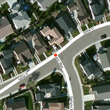
| 18:42, 26 January 2014 | Mismatched Intersection.png (file) |  |
291 KB | This intersection does not perfectly align with the cross streets, so a short segment was created unnecessarily. The segment between the two cross streets should be removed to create a standard 4 way intersection. | 1 |
| 18:42, 15 March 2014 | LiveMap-wazers.png (file) |  |
382 KB | 1 | |
| 05:32, 23 March 2014 | YSplit.png (file) |  |
386 KB | 1 | |
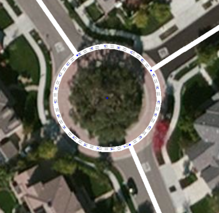
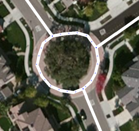
| 07:10, 16 August 2012 | FixRAB-04.png (file) |  |
413 KB | Roundabout fix - Create Roundabout | 1 |
| 07:14, 16 August 2012 | FixRAB-07.png (file) |  |
422 KB | Roundabout fix - Final image | 1 |
| 07:15, 16 August 2012 | FixRAB-06.png (file) |  |
423 KB | Roundabout fix - Unconfirmed road segments | 1 |
| 07:08, 16 August 2012 | FixRAB-01.png (file) |  |
426 KB | Roundabout Fix - Original manually created roundabout to be replaced. | 1 |
| 07:12, 16 August 2012 | FixRAB-05.png (file) |  |
428 KB | Roundabout fix - New Roundabout created | 1 |
| 07:08, 16 August 2012 | FixRAB-02.png (file) |  |
429 KB | Roundabout fix - original segments selected to be deleted. | 1 |
| 07:09, 16 August 2012 | FixRAB-03.png (file) |  |
433 KB | Roundabout fix - Pulled in road segments | 1 |
| 04:53, 23 May 2013 | MainLogin.png (file) |  |
470 KB | Main login screen when first connecting to Waze | 1 |
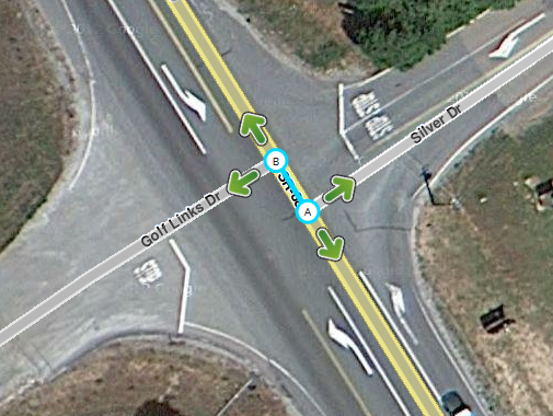
| 18:11, 6 July 2014 | CenterOnA-B.png (file) |  |
518 KB | 1 | |
| 03:31, 11 May 2013 | UR w-show.png (file) |  |
589 KB | Update Request with Show button | 1 |
| 07:32, 10 April 2014 | DriveRoute.png (file) |  |
685 KB | 1 | |
| 06:37, 8 June 2014 | RailroadTracksVanishingPoint.jpg (file) |  |
996 KB | Railroad tracks at vanishing point. Photo taken by Kent Smith. Photo provided to Waze for use on the Wiki page. | 1 |
| 05:39, 5 November 2013 | NorthernCaliforniaUSGS-Polygons.png (file) |  |
1,006 KB | This is the USGA polygons for San Francisco / San Jose and also Sacramento areas used for the numbers of Wazers Nearby. | 1 |
| 16:47, 14 August 2014 | TunnelTracking.png (file) | 1.32 MB | 1 |