This special page shows all uploaded files.
| Date | Name | Thumbnail | Size | Description | Versions |
|---|---|---|---|---|---|
| 21:44, 24 March 2013 | New ap icon green not ident.png (file) | 5 KB | Automated problem report - Closed as not identified | 1 | |
| 21:47, 24 March 2013 | New ap icon green solved.png (file) | 5 KB | Automated problem report - Closed as solved | 1 | |
| 04:49, 25 March 2013 | Arrow Green-2-question2.png (file) |  |
3 KB | 4 | |
| 04:53, 25 March 2013 | Arrow Red-2-question2.png (file) |  |
3 KB | 2 | |
| 05:16, 25 March 2013 | Arrow Red-2.png (file) |  |
3 KB | Red Arrow for hard restricted turn | 1 |
| 06:25, 26 March 2013 | Waze signature 1 0M 5c.png (file) | 9 KB | Waze Forum signature banner for 1.0M map edits and 5 cones | 1 | |
| 05:43, 24 April 2013 | CameraAdd2.PNG (file) |  |
104 KB | Add Camera from client Report menu | 1 |
| 21:38, 27 April 2013 | AddMenuList.png (file) |  |
54 KB | List displayed from Add Menu button in version 3.5. | 1 |
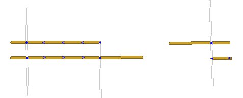
| 22:55, 27 April 2013 | WME Tabs.png (file) | 4 KB | Tabs on Waze Map Editor | 2 | |
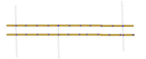
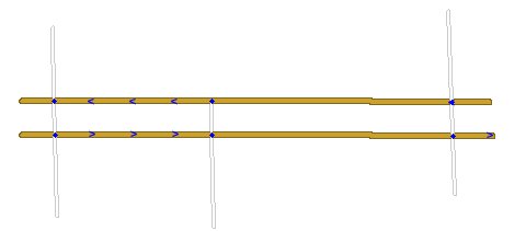
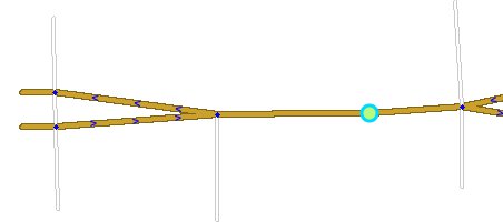
| 23:37, 30 April 2013 | SegmentTraffic1.png (file) |  |
15 KB | Diagram illustrating separate exit speed times can be tracked | 1 |
| 03:31, 11 May 2013 | UR w-show.png (file) |  |
589 KB | Update Request with Show button | 1 |
| 03:46, 11 May 2013 | DisplayRelated-Show.png (file) | 4 KB | 2 | ||
| 16:16, 11 May 2013 | Candy500.png (file) | 28 KB | Road candy - 500 points with description | 1 | |
| 04:53, 23 May 2013 | MainLogin.png (file) |  |
470 KB | Main login screen when first connecting to Waze | 1 |
| 05:00, 23 May 2013 | WazeSig2.png (file) |  |
95 KB | Waze sign in page for new or current users. Also password reset. | 1 |
| 05:34, 23 May 2013 | WazeSig1.png (file) |  |
78 KB | Waze sign in page from main sign in for existing users. | 1 |
| 06:32, 23 May 2013 | Image.png (file) | 6 KB | Reverted to version as of 12:19, 10 March 2011 | 3 | |
| 04:24, 26 May 2013 | NavMain.png (file) |  |
107 KB | Main navigation screen for 3.5 | 1 |
| 06:25, 27 May 2013 | UndivideRd1.jpg (file) |  |
7 KB | Step 1 to undivide a road. | 1 |
| 06:26, 27 May 2013 | UndivideRd2.jpg (file) |  |
5 KB | Step 2 to undivide a road. | 1 |
| 06:27, 27 May 2013 | UndivideRd3.jpg (file) |  |
5 KB | Step 3 to undivide a road. | 1 |
| 06:27, 27 May 2013 | UndivideRd4.jpg (file) |  |
6 KB | Step 4 to undivide a road. | 1 |
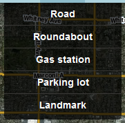
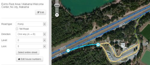
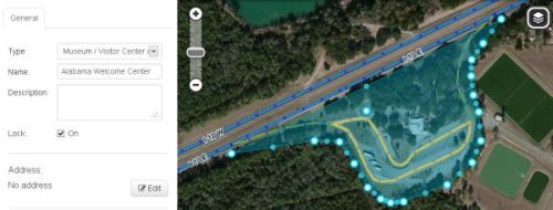
| 05:54, 29 May 2013 | Alabama Welcome 1.jpg (file) |  |
27 KB | Rest Area - Exit from highway | 1 |
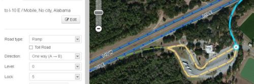
| 05:57, 29 May 2013 | Alabama Welcome 3.jpg (file) |  |
21 KB | Rest Area - Parking Lot roads | 1 |
| 05:59, 29 May 2013 | Alabama Welcome 4.jpg (file) |  |
19 KB | Rest Area - Return to highway | 1 |
| 06:01, 29 May 2013 | Alabama Welcome 2.jpg (file) |  |
20 KB | Rest Area - Landmark | 1 |
| 07:14, 30 May 2013 | DupeCity1.jpg (file) |  |
61 KB | Duplicated City - High level | 1 |
| 07:22, 30 May 2013 | DupeCity2.jpg (file) |  |
126 KB | Duplicate City - Zoomed in | 1 |
| 19:29, 1 June 2013 | CitySmudge01.jpg (file) |  |
22 KB | City Smudge - City named on segment that is outside of any city | 1 |
| 19:32, 1 June 2013 | CitySmudge01zoom.jpg (file) |  |
145 KB | City Smudge - Zoomed into segments with wrong city name | 1 |
| 17:51, 8 September 2013 | Wme update request meta info.png (file) | 7 KB | Updated for most recent editor version | 6 | |
| 18:07, 8 September 2013 | Conversation Screen.png (file) |  |
13 KB | New conversation screen used with Update Requests | 1 |
| 17:31, 29 September 2013 | TdF main.png (file) |  |
188 KB | Mega Event page | 1 |
| 17:36, 29 September 2013 | MegaEventMain.png (file) |  |
129 KB | Mega Event main page | 1 |
| 17:50, 29 September 2013 | ClientNotice1.png (file) |  |
132 KB | Client notice 1 | 1 |
| 17:52, 29 September 2013 | ClientNotice2.png (file) |  |
200 KB | Client notice 2 | 1 |
| 05:39, 5 November 2013 | NorthernCaliforniaUSGS-Polygons.png (file) |  |
1,006 KB | This is the USGA polygons for San Francisco / San Jose and also Sacramento areas used for the numbers of Wazers Nearby. | 1 |
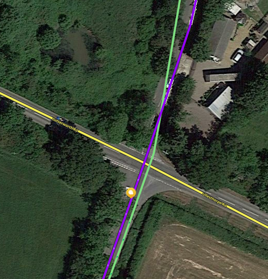
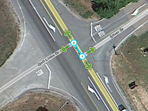
| 18:42, 26 January 2014 | Mismatched Intersection.png (file) |  |
291 KB | This intersection does not perfectly align with the cross streets, so a short segment was created unnecessarily. The segment between the two cross streets should be removed to create a standard 4 way intersection. | 1 |
| 00:04, 27 January 2014 | IPhoneLatLong.png (file) |  |
131 KB | Entering latitude and longitude coordinates in an iPhone or Android phone. | 1 |
| 00:06, 27 January 2014 | WindowsPhoneLatLong.png (file) |  |
72 KB | Entering latitude and longitude coordinates in an iPhone or Android phone. | 1 |
| 06:12, 3 February 2014 | Mbox warning.png (file) |  |
32 KB | 1 | |
| 06:20, 3 February 2014 | Mbox license.png (file) |  |
8 KB | 1 | |
| 09:19, 11 February 2014 | Warning blue construction.png (file) |  |
2 KB | MBOX image: Blue Construction Triangle | 1 |
| 01:05, 17 February 2014 | Badge GlobalChamp.png (file) |  |
8 KB | 1 | |
| 01:05, 17 February 2014 | Badge LocalChamp.png (file) |  |
8 KB | 1 | |
| 01:15, 17 February 2014 | Badge CountryManager.png (file) |  |
9 KB | 1 | |
| 01:16, 17 February 2014 | Badge AreaManager.png (file) |  |
10 KB | 1 | |
| 01:16, 17 February 2014 | Badge Expert.png (file) |  |
10 KB | 1 | |
| 01:17, 17 February 2014 | Badge BetaTester.png (file) |  |
9 KB | 1 | |
| 01:17, 17 February 2014 | Badge Management.png (file) |  |
6 KB | 1 |