This special page shows all uploaded files.
| Date | Name | Thumbnail | Size | Description | Versions |
|---|---|---|---|---|---|
| 11:26, 6 May 2015 | 16403 1.JPG (file) |  |
10 KB | 16403 Jewel Ave, Queens NY before HN confirmation. | 1 |
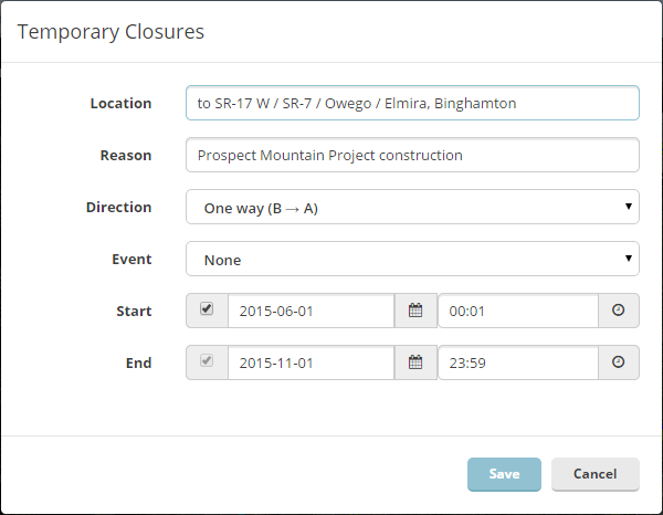
| 21:16, 18 April 2018 | Add closure details.png (file) |  |
16 KB | Major UI changes | 5 |
| 12:23, 29 January 2015 | Advanced.PNG (file) |  |
975 bytes | 1 | |
| 17:09, 4 December 2015 | Avatar eaglestailg8ter.jpg (file) | 16 KB | 1 | ||
| 13:23, 18 September 2015 | Avatar voludu2.jpeg (file) | 43 KB | 1 | ||
| 20:27, 5 February 2015 | Bottom bar.PNG (file) | 9 KB | 1 | ||
| 19:27, 5 December 2014 | Cambria PA mapraid sectors.jpg (file) |  |
695 KB | mapraid sectors for Cambria County, PA | 1 |
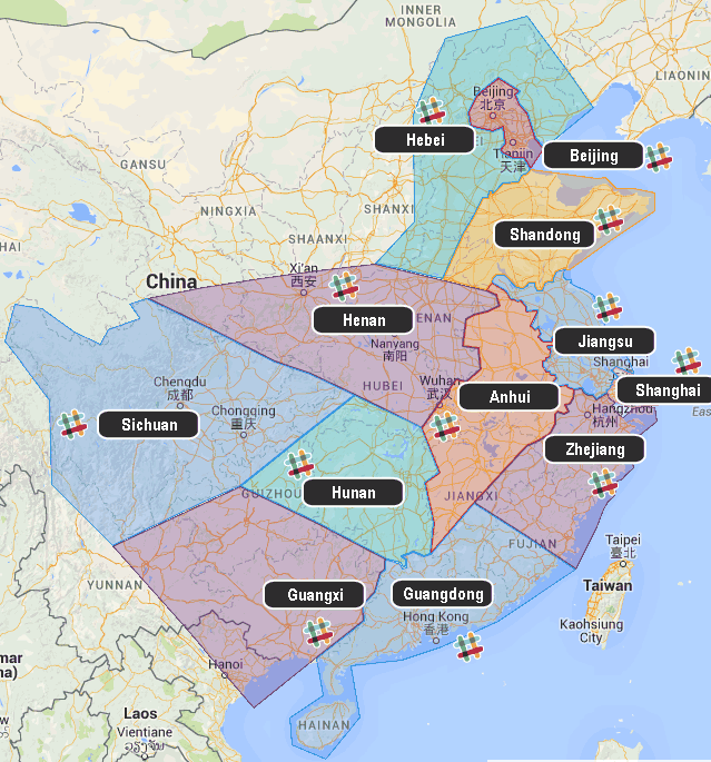
| 14:39, 30 June 2015 | ChinaMMR map.png (file) |  |
109 KB | Category:Mega map raid | 1 |
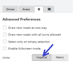
| 05:18, 28 February 2016 | Choose imperial units.png (file) |  |
10 KB | 1 | |
| 17:15, 5 February 2015 | Closure.PNG (file) |  |
2 KB | closure on road segment in WME | 2 |
| 16:57, 27 February 2015 | Closure gray.jpg (file) |  |
8 KB | 1 | |
| 12:01, 31 July 2015 | Cog.PNG (file) |  |
501 bytes | cog used for "my dashboard" | 1 |
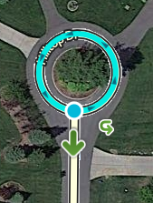
| 13:32, 7 May 2015 | Dead end loop.png (file) |  |
84 KB | 1 | |
| 12:19, 27 November 2014 | DividingRoad.jpg (file) | 19 KB | the first step in creating a divided road is to cut each segment in half. Both sides of the divided road will be created from the two-way road in order to use as much of the accumulated traffic information as possible. | 1 | |
| 20:07, 29 February 2016 | Do not enter1.PNG (file) |  |
5 KB | Category:Traffic Sign | 1 |
| 01:21, 1 March 2016 | Do not enter2.png (file) |  |
3 KB | Category:Traffic Sign | 1 |
| 01:29, 1 March 2016 | Do not enter3.PNG (file) |  |
2 KB | Traffic sign | 1 |
| 15:06, 15 September 2015 | Fishbones.jpg (file) |  |
54 KB | Stubs that go somewhere this time | 2 |
| 11:31, 5 May 2015 | GCB - Connected+NoTurns (1).png (file) | .png) |
102 KB | 1 | |
| 11:32, 5 May 2015 | GCB - Connected+NoTurns (2).png (file) | .png) |
51 KB | 1 | |
| 11:33, 5 May 2015 | GCB - Connected+NoTurns (3).png (file) | .png) |
121 KB | 1 | |
| 11:36, 5 May 2015 | GCB - Connected+NoTurns (4).png (file) | .png) |
86 KB | 1 | |
| 11:36, 5 May 2015 | GCB - Connected+NoTurns (5).png (file) | .png) |
110 KB | 1 | |
| 11:38, 5 May 2015 | GCB - Connected+NoTurns (6).png (file) | .png) |
203 KB | 1 | |
| 11:55, 18 December 2014 | Gate types.jpg (file) |  |
85 KB | Gate types for private installations | 1 |
| 13:14, 1 March 2016 | Google form icon.PNG (file) | 2 KB | 1 | ||
| 19:53, 23 February 2015 | GreenBalloon.png (file) |  |
2 KB | 1 | |
| 14:52, 28 April 2016 | Green arrow highlighted.png (file) | 2 KB | From https://www.waze.com/assets-editor/sprites/vectors/turns-sd65f776611.png | 1 | |
| 20:12, 16 June 2015 | HOF Philadelphia.png (file) |  |
337 KB | Category:Mapraid | 1 |
| 15:21, 9 June 2015 | HowToMakeAnImagemap.png (file) |  |
149 KB | more readable annotations? | 2 |
| 16:16, 24 March 2015 | InheritanceDividedHighway.JPG (file) |  |
40 KB | Zoomed in so Segement labels A, B, C, and D show better | 5 |
| 20:53, 19 March 2015 | InheritedName2segments.jpg (file) |  |
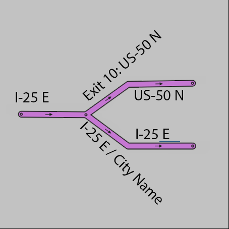
109 KB | The left turn is onto unnamed segment 1. Segment 1 is followed by 1 more unnamed segment -- segment 2. After this comes a named road -- W Lincoln Hwy. Waze gives the instruction to turn left onto W Lincoln Hwy. Later, it will give the instruction to t... | 1 |
| 23:13, 4 June 2015 | Jersey shore selfie.jpg (file) |  |
210 KB | 2 | |
| 20:15, 16 September 2014 | Join Roads.png (file) |  |
3 KB | multi-Select crossing road with no junction (and same elevation) and this icon will pop up. | 1 |
| 21:55, 7 December 2015 | LeftExitRamp new.png (file) |  |
11 KB | replacement for File:LeftExitRamp.png | 1 |
| 21:58, 7 December 2015 | LeftExitSplit new.png (file) |  |
11 KB | replacement for [//wiki.waze.com/wiki/File:LeftExitSplit.png LeftExitSplit] | 1 |
| 23:10, 7 January 2015 | LilyPondU-turn.jpeg (file) |  |
100 KB | 1 | |
| 18:17, 19 November 2015 | MMR-venezuela.gif (file) |  |
455 KB | from leibnitz -- corrected spelling mistake | 2 |
| 06:32, 7 October 2015 | MMR3 Thailand HOF.png (file) |  |
681 KB | Mega map raid 3 -- Thailand Category:Mapraid | 1 |
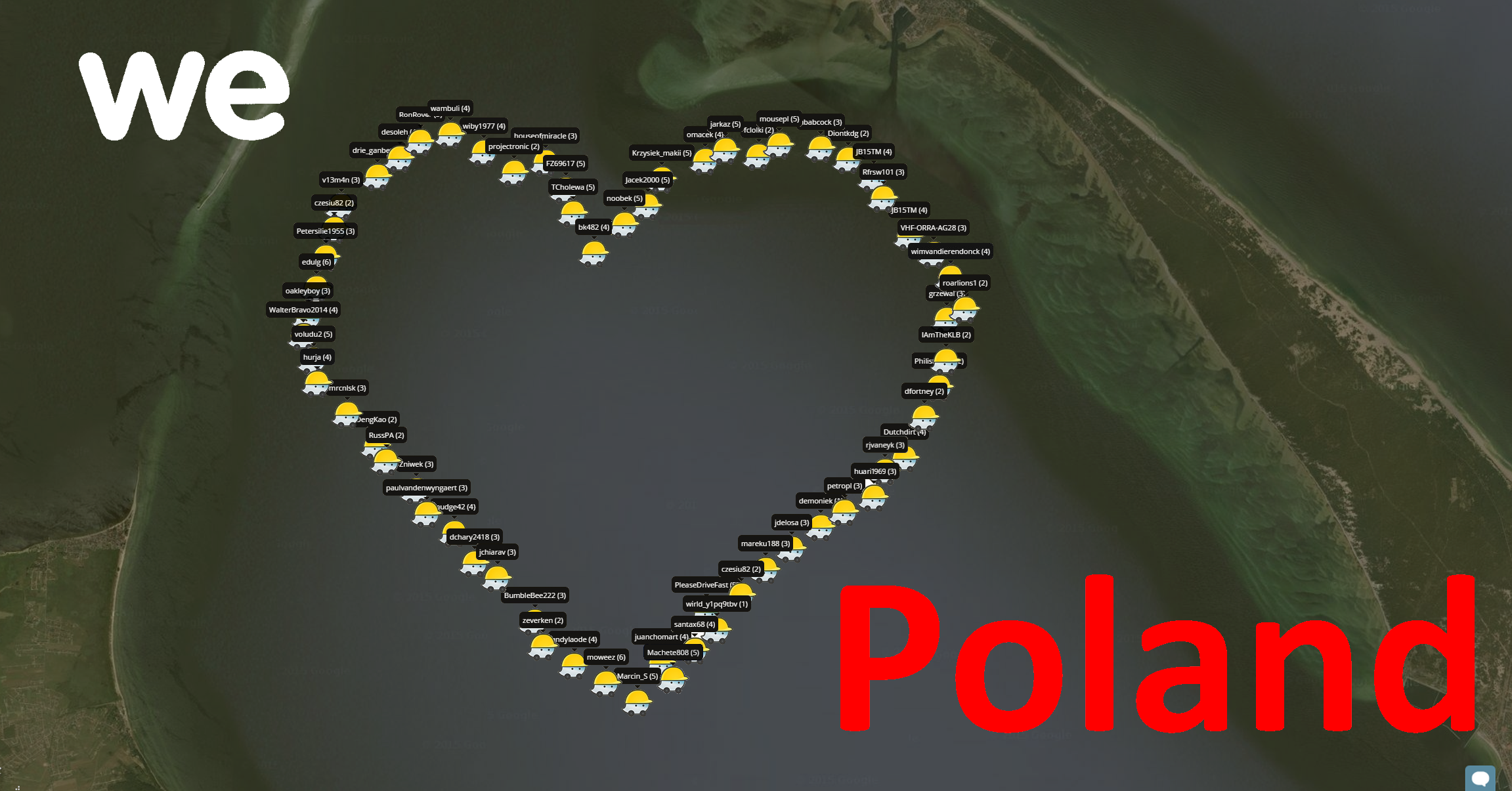
| 20:36, 16 February 2016 | MMR Poland Selfie.png (file) |  |
1.68 MB | Category:Mapraid | 1 |
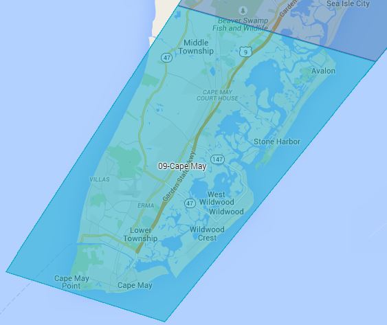
| 12:33, 5 June 2015 | MR PA.png (file) |  |
704 KB | 2 | |
| 20:51, 18 May 2015 | Mapraid JerseyShore group 01.jpg (file) |  |
87 KB | Category:Mapraid JerseyShore images | 1 |
| 20:54, 18 May 2015 | Mapraid JerseyShore group 02.jpg (file) |  |
103 KB | Category:Mapraid JerseyShore images | 1 |
| 20:54, 18 May 2015 | Mapraid JerseyShore group 03.jpg (file) |  |
78 KB | Category:Mapraid JerseyShore images | 1 |
| 20:55, 18 May 2015 | Mapraid JerseyShore group 04.jpg (file) |  |
77 KB | Category:Mapraid JerseyShore images | 1 |
| 20:55, 18 May 2015 | Mapraid JerseyShore group 05.jpg (file) |  |
70 KB | Category:Mapraid JerseyShore images | 1 |
| 20:56, 18 May 2015 | Mapraid JerseyShore group 06.jpg (file) |  |
68 KB | Category:Mapraid JerseyShore images | 1 |
| 20:56, 18 May 2015 | Mapraid JerseyShore group 07.jpg (file) |  |
58 KB | Category:Mapraid JerseyShore images | 1 |
| 20:57, 18 May 2015 | Mapraid JerseyShore group 08.jpg (file) |  |
43 KB | Category:Mapraid JerseyShore images | 1 |
| 21:00, 18 May 2015 | Mapraid JerseyShore group 09.jpg (file) |  |
33 KB | 3 |