There is a page named "Level" on Wazeopedia. See also the other search results found.
 (64 × 81 (8 KB)) - 11:44, 24 October 2014
 (64 × 73 (6 KB)) - 11:45, 24 October 2014
 (105 × 93 (10 KB)) - 11:43, 24 October 2014
 (61 × 51 (6 KB)) - 11:44, 24 October 2014
 (73 × 54 (7 KB)) - 11:44, 24 October 2014
 WAZEレベルの画面...(800 × 1,280 (267 KB)) - 12:30, 26 March 2014
 WME Username, avatar, level, and points...(236 × 93 (16 KB)) - 00:41, 7 May 2017
 WME Username, avatar, level, and points...(236 × 93 (17 KB)) - 20:32, 27 April 2016
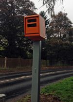 (715 × 1,000 (295 KB)) - 11:22, 9 November 2013
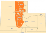 Urban/Rural Lock Level Areas...(698 × 491 (89 KB)) - 04:09, 26 December 2015
 Duplicated City - High level...(440 × 256 (61 KB)) - 07:14, 30 May 2013
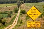 Photo of Level B road in Iowa...(855 × 569 (707 KB)) - 02:16, 25 September 2015
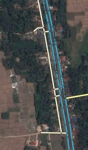 Stubs connected to a locked highway, ready for lower level editors to start drawing....(368 × 628 (54 KB)) - 15:06, 15 September 2015
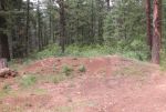 Example of USFS level-1 road...(902 × 610 (327 KB)) - 05:39, 12 February 2014
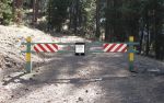 Example of USFS level-1 road...(903 × 564 (321 KB)) - 05:39, 12 February 2014
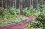 Example of USFS level-2 road...(900 × 594 (353 KB)) - 05:40, 12 February 2014
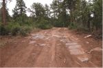 Example of USFS level-2 road...(905 × 596 (285 KB)) - 05:41, 12 February 2014
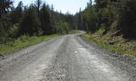 Example of USFS level-3 road...(903 × 543 (257 KB)) - 05:41, 12 February 2014
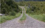 Example of USFS level-3 road...(905 × 566 (281 KB)) - 05:42, 12 February 2014
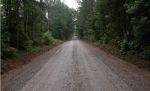 Example of USFS level-4 road...(904 × 550 (226 KB)) - 05:43, 12 February 2014


