Daveacincy (talk | contribs) |
Daveacincy (talk | contribs) |
||
| (21 intermediate revisions by the same user not shown) | |||
| Line 1: | Line 1: | ||
= | = Batman Turkey Raid = | ||
== Before and after images == | |||
[[File: | [[File:Hasankeyf.png|600px]] | ||
== | [[https://www.waze.com/editor/?env=row&lon=41.41400&lat=37.71462&zoom=4 Hasankeyf now]] | ||
[[File:Gercus.png|600px]] | |||
https://www.waze.com/editor/?env= | [[https://www.waze.com/editor/?env=row&lon=41.38698&lat=37.56699&zoom=4 Gercüş now]] | ||
[[File:Cavuslu.png|600px]] | |||
https://www.waze.com/editor/?env= | [[https://www.waze.com/editor/?env=row&lon=41.25352&lat=37.49951&zoom=4 Çavuşlu now]] | ||
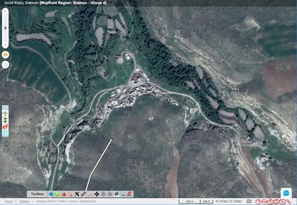
[[File:Incirli.png|600px]] | |||
[[https://www.waze.com/editor/?env=row&lon=41.56848&lat=37.72428&zoom=5 Incirli now]] | |||
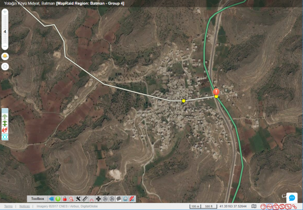
[[File:Yolagzi.png|600px]] | |||
[[https://www.waze.com/editor/?env=row&lon=41.35100&lat=37.52600&s=87555415&zoom=4 Yolağzı now]] | |||
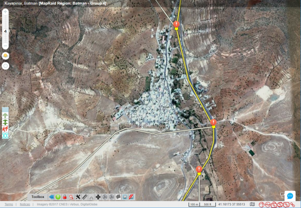
[[File:Kayapinar.png|600px]] | |||
[[https://www.waze.com/editor/?env=row&lon=41.16287&lat=37.55787&zoom=4 Kayapınar now]] | |||
https:// | |||
[[File:Hisar.png|600px]] | |||
[[https://www.waze.com/editor/?env=row&lon=41.22773&lat=37.60116&zoom=4 Hisar now]] | |||
= Zambia Mega MapRaid = | |||
== Interesting Satellite Views == | |||
[[https://www.waze.com/en-US/editor/?env=row&lon=28.16706&lat=-15.52237&zoom=4 Outside Lusaka]] | |||
[[https://www.waze.com/editor/?env=row&lon=28.91009&lat=-15.88964&zoom=1 Crop Circles near Chiawa]] | |||
= Older Raids = | |||
[[User:Daveacincy/Van_Turkey_Raid|Van Turkey Raid]] | |||
[[User:Daveacincy/PA_MapRaid|PA Raid]] | |||
-
Albania

-
Angola

-
Argentina

-
Australia

-
Österreich

-
Bahrain

-
Belarus

-
Belgium

-
Belize

-
Bolivia

-
Bosnia and Herzegovina

-
Brasil

-
Bulgaria

-
Canada

-
Chile

-
China

-
Colombia

-
Media Library
-
Costa Rica

-
Croatia

-
Cyprus

-
Czech

-
Denmark

-
Ecuador

-
Etsi

-
El Salvador

-
Eesti

-
Finland

-
France

-
Germany

-
Waze Communities Hub

-
Greece

-
Guatemala

-
Hong Kong

-
Hungary

-
Iceland

-
India

-
Indonesia

-
Iran

-
Iraq

-
Ireland

-
Israel

-
Italy

-
日本

-
Korea

-
Kosovo

-
Kuwait

-
Laos

-
Latam
-
Latvija

-
Lithuania

-
Luxembourg

-
Malaysia

-
Mauritius

-
Mexico

-
Mongolia

-
Morocco

-
Namibia

-
Nepal

-
Netherlands

-
New Zealand

-
Nicaragua

-
Norway

-
Oman

-
Pakistan

-
Panamá

-
Paraguay
-
Perú

-
Philippines

-
Poland

-
Portugal

-
Qatar

-
República Dominicana

-
Romania

-
Russia

-
EAC

-
Saudi Arabia
-
Serbia

-
Singapore
-
Slovakia

-
Slovenia

-
South Africa

-
España

-
Sudan

-
Sweden

-
Switzerland

-
Taiwan

-
Thailand

-
Türkiye

-
United Arab Emirates

-
Ukraine

-
United Kingdom

-
Uruguay

-
USA

-
Uzbekistan

-
Venezuela

-
Vietnam

-
Yemen


