m (Copying text of wiki page for coparison with the "Wisconsin/Resources/Main" page) |
m (Copying text of wiki page for coparison with the "Idaho/Resources/Main" page) |
||
| Line 2: | Line 2: | ||
------ DO NOT MODIFY ABOVE THIS LINE -------- DO NOT MODIFY ABOVE THIS LINE ------> | ------ DO NOT MODIFY ABOVE THIS LINE -------- DO NOT MODIFY ABOVE THIS LINE ------> | ||
=== Functional Classification === | |||
Idaho follows the Functional Classification (FC) system for both state and non-state roads. There are currently 2015 and 2025 classifications available. At this time, we follow the highest FC of the 2015 and 2025 guidelines, except where they don't make sense (e.g. roads that don't yet exist, not-yet-through roads in neighborhoods, etc). | |||
[http://iplan.maps.arcgis.com/home/webmap/viewer.html?webmap=3321e504a78549e79ac76e3984c90295 Idaho "2025" Functional Classification Map] has both 2015 and 2015 functional classifications available as overlays. Do not map the planned streets on the 2025 layer which are not built yet. | |||
Refer to the [[Road_types/USA#Quick_reference_chart|Functional Classification Quick Reference Chart]] to determine the correct Waze road type. Remember that a US Highway or Interstate business route in urban areas where streets are named locally, that an alternate street designation may be key to determining the correct Waze road type. | |||
Please feel free to ask for help if you have questions on any of this! | |||
=== State-wide === | |||
[ | * [http://itd.idaho.gov/ Idaho Department of Transportation] | ||
[ | * [http://itd.idaho.gov/highways/gis/StateMaps/ Statewide and District Maps] | ||
* [http://iplan.maps.arcgis.com/home/webmap/viewer.html?webmap=3321e504a78549e79ac76e3984c90295 Idaho Interactive Functional Classification] | |||
[ | |||
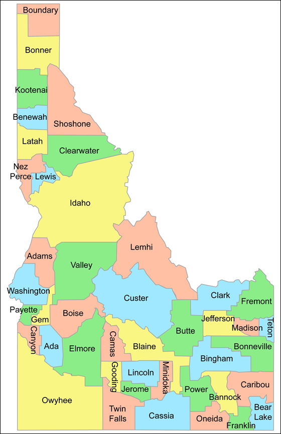
=== Counties' GIS Resources === | |||
<imagemap> | |||
Image:idaho_counties_1.jpg|center|Idaho Counties | |||
rect 56 7 120 72 [[Boundary]] | |||
desc none | |||
</imagemap> | |||
<br /> | |||
<div style="column-count:2;-moz-column-count:2;-webkit-column-count:2"> | |||
* [http://www.adacountyassessor.org/adamaps/ Ada] | |||
* [http://data.idahoparcels.us/www/rib/adams.html Adams] | |||
* [http://pnz.maps.arcgis.com/apps/webappviewer/index.html?id=dfe86cb077844d8f8b68ba01ac6f7087 Bannock] | |||
* Bear Lake | |||
* [http://benewah.idahoparcels.us/ Benewah] | |||
* [http://www.co.bingham.id.us/gis/parcels/ Bingham] | |||
* [http://maps.co.blaine.id.us/jsapi/ParcelInfoMap.html Blaine] | |||
* [http://data.idahoparcels.us/www/rib/boise.html Boise] | |||
* [http://maps.bonnercounty.us/apps/public/ Bonner] | |||
* [http://bonneville.maps.arcgis.com/apps/Solutions/s2.html?appid=9888e5fe5c864f10bb14e45aa6d378f6 Bonneville] | |||
* Boundary | |||
* [http://data.idahoparcels.us/www/rib/butte.html Butte] | |||
* [http://data.idahoparcels.us/www/rib/camas.html Camas] | |||
* [http://gis.canyonco.org/flexviewers/Test/ Canyon] | |||
* [http://data.idahoparcels.us/www/rib/caribou.html Caribou] | |||
* [http://data.idahoparcels.us/www/rib/cassia.html Cassia] | |||
* [http://data.idahoparcels.us/www/rib/clark.html Clark] | |||
* [http://gis.clearwatercounty.org/propertymap/ Clearwater] | |||
* [http://www.greenwoodmap.com/custer/ Custer] | |||
* [http://data.idahoparcels.us/www/rib/elmore.html Elmore] | |||
* [http://data.idahoparcels.us/www/rib/franklin.html Franklin] | |||
* [http://maps.greenwoodmap.com/fremontid/ Fremont] | |||
* [http://data.idahoparcels.us/www/rib/gem.html Gem] | |||
* [http://data.idahoparcels.us/www/rib/gooding.html Gooding] | |||
* [http://data.idahoparcels.us/www/rib/idaho.html Idaho] | |||
* [http://maps.co.jefferson.id.us/flexviewers/public/ Jefferson] | |||
* [http://data.idahoparcels.us/www/rib/jerome.html Jerome] | |||
* [http://kcearth.kcgov.us/map/default.html Kootenai] † | |||
* [http://gis.latah.id.us/gisgallery.php Latah] | |||
* [http://data.idahoparcels.us/www/rib/lemhi.html Lemhi] | |||
* [http://data.idahoparcels.us/www/rib/lewis.html Lewis] | |||
* Lincoln | |||
* [http://madison.rexburg.org/Html5Viewer2.4/?viewer=public Madison] | |||
* [http://minidoka.idahoparcels.us/ Minidoka] | |||
* [http://www.co.nezperce.id.us/Departments/InformationSystems/WebMapTOU.aspx Nez Perce] | |||
* [http://data.idahoparcels.us/www/rib/oneida.html Oneida] | |||
* [http://data.idahoparcels.us/www/rib/owyhee.html Owyhee] | |||
* [http://data.idahoparcels.us/www/rib/payette.html Payette] | |||
* [http://data.idahoparcels.us/www/rib/power.html Power] | |||
* [http://data.idahoparcels.us/www/rib/shoshone.html Shoshone] | |||
* [http://tetonidaho.maps.arcgis.com/apps/webappviewer/index.html?id=7cad88173b644a6a8e8c1147e94aa524 Teton] | |||
* [http://twinfalls.idahoparcels.us/ Twin Falls] | |||
* [http://data.idahoparcels.us/www/rib/valley.html Valley] | |||
* [http://data.idahoparcels.us/www/rib/washington.html Washington] | |||
</div> | |||
† Requires Internet Explorer for Silverlight. | |||
Revision as of 05:14, 16 February 2017
Functional Classification
Idaho follows the Functional Classification (FC) system for both state and non-state roads. There are currently 2015 and 2025 classifications available. At this time, we follow the highest FC of the 2015 and 2025 guidelines, except where they don't make sense (e.g. roads that don't yet exist, not-yet-through roads in neighborhoods, etc).
Idaho "2025" Functional Classification Map has both 2015 and 2015 functional classifications available as overlays. Do not map the planned streets on the 2025 layer which are not built yet.
Refer to the Functional Classification Quick Reference Chart to determine the correct Waze road type. Remember that a US Highway or Interstate business route in urban areas where streets are named locally, that an alternate street designation may be key to determining the correct Waze road type.
Please feel free to ask for help if you have questions on any of this!
State-wide
- Idaho Department of Transportation
- Statewide and District Maps
- Idaho Interactive Functional Classification
Counties' GIS Resources
- Ada
- Adams
- Bannock
- Bear Lake
- Benewah
- Bingham
- Blaine
- Boise
- Bonner
- Bonneville
- Boundary
- Butte
- Camas
- Canyon
- Caribou
- Cassia
- Clark
- Clearwater
- Custer
- Elmore
- Franklin
- Fremont
- Gem
- Gooding
- Idaho
- Jefferson
- Jerome
- Kootenai †
- Latah
- Lemhi
- Lewis
- Lincoln
- Madison
- Minidoka
- Nez Perce
- Oneida
- Owyhee
- Payette
- Power
- Shoshone
- Teton
- Twin Falls
- Valley
- Washington
† Requires Internet Explorer for Silverlight.