- Toll Price Mapping (section Ferry crossings)Bridge 6 Ferry crossings 6.1 Cowes Floating Bridge 6.2 Torpoint Ferry 6.3 Windermere Ferry 6.4 Reedham Ferry 6.5 Cromarty Ferry 6.6 Dartmouth Lower Ferry 6.7...20 KB (1,806 words) - 12:40, 24 September 2023
- Toll Road, like the M6 Toll or Dartford Crossing. Ferries should be mapped using the • • • • Ferry • • • • Road Type. This should be connected to the...40 KB (2,605 words) - 19:16, 31 December 2023
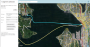 Importing file...(968 × 504 (726 KB)) - 10:13, 30 November 2015
- [purge] Use {{Ferry}} to create • • • • Ferry • • • • text. Use {{Ferry|custom text}} to create • • • • custom text • • • • text. Use {{Ferry|style= display:...175 bytes (125 words) - 12:24, 22 April 2020

- forum on Ferries for more discussion on this topic. Members of the Waze staff and Waze champs have discussed having a better way to support ferries. Futurevías debido a obras de larga duración desastres naturales, etc. How to add ferries (TO DO) How to add tunnels (TO DO) Nombrar segmentos que cruzan vías conImporting fileforum on Ferries for more discussion on this topic. Members of the Waze staff and Waze champs have discussed having a better way to support ferries. Futurevías debido a obras de larga duración desastres naturales, etc. How to add ferries (TO DO) How to add tunnels (TO DO) Nombrar segmentos que cruzan vías conImporting file
- entries: Bot • WazeBot 2015-02-23 (A) Ferry FY • • • • Ferry • • • • is a road type in Waze used to represent ferry routes which can be taken with a vehicleTemplate:Documentation/start box Template:Documentation/end box