- under Layers > Planning Select Adopted Highways layer under Layers > Transport & Streets Select Traffic Regulation Orders and / or Turning Point Restrictions...30 KB (592 words) - 18:12, 26 December 2023
- Country Admins. Location: Ensure the relevant options are visible in the layers menu. Function: Allowed to close URs & MPs created by any users and themselves...5 KB (531 words) - 16:53, 18 February 2024
 Importing file...(38 × 38 (2 KB)) - 10:14, 30 November 2015
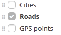 Importing file...(119 × 70 (6 KB)) - 10:11, 30 November 2015
 Importing file...(22 × 21 (3 KB)) - 10:14, 30 November 2015
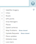 Importing file...(282 × 348 (24 KB)) - 10:15, 30 November 2015
 Importing file...(640 × 428 (547 KB)) - 10:14, 30 November 2015
 Importing file...(1,000 × 300 (32 KB)) - 10:15, 30 November 2015
- lanes merging Sharp curves (bends) To map Permanent Hazards, the Hazard Layer must be enabled. The PH types can be found under the Hazard menu. After selecting...3 KB (525 words) - 16:29, 5 March 2024
- is still yellow and there is an Area Manager for the area (check the AM layer in the editor) and the problem is unclear, please leave the UR alone, at...7 KB (1,160 words) - 22:59, 31 December 2023
- a significant distance between the entry and exit segments (see the GPS layer for guidance), then they should be mapped with a Y shape. Doing this may...10 KB (1,506 words) - 17:37, 31 December 2023
- external search engines not the internal Waze database. Map editor - city layer Waze will only learn your frequent destinations and will always try to find...13 KB (2,209 words) - 09:09, 27 December 2022


- Good afternoon. This is my first time editingThis is an additional image of the Layers button in the WME.Papyrus layers buttonReload layers icon in WMEReorder layers icons in WMEGood afternoon. This is my first time editingThis is an additional image of the Layers button in the WME.Papyrus layers buttonReload layers icon in WMEReorder layers icons in WME
- tracker, click on the issues layer. Please note that only the issue layers will still be active, while all the other child layers that used to exist can beOur GPS points layer in WME is based on aggregated and anonymous Waze data from the mobile client in order to help you to improve the map and solve mapinstructions may be influenced by street names. Routing-FAQ Our GPS points layer in WME is based on aggregated and anonymous Waze data from the mobile clientclosures to the traffic event Once the event is created Turn on the following layers to the map : Segments Road Closures Satellite Imagery Zoom-in close to make