(Created page with "right|350px Rotondes zijn specifiek segmenten in Waze. Als je een rotonde nadert, wordt een icoon 30px ge...") |
(Created page with "==How to create a roundabout== <gallery> File:FixRAB-03.png|1 File:FixRAB-04.png|3 File:FixRAB-06.png|4 File:FixRAB-07.png|5 </gallery> # Teken alle wegsegmenten die naar de r...") |
||
| Line 15: | Line 15: | ||
File:FixRAB-07.png|5 | File:FixRAB-07.png|5 | ||
</gallery> | </gallery> | ||
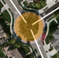
# | # Teken alle wegsegmenten die naar de rotonde leiden tot in het midden van de rotonde (zie foto 1). Gebruik de zichtbare kaart en/of GPS sporen om de wegen uit te lijnen. | ||
# | # Beweeeg je muis over het symbool [[File:DrawRoad.PNG]] bovenaan je scherm in de knoppenbalk. Kies "Rotonde" (Sneltoets: o). | ||
# | # Klik eenmaal met de muis op het midden van waar de rotonde moet komen. | ||
# | # Beweeg dan de muis naar buiten, tot je de gewenste grootte van de nieuwe rotonde bereikt hebt (het midden van waar de weg loopt) en klik opnieuw. WME zal nu alle overtollige segmenten verwijderen en de rotonde aanmaken. | ||
# | # Een rotonde krijgt geen straatnaam, alleen de naam van de stad of gemeente waar ze gesitueerd is (Plaatsnaam). Geef de naam in het menu aan de linkerzijde ("Bewerken"). Klik op "Geen" achter de straatnaam. | ||
===Normal vs complex roundabouts=== | ===Normal vs complex roundabouts=== | ||
Revision as of 12:29, 12 May 2020


Rotondes zijn specifiek segmenten in Waze. Als je een rotonde nadert, wordt een icoon ![]() getoond die aangeeft in welke richting je gaat, met een nummer dat het bijbehorende aantal afslagen meldt.
getoond die aangeeft in welke richting je gaat, met een nummer dat het bijbehorende aantal afslagen meldt.

Only traffic circles with the D5 traffic sign should be mapped as roundabout. Other traffic circles should be mapped with separate curved segments or just as crossing.
How to create a roundabout
-

1
-
3
-

4
-
5


- Teken alle wegsegmenten die naar de rotonde leiden tot in het midden van de rotonde (zie foto 1). Gebruik de zichtbare kaart en/of GPS sporen om de wegen uit te lijnen.
- Beweeeg je muis over het symbool
 bovenaan je scherm in de knoppenbalk. Kies "Rotonde" (Sneltoets: o).
 - Klik eenmaal met de muis op het midden van waar de rotonde moet komen.
- Beweeg dan de muis naar buiten, tot je de gewenste grootte van de nieuwe rotonde bereikt hebt (het midden van waar de weg loopt) en klik opnieuw. WME zal nu alle overtollige segmenten verwijderen en de rotonde aanmaken.
- Een rotonde krijgt geen straatnaam, alleen de naam van de stad of gemeente waar ze gesitueerd is (Plaatsnaam). Geef de naam in het menu aan de linkerzijde ("Bewerken"). Klik op "Geen" achter de straatnaam.
Normal vs complex roundabouts
-to be added-
When NOT to use a Roundabout
Roundabouts in WME will yield specific routing instructions to drivers, such as "at the roundabout, take the third exit". If those routing instructions could confuse drivers, the Roundabout tool should not be used.
-
Cul-de-sac
-
No roundabout
-
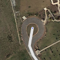
Correct use


Roundabouts should never be used for cul-de-sacs or other dead end streets, regardless of how round they are. A single road segment leading to a cul-de-sac should be drawn as a dead end. With very large roads it might be advisable to create a loop, but not a roundabout.
Remarks
- The road type of the roundabout is always the same as the highest road type connected.
- Enter as Speed limit the highest maximum speed of the connected segments.
- A dead-end street (cul-de-sac) should not have a roundabout at the end (see above).
- If there is no road sign for a roundabout, don't use a roundabout.
- In some cases, a roundabout is not used even if there is a roundabout sign, to create the best possible instructions for the situation.
- Don't connect more than one segment on to 1 junction of the roundabout, nor make connections within the roundabout. This lead to weird instructions, like "take exit zero", or no instructions at all.
Tools

For moving and resizing a complete roundabout without losing traffic data, the Roundabout Utility Script (WME RA util) can be used.