WIP (WORK IN PROGRESS)
Traduction / Simplification / Adaptation FR de la page US
Community Plugins, Extensions and Tools
Extensions, Plugins et Outils de la communauté
La communauté Waze a créé un certain nombre d'outils d'aide à l'édition ou à l'usage sous la forme d'extensions à utiliser dans les interfaces web de Waze.
| Ces scripts requièrent des mises à jour régulière pour fonctionner correctement, en particulier suite à une publication d'une mise à jour des produits Waze tel que l'éditeur ou l'application cliente. Certains scripts se mettent à jour automatiquement dès que leur auteur les modifient, tandis que d'autres nécessitent une mise à jour manuelle de votre part |
Pour pouvoir utiliser ces scripts ou extensions, certains paramètres ou options doivent être vérifiés dans votre navigateur internet afin d'autoriser leur installation et leur bon fonctionnement
Chrome / Blink / Opera Next
Vous devrez activer le Mode Développeur sur votre navigateur.
- Si l'extension est disponible sur le Chrome Web Store, préférez là à tout autre source.
- Sans add-on spécifique pour gérer les scripts, téléchargez simplement le fichier script (.js) ou le paquet executable Chrome (.crx) puis faitez un glisser-déplacer du fichier dans l' onglet Extensions de Chrome sur votre navigateur (Menu -> Outils -> Extensions).
- Installez l'extension Tampermonkey à partir du Chrome Web Store.
Firefox / Mozilla
- Installez GreaseMonkey à partir des modules officiels de firefox. Pour ce faire, cliquez sur ce lien.
Internet Explorer
- Install GreaseMonkey or equivalent.
Safari
- Install script as an extension.
- Install WazeBar for Safari.
GreaseMonkey or TamperMonkey add-on for script management
The easiest way to load and manage add-on scripts is with Greasemonkey, TamperMonkey, or an equivalent browser add-on for script management. When you install a user script, the script manager catalogs it and automatically runs it anytime any page for which it is declared is loaded by your browser.
Améliorations de l'affichage sur WME
Les scripts ci-dessous apportent de nombreuses informations utiles à l'éditeur par le biais un affichage complémentaire directement dans l'interface web de WME.
Ce script ajoute un surlignage coloré des segments et des zones POI (landmark) en fonction de leur état et de certains critères. Ce script est particulièrement utile pour identifier les segments verrouillés, mal nommé, modifiés récemment, etc...
 Télécharger WME Color Highlights
Complément d'information
Ce script permet de normaliser correctement les intersections en affichant soit l'angle de changement de direction lorsque l'intersection ne relie que 2 segments, soit les angles entre chaques segments lorsque l'intersection en relie plus de 2.

Télécharger WME Junction Angle info
Complément d'information
- Ce script ajoute un onglet dans le panneau à gauche de l'interface de WME permettant d'appliquer plusieurs types de filtres d'affichage sur les demandes de mises à jour, les problèmes de cartographie et les radars en fonction de leur catégorie, leur ancienneté, la présence de mots clés, etc.
- Pour chaque repère de demande de mise à jour où une conversation est entamée, l'icone par défaut est remplacée par une petite bulle. Sa couleur est par défaut verte, sauf si vous avez participé à la conversation auquel cas sa couleur est jaune. Une option permet d'afficher dans un petit cercle le nombre de messages qui ont animés la conversation.
- Pour chaque repère visible, si vous le survolez avec la souris, une popup s'affiche avec un résumé des informations propre à ce repère et propose des raccourcis vers quelques actions-types
- Fonctionnalités optionnelles intégrées (allez dans le sous-oglet Misc, et sélectionnez "Enable integrated scripts"):
- fonctionnalités du script DrivesTabEnhancer (DTE):
- Modifie l'onglet Drives dans le panneau à gauche de l'interface WME pour afficher davantage de parcours par pages et pour indiquer à l'utilisateur quels sont les parcours dont le trajet est affichable sur la carte.
- fonctionnalités du script Select Roundabout Segments (SRS):
- Ajoute un bouton Select roundabout dans le panneau d'édition lorsqu'un segment appartenant à un rond-point est sélectionné. En cliquant sur ce bouton, l'interface sélectionne automatiquement tous les segments qui composent le rond-point. (Si certains segments ne sont pas inclus dans la sélection faite par le script, alors cela signifie sûrement que le rond-point en question est erroné et doit être entièrement refait)
- fonctionnalités du script DrivesTabEnhancer (DTE):
Télécharger UR Overview Plus
Complément d'information
WME layout tweaking user style
This is a custom stylesheet that tweaks the Waze Map Editor layout to reduce the amount of white-space and increase the editable area.
Custom stylesheets require that you first install the Stylish add-on. (Get Stylish for Chrome or Stylish for Firefox).
Download WME layout tweaking user style
Édition de la carte
Junction Node Fixer a plusieurs caractéristiques. La principale fonctionnalité de JNF est l'enrichissement du keyboard shortcut Q (disallowAllTurns) en préservant les interdictions de tourner. 'Enrichissement' signifie qu'il reprend toutes les fonctionnalités de la touche Q. Le raccourci-clavier Q réalise les actions suivantes:
- Répare toutes les erreurs de Self and Reverse Connectivity.
- Répare toutes les closed loop roads (en divisant la boucle en deux segments, avec un nœud de jonction)
- Terminates dead-ends with a junction
- Passe à double-sens les dead-ends (uniquement si chacune des extrémités du segment est visible)
- Paramètre le Type d'un rond-point en utilisant la règle du plus faible des deux plus forts, et ajoute le pays si nécessaire.
- Réalise un tradiotnnel 'Q W' (nettoie la reverse connectivity, et verrouille les autorisations de tourner)
- Provoque le rafraichissement des autorisations de tourner (effet similaire à la touche S, mais sans le shifting).
Since you end up with the same turns restricted, that means you need to press 'w' if you really want all turns allowed. This is why it overloads 'q' instead of 'w'. Ultimately this will be a separate hotkey that's editable through WME's '?' interface.
JNF also:
- Saves the state of WME's ShowAllTurns, ShowTurns, and Full-screen mode across Refresh/F5/Permalink.
- Forces data model reload after successful save.
This has been tested only in Chrome; it has been reported to work in Firefox with GreaseMonkey.
DOWNLOAD WME Junction Node Fixer
- from userscripts.org ***Not a current version***
- Chrome extension now available
More information
WME Toolbox
by OyyoDams
This script adds many features like small junctions highlight, redo roundabout, convert roundabout to standard road, clear road geometry, many permalinks to external sites, and more.
Please read the WME Toolbox page
WazeBar for Safari
by Mike Bronner; maintained by edsonajj (Edson Jiménez)
WazeBar for Safari is an alternative menu bar for WME that integrates other scripts to make them available on Safari.
Currently integrated scripts are:
- WME Colour Highlights by timbones.
- UR Overview by Twister-UK.
- GeoWipe by bgodette.
- Junction Node Fixer by bgodette.
Additional features:
- Autosave at a certain number of edits.
- More features and script integrations are underway.
DOWNLOAD WazeBar
More information
Roundabout Angles and Landmark
by davipt
Roundabout Angles and Landmark is a script with two features:
- selecting a roundabout node, on the left side there is a button to automatically create a "junction" landmark around the landmark. Roundabout segments shall not have street name set, but the roundabout name should be added to this landmark in the middle, so the label appears horizontally.
- selecting a roundabout node, on the left side there is a button to create a temporary landmark in the form of a leaf, which will denote the approximate 90º, 180º and 270º range that Waze uses to switch from the "take the nth exit" to the "straight ahead/turn left/turn right" on roundabouts with two to four connections.
If the created landmark is not round, it means the roundabout has something screwed up, usually a reversed A->B segment, so it also helps ensuring proper roundabouts.
DOWNLOAD Roundabout Angles and Landmark
More information
WME Aerial Shifter (WAS)
by byo; patched and packaged by berestovskyy
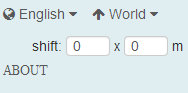
This script helps you adjust the position of underlying satellite imagery to work on road alignment inside WME. Generally the GPS points layer will be displayed on the map at a location parallel to the visual roadway. Adjust the setting until the GPS points are aligned with the visual map. Different sections of the map may or may not have this same amount of misalignment, so it is best to use this same technique in other areas before you use the same offset as a prior area.
Before downloading a new version, uninstall or disable all previous versions of this script. DOWNLOAD Waze Aerial Shifter version 1.3.2 (Oct 07, 2013):
More information
Street to River PLUS
by EduardoCarvajal based on aeytom script


The script is designed as a helper for creating river landmarks for the free Waze navigation system. The script transforms the geometry of a new unsaved street to a river landmark. You can predefine the width and the name for the new landmark in the form of a special street name.
Mini how-to:
To add a new river:
- Install this script and go to WME.
- Draw a new street but do not save the street.
- Add and apply a street name to define the rivers name and width. This step is optional.
- Example: 20m Spree creates a 20 meters wide river named Spree
- Select the helper street.
- Click the Street to river button.
- Delete the helper street.
- Edit the new landmark as you like. You can even set the landmark to another type. Here it is used to mark a railroad, using landmark type 'other'.
To expand an existing river:
- Draw a new Street that starts inside an existing river, but do not save the Street.
- Make sure that you see on map the begining of the Street (the instersection point of the street and the river)
- Select the helper Street.
- Click the "Street to river" button.
- Delete the helper Street.
- Edit the new landmark as you like.
Examples of rivers created by the script are Sixaola River and Telire River.
Multilingual interface: English, Spanish, French, Russian, Hungarian and Czech.
DOWNLOAD Street to River PLUS
More information
Road Type Calculator
by edsonajj (Edson Jiménez)
This is a calculator meant as an aid to classify roads, specially when faced with routing issues or difficulties on applying the current classification found on the wiki.
The current version is only designed to work for Mexico, but anyone interested in adapting it to another country can contact edsonajj and work together in developing a version for another country.
The extension is currently available for the four major browsers (Chrome, Firefox, Internet Explorer and Safari).
DOWNLOAD Road Type Calculator
More information
WME center to begin-end of street
by tkr85


The script adds the ability to center the map at the beginning or end of the currently selected segment. The ends are selected with the A and B buttons. The script also remembers the last map position and zoom level before pressing either A or B. That feature is accessed with the return button. The X button will clear the last map position until A or B is pressed again (setting a new remembered map position).
DOWNLOAD WME center to begin-end of street
More information
Map validation and routing
WME Route Tester
by Timbones
This script allows you to see the current navigation instructions in the editor. Simply select two segments, and click on the Routes tab that appears on the left.
Screenshot: wme-routes.png
DOWNLOAD Route Tester
More information
WME Validator
by berestovskyy
This script validates a map area in Waze Map Editor, highlights issues, and generates a very detailed report with wiki references and how-tos.
- Validator reports issues for your country and provides links to the country wiki. See How to adjust Validator for your country.
- Validator highlights issues not features. For example, it highlights not just any locked segment, but only if the lock is an issue.
- There are many country-specific checks on every segment. See complete list of validations.
- You may define your own custom validations.
Validator is BETA software. Please report any issues/suggestions in the forum thread.
DOWNLOAD WME Validator
More information
WME Chat
Device
Geocaching
by davipt
Geocaching-Waze bookmarklet is a iOS Safari bookmarklet that allows driving to a given Geocaching coordinate. It assumes a fixed flow within iOS and the official Geocaching client, but it could be adapted to other situations.
Open the iOS Geocaching app, pick up a cache, click on Open on external map, which will open Google Maps on the browser. From this page, click on the bookmarklet which will display the lat+lon; then open Waze on that point, ready to drive there.
More information
Live Map
Live Map UR Overlay (LMUR)
by Twister-UK
LMUR allows update requests and map problems to be displayed on the Live Map, with various filtering options to show/hide requests/problems by type, age, keyword, etc. Requires Live Map to be viewed via the secure (https) URL - LMUR will prompt you if a non-secure URL is used.
DOWNLOAD Live Map UR Overlay (LMUR)
More information
Bookmarklets
Several very useful bookmarklet scripts have been developed to enhance the map editing process. A complete list of available scripts are on the Bookmarklets Wiki page along with instructions on how to add them to your browser.
Developing scripts
Obsolete scripts
| Name | Superseded by |
|---|---|
| WME Add-Ons | WME Toolbox |
| WME Permalink+ (WP+) | |
| Drives Tab Enhancer (DTE) | URO+ (v3.0) |
| Live Map Navigation List | WME Route Tester |
| Select Roundabout Segments (SRS) | URO+ (v3.0) |
| WME Tools (WMET) | WME Validator |