Roundabout/fr


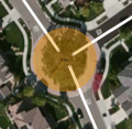
Les ronds-point, giratoires ou carrefour à sens giratoire sont des segments particuliers pour la navigation dans l’algorithme de calcul de Waze. Quand un conducteur approche un rond-point, un icône spécifique ![]() apparaît, dans la zone d'instruction de changement de direction, avec le numéro de sortie qui s'affiche. Ce numéro correspond au nombre de sorties depuis l'entrée du conducteur dans le rond-point.
apparaît, dans la zone d'instruction de changement de direction, avec le numéro de sortie qui s'affiche. Ce numéro correspond au nombre de sorties depuis l'entrée du conducteur dans le rond-point.

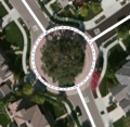
Seuls les ronds-points avec le panneau de signalisation D5 doivent être cartographiés en tant que tel. Les autres ronds-points doivent être cartographiés avec des segments courbes séparés ou tout simplement comme croisement.
How to create a roundabout
-

1
-
3
-

4
-
5


- Draw single road segments that will lead to the roundabout and ensure they extend into the center of the roundabout area. Use the visual map or gps points to align the roads.
- Hover the mouse over the
 button, on the toolbar at the top of the page. Choose "Roundabout" (Shortcut key: o).
 - Click the mouse on the map at the center of the roundabout area.
- Move the mouse cursor outside, up to the middle of where the roundabout road should be, and single-click. WME now creates the roundabout and will remove all segments within it.
For an oval shape, hold Shift while moving the cursor outside. - Enter the City name in the "Edit" menu left. A street name isn't necessary and can be set to "None", unless there is a official street name and there are addresses.
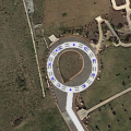
Normal vs complex roundabouts
Waze supports two different styles of roundabout navigation instructions. One style instructs simply to turn or continue at the roundabout, while the other instructs how many exits one must pass before leaving the roundabout. The US editing community terms these two instruction styles as "normal" and "non-normal" respectively. The term "normal" is used here in its mathematical sense to mean "orthogonal", "perpendicular", or "at right angles".
This section will explain the difference between a normal and a non-normal roundabout. Normal roundabouts:
Require all of the following
- 2-4 nodes.
- All exit nodes aligned within "normal" range of the entry node
- A diameter less than 50 meters
Provide the following instructions:
- "At the roundabout turn right"
- "At the roundabout continue straight"
- "At the roundabout turn left"
- "At the roundabout make a U-turn"
When NOT to use a Roundabout
Roundabouts in WME will yield specific routing instructions to drivers, such as "at the roundabout, take the third exit". If those routing instructions could confuse drivers, the Roundabout tool should not be used.
-
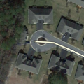
Cul-de-sac
-
No roundabout
-
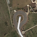
Correct use


Roundabouts should never be used for cul-de-sacs or other dead end streets, regardless of how round they are. A single road segment leading to a cul-de-sac should be drawn as a dead end. With very large roads it might be advisable to create a loop, but not a roundabout.
Remarks
- The road type of the roundabout is always the same as the highest road type connected.
- Enter as Speed limit the highest maximum speed of the connected segments.
- A dead-end street (cul-de-sac) should not have a roundabout at the end (see above).
- If there is no road sign for a roundabout, don't use a roundabout.
- In some cases, a roundabout is not used even if there is a roundabout sign, to create the best possible instructions for the situation.
- Don't connect more than one same direction segment on to 1 junction of the roundabout
- Don't make connections within the roundabout. This lead to weird instructions, like "take exit zero", or no instructions at all.
Tools

For moving and resizing a complete roundabout without losing traffic data, the Roundabout Utility Script (WME RA util) can be used.